


<< Text Pages >> Pen-Y-Gaer (Meidrim) - Hillfort in Wales in Carmarthenshire
Submitted by coldrum on Tuesday, 12 October 2010 Page Views: 5530
Iron Age and Later PrehistorySite Name: Pen-Y-Gaer (Meidrim)Country: Wales
NOTE: This site is 2.001 km away from the location you searched for.
County: Carmarthenshire Type: Hillfort
Map Ref: SN31002102
Latitude: 51.862098N Longitude: 4.45572W
Condition:
| 5 | Perfect |
| 4 | Almost Perfect |
| 3 | Reasonable but with some damage |
| 2 | Ruined but still recognisable as an ancient site |
| 1 | Pretty much destroyed, possibly visible as crop marks |
| 0 | No data. |
| -1 | Completely destroyed |
| 5 | Superb |
| 4 | Good |
| 3 | Ordinary |
| 2 | Not Good |
| 1 | Awful |
| 0 | No data. |
| 5 | Can be driven to, probably with disabled access |
| 4 | Short walk on a footpath |
| 3 | Requiring a bit more of a walk |
| 2 | A long walk |
| 1 | In the middle of nowhere, a nightmare to find |
| 0 | No data. |
| 5 | co-ordinates taken by GPS or official recorded co-ordinates |
| 4 | co-ordinates scaled from a detailed map |
| 3 | co-ordinates scaled from a bad map |
| 2 | co-ordinates of the nearest village |
| 1 | co-ordinates of the nearest town |
| 0 | no data |
Be the first person to rate this site - see the 'Contribute!' box in the right hand menu.
Internal Links:
External Links:
Hillfort in Carmarthenshire (Sir Caerfyrddin)
"A roughly 68m stretch of east-facing rampart cuts off an elongated promonrory summit area, some 220m deep, showing traces of at least one cross-bank."
Source: Coflein
You may be viewing yesterday's version of this page. To see the most up to date information please register for a free account.
Do not use the above information on other web sites or publications without permission of the contributor.
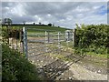
Nearby Images from Geograph Britain and Ireland:
©2011(licence)
©2023(licence)
©2023(licence)
©2023(licence)
©2020(licence)
The above images may not be of the site on this page, they are loaded from Geograph.
Please Submit an Image of this site or go out and take one for us!
Click here to see more info for this site
Nearby sites
Key: Red: member's photo, Blue: 3rd party photo, Yellow: other image, Green: no photo - please go there and take one, Grey: site destroyed
Download sites to:
KML (Google Earth)
GPX (GPS waypoints)
CSV (Garmin/Navman)
CSV (Excel)
To unlock full downloads you need to sign up as a Contributory Member. Otherwise downloads are limited to 50 sites.
Turn off the page maps and other distractions
Nearby sites listing. In the following links * = Image available
4.3km NNW 335° Crug-Y-Dryn* Chambered Cairn (SN29342500)
5.1km ENE 63° Pen-Y-Gaer (Abernant) Hillfort (SN35602316)
5.1km SSE 148° Bryn Cywyn* Ancient Village or Settlement (SN33551660)
5.6km SSE 148° Twlc y Filiast* Chambered Tomb (SN33811618)
6.2km S 180° Pont Ddu* Stone Row / Alignment (SN30791484)
6.2km SSW 212° Eithin Fach Mound* Round Barrow(s) (SN27521589)
6.4km WSW 248° Withybush Timber Circle (SN250188)
6.8km ENE 60° Cilcrug Hillfort (SN37002416)
7.0km S 176° Gors Llangynog* Standing Stones (SN312140)
7.1km S 174° Meini Llwydion, Llangynog* Standing Stones (SN3145513969)
7.6km NNW 327° Castell Mawr (Carmarthenshire) Hillfort (SN27032750)
7.9km N 349° Llandrilo Cross Standing Stones (SN298288)
8.2km SW 219° Llanddowror Standing stone* Standing Stone (Menhir) (SN25621487)
8.4km SW 218° Cross Stones, Llanddowror* Early Christian Sculptured Stone (SN25531458)
8.5km SE 124° Myrddin's Quoits* Chambered Tomb (SN37911598)
8.8km SE 128° Meini Llwydion* Chambered Tomb (SN37721534)
9.0km SSE 154° Maen Melyn, Llanybri* Standing Stone (Menhir) (SN34711279)
9.1km ENE 70° Garn-Fawr Hillfort (SN397238)
9.1km ENE 68° Crug Tumuli* Round Barrow(s) (SN396241)
9.2km ENE 68° Crugiau Garn Fawr* Barrow Cemetery (SN39682419)
9.3km SW 221° Vaynor Farm Henge* Henge (SN24701417)
9.5km NW 325° Pencastell Promontory Fort / Cliff Castle (SN25722899)
9.8km SE 130° Maenau Llwydion, Llangain* Standing Stones (SN38311450)
9.8km SE 127° Quoit Stone, Parc-y-maen llwyd* Standing Stone (Menhir) (SN38691485)
10.0km S 183° St Martin's Church (Laugharne)* Ancient Cross (SN302110)
View more nearby sites and additional images


 We would like to know more about this location. Please feel free to add a brief description and any relevant information in your own language.
 Wir möchten mehr über diese Stätte erfahren. Bitte zögern Sie nicht, eine kurze Beschreibung und relevante Informationen in Deutsch hinzuzufügen.
 Nous aimerions en savoir encore un peu sur les lieux. S'il vous plaît n'hesitez pas à ajouter une courte description et tous les renseignements pertinents dans votre propre langue.
 Quisieramos informarnos un poco más de las lugares. No dude en añadir una breve descripción y otros datos relevantes en su propio idioma.