


<< Text Pages >> Kilpatrick Crannog - Crannog in Scotland in West Dunbartonshire
Submitted by AstroGeologist on Sunday, 05 May 2019 Page Views: 946
Iron Age and Later PrehistorySite Name: Kilpatrick Crannog Alternative Name: Old Kilpatrick Crannog; Erskine Ferry CrannogCountry: Scotland
NOTE: This site is 1.621 km away from the location you searched for.
County: West Dunbartonshire Type: Crannog
Nearest Town: Clydebank Nearest Village: Old Kilpatrick
Map Ref: NS4658172121
Latitude: 55.917637N Longitude: 4.456471W
Condition:
| 5 | Perfect |
| 4 | Almost Perfect |
| 3 | Reasonable but with some damage |
| 2 | Ruined but still recognisable as an ancient site |
| 1 | Pretty much destroyed, possibly visible as crop marks |
| 0 | No data. |
| -1 | Completely destroyed |
| 5 | Superb |
| 4 | Good |
| 3 | Ordinary |
| 2 | Not Good |
| 1 | Awful |
| 0 | No data. |
| 5 | Can be driven to, probably with disabled access |
| 4 | Short walk on a footpath |
| 3 | Requiring a bit more of a walk |
| 2 | A long walk |
| 1 | In the middle of nowhere, a nightmare to find |
| 0 | No data. |
| 5 | co-ordinates taken by GPS or official recorded co-ordinates |
| 4 | co-ordinates scaled from a detailed map |
| 3 | co-ordinates scaled from a bad map |
| 2 | co-ordinates of the nearest village |
| 1 | co-ordinates of the nearest town |
| 0 | no data |
Internal Links:
External Links:
Crannog in West Dunbartonshire
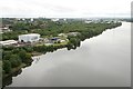
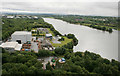
This Crannog was located on the North bank of the River Clyde, near modern day Old Kilpatrick (The reputed birthplace of 'Maewyn Succat' - canonized by the Church as St. Patrick)
The discovery of Carbonised, unthreshed ears of Barley and many other seeds types were recovered from the Crannog remains in 1906, and documented by "J.G. Callander" in 1911.
The Crannog was excavated by Messrs Napier's Shipyards Ltd, during the construction of a shipyard in the early part of the 19th century, the site was excavated and a number of photographs are now held by RCAHMS. Due to the major engineering works at the shipyard, and its subsequent demolition and landfill programme, the site appears to have been destroyed - although during the summer of 1997, "A.G.C Hale" found the probable location and a timber, possibly from the original structure excavated in the early 19th century.
Just over 100m away downriver, in the grounds of the old shipyard, a possible Souterrain was also discovered. A "Mr Ludovic Mann" found an abundance of Barley, showing the awn and stalk, on the floor of a pre-Roman house at Messrs Napier and Miller's Yard. (The area housed the most Westerly of the Roman Forts along the Antonine Wall)
For more information : Canmore ID 43277
You may be viewing yesterday's version of this page. To see the most up to date information please register for a free account.
Do not use the above information on other web sites or publications without permission of the contributor.
Nearby Images from Geograph Britain and Ireland:
©2018(licence)
©2018(licence)
©2011(licence)
©2007(licence)
©2009(licence)
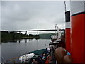
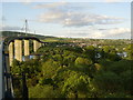
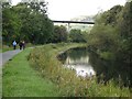
The above images may not be of the site on this page, they are loaded from Geograph.
Please Submit an Image of this site or go out and take one for us!
Click here to see more info for this site
Nearby sites
Key: Red: member's photo, Blue: 3rd party photo, Yellow: other image, Green: no photo - please go there and take one, Grey: site destroyed
Download sites to:
KML (Google Earth)
GPX (GPS waypoints)
CSV (Garmin/Navman)
CSV (Excel)
To unlock full downloads you need to sign up as a Contributory Member. Otherwise downloads are limited to 50 sites.
Turn off the page maps and other distractions
Nearby sites listing. In the following links * = Image available
981m W 273° Erskine Park* Ancient Village or Settlement (NS45607220)
1.3km WNW 303° Erskine Bridge Crannog Crannog (NS4548272901)
2.9km NW 320° Hill of Dun* Hillfort (NS44807439)
2.9km ENE 76° Antonine Wall remains below Golden Hill* Stone Fort or Dun (NS49467274)
3.0km ENE 78° Golden Hill Roman Fort* Stone Fort or Dun (NS49517265)
3.8km W 274° Longhaugh Point Menhir* Standing Stone (Menhir) (NS4279972498)
3.8km ENE 65° Auchnacraig 5* Rock Art (NS501736)
3.8km NW 304° Ardconnel Hill Fort* Hillfort (NS4348074400)
4.0km NW 307° Greenland 2 Rock Art (NS43487462)
4.0km ENE 66° Auchnacraig 4* Rock Art (NS50297362)
4.0km ENE 65° Auchnacraig 1* Rock Art (NS50287365)
4.0km NW 306° Greenland 1 Rock Art (NS43447460)
4.2km ENE 62° Auchnacraig Stone Circle* Stone Circle (NS50347391)
4.2km ENE 63° The Cochno Stone* Rock Art (NS50457388)
4.3km ENE 62° Cochno Crags* Natural Stone / Erratic / Other Natural Feature (NS50487401)
4.9km ENE 67° Whitehill 3* Rock Art (NS51157386)
5.1km ENE 66° Whitehill 4* Rock Art (NS51307398)
5.1km ENE 66° Whitehill 5* Rock Art (NS51387403)
5.3km WNW 288° Dumbuck Crannog* Crannog (NS41577392)
5.3km WNW 303° Dumbuie Dun* Hillfort (NS42187517)
5.9km E 83° Castlehill Fort (Bearsden)* Hillfort (NS5248272614)
6.2km W 278° Langbank Crannog (East)* Crannog (NS4049773171)
6.8km WSW 241° Barochan Hillfort Hillfort (NS40566902)
7.0km WNW 287° Dumbarton Hilllfort* Hillfort (NS399744)
7.9km WSW 238° Sewn Dun Hillfort (NS39766816)
View more nearby sites and additional images


 We would like to know more about this location. Please feel free to add a brief description and any relevant information in your own language.
 Wir möchten mehr über diese Stätte erfahren. Bitte zögern Sie nicht, eine kurze Beschreibung und relevante Informationen in Deutsch hinzuzufügen.
 Nous aimerions en savoir encore un peu sur les lieux. S'il vous plaît n'hesitez pas à ajouter une courte description et tous les renseignements pertinents dans votre propre langue.
 Quisieramos informarnos un poco más de las lugares. No dude en añadir una breve descripción y otros datos relevantes en su propio idioma.