

<< Text Pages >> St Ronan's Well - Holy Well or Sacred Spring in Scotland in West Dunbartonshire
Submitted by vicky on Monday, 29 March 2004 Page Views: 10746
Springs and Holy WellsSite Name: St Ronan's WellCountry: Scotland
NOTE: This site is 2.633 km away from the location you searched for.
County: West Dunbartonshire Type: Holy Well or Sacred Spring
Map Ref: NS4478087647 Landranger Map Number: 57
Latitude: 56.056424N Longitude: 4.49422W
Condition:
| 5 | Perfect |
| 4 | Almost Perfect |
| 3 | Reasonable but with some damage |
| 2 | Ruined but still recognisable as an ancient site |
| 1 | Pretty much destroyed, possibly visible as crop marks |
| 0 | No data. |
| -1 | Completely destroyed |
| 5 | Superb |
| 4 | Good |
| 3 | Ordinary |
| 2 | Not Good |
| 1 | Awful |
| 0 | No data. |
| 5 | Can be driven to, probably with disabled access |
| 4 | Short walk on a footpath |
| 3 | Requiring a bit more of a walk |
| 2 | A long walk |
| 1 | In the middle of nowhere, a nightmare to find |
| 0 | No data. |
| 5 | co-ordinates taken by GPS or official recorded co-ordinates |
| 4 | co-ordinates scaled from a detailed map |
| 3 | co-ordinates scaled from a bad map |
| 2 | co-ordinates of the nearest village |
| 1 | co-ordinates of the nearest town |
| 0 | no data |
Be the first person to rate this site - see the 'Contribute!' box in the right hand menu.
Internal Links:
External Links:
Holy Well / Spring in West Dunbartonshire.
Canmore ID 43436
You may be viewing yesterday's version of this page. To see the most up to date information please register for a free account.
Do not use the above information on other web sites or publications without permission of the contributor.
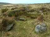
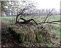
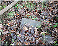
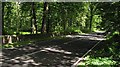
Nearby Images from Geograph Britain and Ireland:
©2022(licence)
©2022(licence)
©2010(licence)
©2009(licence)
©2011(licence)
The above images may not be of the site on this page, they are loaded from Geograph.
Please Submit an Image of this site or go out and take one for us!
Click here to see more info for this site
Nearby sites
Key: Red: member's photo, Blue: 3rd party photo, Yellow: other image, Green: no photo - please go there and take one, Grey: site destroyed
Download sites to:
KML (Google Earth)
GPX (GPS waypoints)
CSV (Garmin/Navman)
CSV (Excel)
To unlock full downloads you need to sign up as a Contributory Member. Otherwise downloads are limited to 50 sites.
Turn off the page maps and other distractions
Nearby sites listing. In the following links * = Image available
5.3km S 173° Gallangad Muir Standing Stone* Standing Stone (Menhir)
6.2km SSE 169° Lang Cairn* Chambered Cairn (NS458815)
7.0km S 169° Shiels of Gartlea* Chambered Cairn (NS459807)
7.1km SSE 152° Aucheneck* Chambered Cairn (NS4793681308)
8.3km SE 145° The Whangie* Natural Stone / Erratic / Other Natural Feature (NS49238066)
8.7km SE 130° Quinloch Muir Stones* Standing Stones (NS5125181730)
9.2km SE 131° Quinloch Muir Hillfort* Hillfort (NS51508134)
9.3km SW 232° Cameron Farm* Chambered Cairn (NS372822)
9.4km SW 235° Round Hill (Cameron home farm cairn)* Cairn (NS36918252)
9.9km W 271° Shemore* Rock Art (NS349882)
10.1km WNW 299° St Kessog's Church* Sculptured Stone (NS36129286)
10.9km SE 127° Blanefield* Stone Row / Alignment (NS53288072)
11.1km SW 221° Carman Hill Fort* Hillfort (NS37207944)
11.2km SE 132° Craigmore Cottage Standing Stones (NS529799)
11.8km SE 141° Craigenkirn (New Kilpatrick) Cairn (NS5183978157)
12.0km ESE 106° Earl’s Seat Cairn* Cairn (NS562840)
12.7km SW 219° Carman Hill cairn* Chambered Cairn (NS36357815)
12.7km S 190° Dumbuie Dun* Hillfort (NS42187517)
13.1km S 184° Greenland 2 Rock Art (NS43487462)
13.1km S 184° Greenland 1 Rock Art (NS43447460)
13.2km S 178° Hill of Dun* Hillfort (NS44807439)
13.3km S 184° Ardconnel Hill Fort* Hillfort (NS4348074400)
13.9km SW 227° St Mahew’s Cross* Standing Stone (Menhir) (NS34207863)
14.1km S 191° Dumbuck Crannog* Crannog (NS41577392)
14.1km SSW 198° Dumbarton Hilllfort* Hillfort (NS399744)
View more nearby sites and additional images


 We would like to know more about this location. Please feel free to add a brief description and any relevant information in your own language.
 Wir möchten mehr über diese Stätte erfahren. Bitte zögern Sie nicht, eine kurze Beschreibung und relevante Informationen in Deutsch hinzuzufügen.
 Nous aimerions en savoir encore un peu sur les lieux. S'il vous plaît n'hesitez pas à ajouter une courte description et tous les renseignements pertinents dans votre propre langue.
 Quisieramos informarnos un poco más de las lugares. No dude en añadir una breve descripción y otros datos relevantes en su propio idioma.