


<< Text Pages >> Nether Glenny (42) - Rock Art in Scotland in Perth and Kinross
Submitted by Anne T on Wednesday, 06 December 2017 Page Views: 1121
Rock ArtSite Name: Nether Glenny (42)Country: Scotland
NOTE: This site is 9.435 km away from the location you searched for.
County: Perth and Kinross Type: Rock Art
Nearest Town: Aberfoyle Nearest Village: Port of Menteith
Map Ref: NN56430229
Latitude: 56.191515N Longitude: 4.315201W
Condition:
| 5 | Perfect |
| 4 | Almost Perfect |
| 3 | Reasonable but with some damage |
| 2 | Ruined but still recognisable as an ancient site |
| 1 | Pretty much destroyed, possibly visible as crop marks |
| 0 | No data. |
| -1 | Completely destroyed |
| 5 | Superb |
| 4 | Good |
| 3 | Ordinary |
| 2 | Not Good |
| 1 | Awful |
| 0 | No data. |
| 5 | Can be driven to, probably with disabled access |
| 4 | Short walk on a footpath |
| 3 | Requiring a bit more of a walk |
| 2 | A long walk |
| 1 | In the middle of nowhere, a nightmare to find |
| 0 | No data. |
| 5 | co-ordinates taken by GPS or official recorded co-ordinates |
| 4 | co-ordinates scaled from a detailed map |
| 3 | co-ordinates scaled from a bad map |
| 2 | co-ordinates of the nearest village |
| 1 | co-ordinates of the nearest town |
| 0 | no data |
Be the first person to rate this site - see the 'Contribute!' box in the right hand menu.
Internal Links:
External Links:
Rock Art in Perth and Kinross
The Northern Antiquarian (TNA) features a page for this site - see their entry for Nether Glenny (42), Port of Menteith, Perthshire, which gives directions for finding this cup marked stone, together with photographs and a brief archaeology & history.
This stone is also recorded as Canmore ID 87397, their most recent report from 1995 saying: "Some 60m NE upslope from cup-marked rock at NN 5641 0224 is a second outcrop aligned NE-SW, measuring 4.70m in length by approximately 0.7m in width with four possible cup-marks."
TNA adds: "This 15-foot long stone halfway up the slope was said by the Royal Commission lads to have “four possible cup-marks” on it, whereas there are at least nine of them and maybe as many as eleven! Most of them are dead certs as prehistoric etchings, not just ‘possibles’. The more visible cup-marks here are found on the more western end of the stone, just below the grass-line. The cups here are quite distinct, measuring some two-inches across and nearly half-an-inch deep in two of them. The others in this section are a little smaller and further down the slope of the rock. Seemingly not noticed for a long long time however is a small cluster of very faded cups, gathered like a very faint 4-star Pleiades cluster."
Note: Have you visited this site? Do you have any photographs or information to add?
You may be viewing yesterday's version of this page. To see the most up to date information please register for a free account.
Do not use the above information on other web sites or publications without permission of the contributor.
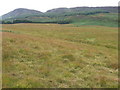
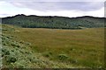
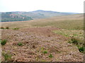
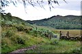
Nearby Images from Geograph Britain and Ireland:
©2007(licence)
©2015(licence)
©2011(licence)
©2015(licence)
©2006(licence)
The above images may not be of the site on this page, they are loaded from Geograph.
Please Submit an Image of this site or go out and take one for us!
Click here to see more info for this site
Nearby sites
Key: Red: member's photo, Blue: 3rd party photo, Yellow: other image, Green: no photo - please go there and take one, Grey: site destroyed
Download sites to:
KML (Google Earth)
GPX (GPS waypoints)
CSV (Garmin/Navman)
CSV (Excel)
To unlock full downloads you need to sign up as a Contributory Member. Otherwise downloads are limited to 50 sites.
Turn off the page maps and other distractions
Nearby sites listing. In the following links * = Image available
191m S 180° Nether Glenny (35) Rock Art (NN5642502099)
270m S 176° Nether Glenny (02) Cairn (NN56440202)
371m S 173° Nether Glenny Cairn* Cairn (NN56460192)
399m SW 215° Nether Glenny (28) Rock Art (NN56190197)
577m SSW 208° Nether Glenny Rock Art* Rock Art (NN56140179)
657m NE 41° Upper Glenny* Rock Art (NN56880277)
661m SSW 207° Mask Stone (Port of Menteith) Rock Art (NN5610701712)
662m SSW 207° Ballochraggan 12 Rock Art (NN5610601711)
834m SSW 206° Ballochraggan 5 Rock Art (NN5604401549)
1.4km SSW 200° Ballochraggan 1 Rock Art (NN5590001005)
2.1km ESE 122° Lake of Menteith Crannogs* Crannog (NN5821901097)
2.7km S 178° The Peace Stone* Rock Art (NS56419954)
5.8km ESE 102° The Ruskie Stane* Modern Stone Circle etc (NN6203800912)
6.8km NNE 34° Samson Stone (Callendar) Ancient Village or Settlement (NN6039807821)
8.3km SSE 163° Buchlyvie Broch* Broch or Nuraghe (NS5856494259)
9.2km ENE 67° St Mary's Well (Callender)* Holy Well or Sacred Spring (NN65070556)
9.2km ENE 72° Wester Torrie Stone Circle (NN65340480)
9.7km ENE 68° Ballochallan* Modern Stone Circle etc (NN65580559)
9.8km ENE 58° Auchenlaich Cairn* Chambered Cairn (NN64980715)
10.3km NE 42° Druim Mor (Callander)* Standing Stone (Menhir) (NN6354209721)
11.4km NE 47° West Bracklinn* Chambered Cairn (NN6501809794)
11.4km SSE 162° Carlin Stone (Balfron) Marker Stone (NS5955391277)
11.5km SSE 160° Wife with the Bratty Plaid (Balfron) Standing Stone (Menhir) (NS6002791383)
12.3km ENE 68° Ballachraggan Chambered Cairn (NN68050650)
13.2km ESE 106° Craighead Cairn* Cairn (NS69039822)
View more nearby sites and additional images


 We would like to know more about this location. Please feel free to add a brief description and any relevant information in your own language.
 Wir möchten mehr über diese Stätte erfahren. Bitte zögern Sie nicht, eine kurze Beschreibung und relevante Informationen in Deutsch hinzuzufügen.
 Nous aimerions en savoir encore un peu sur les lieux. S'il vous plaît n'hesitez pas à ajouter une courte description et tous les renseignements pertinents dans votre propre langue.
 Quisieramos informarnos un poco más de las lugares. No dude en añadir una breve descripción y otros datos relevantes en su propio idioma.