


<< Our Photo Pages >> St John's Well (Caradon) - Holy Well or Sacred Spring in England in Cornwall
Submitted by Thorgrim on Monday, 11 October 2004 Page Views: 5653
Springs and Holy WellsSite Name: St John's Well (Caradon)Country: England
NOTE: This site is 0.411 km away from the location you searched for.
County: Cornwall Type: Holy Well or Sacred Spring
Nearest Town: Wadebridge Nearest Village: Caradon
Map Ref: SX291714 Landranger Map Number: 201
Latitude: 50.517373N Longitude: 4.412029W
Condition:
| 5 | Perfect |
| 4 | Almost Perfect |
| 3 | Reasonable but with some damage |
| 2 | Ruined but still recognisable as an ancient site |
| 1 | Pretty much destroyed, possibly visible as crop marks |
| 0 | No data. |
| -1 | Completely destroyed |
| 5 | Superb |
| 4 | Good |
| 3 | Ordinary |
| 2 | Not Good |
| 1 | Awful |
| 0 | No data. |
| 5 | Can be driven to, probably with disabled access |
| 4 | Short walk on a footpath |
| 3 | Requiring a bit more of a walk |
| 2 | A long walk |
| 1 | In the middle of nowhere, a nightmare to find |
| 0 | No data. |
| 5 | co-ordinates taken by GPS or official recorded co-ordinates |
| 4 | co-ordinates scaled from a detailed map |
| 3 | co-ordinates scaled from a bad map |
| 2 | co-ordinates of the nearest village |
| 1 | co-ordinates of the nearest town |
| 0 | no data |
Internal Links:
External Links:
I have visited· I would like to visit
cazzyjane has visited here
 (PID:84394)")
Have you visited this site? Please add a comment below.
You may be viewing yesterday's version of this page. To see the most up to date information please register for a free account.
 (PID:84396)")
 (PID:200298)")
 (PID:200297)")
Do not use the above information on other web sites or publications without permission of the contributor.
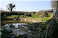
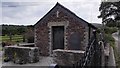
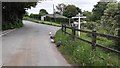
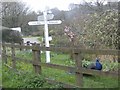
Nearby Images from Geograph Britain and Ireland:
©2007(licence)
©2016(licence)
©2016(licence)
©2012(licence)
©2012(licence)
The above images may not be of the site on this page, they are loaded from Geograph.
Please Submit an Image of this site or go out and take one for us!
Click here to see more info for this site
Nearby sites
Key: Red: member's photo, Blue: 3rd party photo, Yellow: other image, Green: no photo - please go there and take one, Grey: site destroyed
Download sites to:
KML (Google Earth)
GPX (GPS waypoints)
CSV (Garmin/Navman)
CSV (Excel)
To unlock full downloads you need to sign up as a Contributory Member. Otherwise downloads are limited to 50 sites.
Turn off the page maps and other distractions
Nearby sites listing. In the following links * = Image available
967m SSW 208° Roundabury* Hillfort (SX28627056)
2.0km WSW 248° Caradon Hill cairns* Barrow Cemetery (SX272707)
2.6km WSW 240° Caradon Hill stone row Stone Row / Alignment (SX26797016)
2.9km W 278° Minions Settlement* Ancient Village or Settlement (SX262719)
3.1km NW 319° Notter Tor Ancient Village or Settlement (SX27157377)
3.1km W 263° Minions Mound* Round Barrow(s) (SX26017112)
3.1km W 278° Rillaton Barrow* Round Barrow(s) (SX26027191)
3.1km W 278° Rillaton N Cairn* Cairn (SX26007195)
3.2km W 272° The Hurlers North* Stone Circle (SX25877159)
3.3km W 269° The Hurlers (N)* Stone Circle (SX25847145)
3.3km W 268° The Hurlers* Stone Circle (SX25837140)
3.3km W 268° The Hurlers causeway* Ancient Trackway (SX25837142)
3.3km W 268° The Hurlers (C)* Stone Circle (SX25827139)
3.3km W 267° The Hurlers (S)* Stone Circle (SX25817133)
3.3km NE 55° St Melor's Well* Holy Well or Sacred Spring (SX319732)
3.3km W 263° Minions Platform Round Barrow* Cairn (SX25787109)
3.4km W 276° The Hurlers Avenue* Multiple Stone Rows / Avenue (SX2576371864)
3.4km W 267° The Hurlers Pipers* Standing Stones (SX25717135)
3.5km WNW 285° The Cheesewring* Natural Stone / Erratic / Other Natural Feature (SX25787239)
3.5km WNW 286° Stowe's Pound* Ancient Village or Settlement (SX25787247)
3.6km WSW 255° The Long Stone (Minions)* Standing Stone (Menhir) (SX25547055)
3.7km NE 48° Linkinhorne Round* Misc. Earthwork (SX31927376)
3.8km WSW 258° Minions Cairns Cairn (SX25357073)
3.9km W 263° Minions Kerbed Cairn Cairn (SX25247103)
3.9km W 266° Minions Round Cairns* Round Cairn (SX25157126)
View more nearby sites and additional images


 We would like to know more about this location. Please feel free to add a brief description and any relevant information in your own language.
 Wir möchten mehr über diese Stätte erfahren. Bitte zögern Sie nicht, eine kurze Beschreibung und relevante Informationen in Deutsch hinzuzufügen.
 Nous aimerions en savoir encore un peu sur les lieux. S'il vous plaît n'hesitez pas à ajouter une courte description et tous les renseignements pertinents dans votre propre langue.
 Quisieramos informarnos un poco más de las lugares. No dude en añadir una breve descripción y otros datos relevantes en su propio idioma.