


<< Text Pages >> Cairnennock - Cairn in Scotland in East Ayrshire
Submitted by coldrum on Monday, 25 June 2007 Page Views: 3890
Neolithic and Bronze AgeSite Name: Cairnennock Alternative Name: The White Cairn of CarnannockCountry: Scotland County: East Ayrshire Type: Cairn
Nearest Village: Eriff
Map Ref: NS50800078
Latitude: 55.278495N Longitude: 4.3504W
Condition:
| 5 | Perfect |
| 4 | Almost Perfect |
| 3 | Reasonable but with some damage |
| 2 | Ruined but still recognisable as an ancient site |
| 1 | Pretty much destroyed, possibly visible as crop marks |
| 0 | No data. |
| -1 | Completely destroyed |
| 5 | Superb |
| 4 | Good |
| 3 | Ordinary |
| 2 | Not Good |
| 1 | Awful |
| 0 | No data. |
| 5 | Can be driven to, probably with disabled access |
| 4 | Short walk on a footpath |
| 3 | Requiring a bit more of a walk |
| 2 | A long walk |
| 1 | In the middle of nowhere, a nightmare to find |
| 0 | No data. |
| 5 | co-ordinates taken by GPS or official recorded co-ordinates |
| 4 | co-ordinates scaled from a detailed map |
| 3 | co-ordinates scaled from a bad map |
| 2 | co-ordinates of the nearest village |
| 1 | co-ordinates of the nearest town |
| 0 | no data |
Be the first person to rate this site - see the 'Contribute!' box in the right hand menu.
Internal Links:
External Links:
Cairn in East Ayrshire
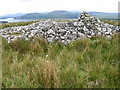
Remains of a cairn 20m in diameter and 0.5m in height on the top of Little Eriff Hill overlooking Loch Muck. Has a modern marker cairn built open it.
Human remains were found when the cairn was robbed for stone.
Site at RCAHMS
You may be viewing yesterday's version of this page. To see the most up to date information please register for a free account.
Do not use the above information on other web sites or publications without permission of the contributor.
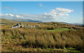
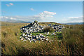
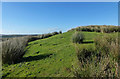
Nearby Images from Geograph Britain and Ireland:
©2008(licence)
©2016(licence)
©2016(licence)
©2016(licence)
©2016(licence)
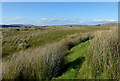
The above images may not be of the site on this page, they are loaded from Geograph.
Please Submit an Image of this site or go out and take one for us!
Click here to see more info for this site
Nearby sites
Key: Red: member's photo, Blue: 3rd party photo, Yellow: other image, Green: no photo - please go there and take one, Grey: site destroyed
Download sites to:
KML (Google Earth)
GPX (GPS waypoints)
CSV (Garmin/Navman)
CSV (Excel)
To unlock full downloads you need to sign up as a Contributory Member. Otherwise downloads are limited to 50 sites.
Turn off the page maps and other distractions
Nearby sites listing. In the following links * = Image available
2.6km SE 127° Lamford Burn* Cairn (NX52829916)
4.4km E 87° Brownhill Burn* Cairn (NS55210089)
4.6km E 84° Water of Deugh* Chambered Cairn (NS55420114)
7.9km SE 140° Green Well of Scotland (Carsphairn) Holy Well or Sacred Spring (NX5573494565)
7.9km SE 144° Holm Of Daltallochan Stone Circle* Stone Circle (NX55289422)
8.0km SE 143° Holm of Daltallochan Standing Stone* Standing Stone (Menhir) (NX55399420)
8.5km NNE 13° Beoch Stone Circle Stone Circle (NS530090)
8.7km ESE 108° Gold Wells (Carsphairn) Holy Well or Sacred Spring (NX5896497793)
9.5km S 180° King's Stone (Carsphairn) Natural Stone / Erratic / Other Natural Feature (NX50419127)
9.5km S 180° King's Well (Carsphairn) Holy Well or Sacred Spring (NX5043591268)
9.7km NNE 17° Nith Lodge Stone Circle (NS540100)
9.8km SSE 146° Cairn Avel* Cairn (NX55949245)
10.8km WSW 253° Cairnwhapple Stone* Natural Stone / Erratic / Other Natural Feature (NX40399796)
11.3km SE 146° Bardennoch* Cairn (NX56859120)
11.7km SW 225° Moss Knowes* Natural Stone / Erratic / Other Natural Feature (NX42239281)
11.8km SE 146° Braidenoch Cross Slabs* Early Christian Sculptured Stone (NX57099081)
14.1km E 93° Mungo's Well (Carsphairn) Holy Well or Sacred Spring (NX6492799555)
14.3km SSE 156° Physic Well (Kells) Holy Well or Sacred Spring (NX5622587525)
15.4km ESE 123° Smittons Bridge* Cairn (NX63409188)
15.5km ESE 116° Round Craigs* Cairn (NX64519355)
15.5km ESE 122° Stroanfreggan Craig* Hillfort (NX63709206)
16.0km SSE 148° Stroangassel Stone Circle (NX589869)
16.1km ESE 118° Chalybeate Well (Dalry)* Holy Well or Sacred Spring (NX6488792815)
16.1km ESE 123° Stroanfreggan Cairn* Cairn (NX64019142)
16.5km W 267° Knockinculloch* Ancient Village or Settlement (NS34200050)
View more nearby sites and additional images


 We would like to know more about this location. Please feel free to add a brief description and any relevant information in your own language.
 Wir möchten mehr über diese Stätte erfahren. Bitte zögern Sie nicht, eine kurze Beschreibung und relevante Informationen in Deutsch hinzuzufügen.
 Nous aimerions en savoir encore un peu sur les lieux. S'il vous plaît n'hesitez pas à ajouter une courte description et tous les renseignements pertinents dans votre propre langue.
 Quisieramos informarnos un poco más de las lugares. No dude en añadir una breve descripción y otros datos relevantes en su propio idioma.