 with our Megalithic Portal iPhone app")


<< Text Pages >> Aratispi - Ancient Village or Settlement in Spain in Andalucía
Submitted by holger_rix on Saturday, 05 December 2015 Page Views: 1171
Multi-periodSite Name: AratispiCountry: Spain Region: Andalucía Type: Ancient Village or Settlement
Nearest Village: Villanueva de Cauche
Latitude: 36.938420N Longitude: 4.44118W
Condition:
| 5 | Perfect |
| 4 | Almost Perfect |
| 3 | Reasonable but with some damage |
| 2 | Ruined but still recognisable as an ancient site |
| 1 | Pretty much destroyed, possibly visible as crop marks |
| 0 | No data. |
| -1 | Completely destroyed |
| 5 | Superb |
| 4 | Good |
| 3 | Ordinary |
| 2 | Not Good |
| 1 | Awful |
| 0 | No data. |
| 5 | Can be driven to, probably with disabled access |
| 4 | Short walk on a footpath |
| 3 | Requiring a bit more of a walk |
| 2 | A long walk |
| 1 | In the middle of nowhere, a nightmare to find |
| 0 | No data. |
| 5 | co-ordinates taken by GPS or official recorded co-ordinates |
| 4 | co-ordinates scaled from a detailed map |
| 3 | co-ordinates scaled from a bad map |
| 2 | co-ordinates of the nearest village |
| 1 | co-ordinates of the nearest town |
| 0 | no data |
Be the first person to rate this site - see the 'Contribute!' box in the right hand menu.
Internal Links:
External Links:
Ancient Village or Settlement in Andalucía
You may be viewing yesterday's version of this page. To see the most up to date information please register for a free account.
Do not use the above information on other web sites or publications without permission of the contributor.
Nearby Images from Flickr
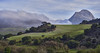
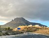
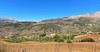
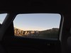


The above images may not be of the site on this page, but were taken nearby. They are loaded from Flickr so please click on them for image credits.
Click here to see more info for this site
Nearby sites
Click here to view sites on an interactive map of the areaKey: Red: member's photo, Blue: 3rd party photo, Yellow: other image, Green: no photo - please go there and take one, Grey: site destroyed
Download sites to:
KML (Google Earth)
GPX (GPS waypoints)
CSV (Garmin/Navman)
CSV (Excel)
To unlock full downloads you need to sign up as a Contributory Member. Otherwise downloads are limited to 50 sites.
Turn off the page maps and other distractions
Nearby sites listing. In the following links * = Image available
6.7km SE 136° Peñas de Cabrera* Rock Art
6.9km SE 133° Dólmen del Tajillo del Moro* Burial Chamber or Dolmen
9.0km WNW 282° El Tornillo Del Torcal* Natural Stone / Erratic / Other Natural Feature
9.3km S 177° Necrópolis de Las Chaperas Burial Chamber or Dolmen
13.3km NW 315° Dólmenes de Antequera centro de visitantes* Museum
13.5km NW 315° Cueva de Viera* Chambered Tomb
13.5km NW 315° Cueva de Menga* Chambered Cairn
13.5km NW 322° Cueva del Romeral* Chambered Cairn
14.6km NNW 346° Necrópolis de la Angostura* Burial Chamber or Dolmen
14.7km NW 313° Villa Romana de la Estación Ancient Village or Settlement
15.1km NNW 343° La Peña de los Enamorados* Natural Stone / Erratic / Other Natural Feature
15.7km NNW 343° Piedras Blancas* Rock Cut Tomb
20.6km ESE 111° Necrópolis de la Peña de Hierro Cist
23.0km SSE 148° Dolmen Cerro de la Corona* Burial Chamber or Dolmen
23.2km NNW 331° Los Silillos Ancient Village or Settlement
27.8km N 353° Necrópolis de las Cuevas del Alcaide* Rock Cut Tomb
29.7km S 184° Cerro Del Villar* Ancient Village or Settlement
30.2km SW 229° Tumbas de Castillejos de Luna Cist
30.5km W 263° Ruines de Bobastro* Ancient Village or Settlement
33.5km E 88° Dólmen de Llano de Zafarraya Burial Chamber or Dolmen
33.7km W 272° Necrópolis de las Aguilillas* Rock Cut Tomb
35.2km WSW 258° Cueva de Dona Trinidad* Cave or Rock Shelter
40.0km NE 35° Necrópolis de Sierra Martilla* Rock Cut Tomb
43.6km SW 234° Dólmen de la Cuesta de los Almendrillos* Burial Chamber or Dolmen
45.1km SW 234° Dolmen El Tesorillo de La Llaná* Burial Chamber or Dolmen
View more nearby sites and additional images


 We would like to know more about this location. Please feel free to add a brief description and any relevant information in your own language.
 Wir möchten mehr über diese Stätte erfahren. Bitte zögern Sie nicht, eine kurze Beschreibung und relevante Informationen in Deutsch hinzuzufügen.
 Nous aimerions en savoir encore un peu sur les lieux. S'il vous plaît n'hesitez pas à ajouter une courte description et tous les renseignements pertinents dans votre propre langue.
 Quisieramos informarnos un poco más de las lugares. No dude en añadir una breve descripción y otros datos relevantes en su propio idioma.