


<< Text Pages >> Carn Deasgan - Broch or Nuraghe in Scotland in Sutherland
Submitted by SolarMegalith on Sunday, 27 March 2011 Page Views: 2918
Iron Age and Later PrehistorySite Name: Carn Deasgan Alternative Name: ArgayCountry: Scotland
NOTE: This site is 1.606 km away from the location you searched for.
County: Sutherland Type: Broch or Nuraghe
Map Ref: NH5990
Latitude: 57.877124N Longitude: 4.379177W
Condition:
| 5 | Perfect |
| 4 | Almost Perfect |
| 3 | Reasonable but with some damage |
| 2 | Ruined but still recognisable as an ancient site |
| 1 | Pretty much destroyed, possibly visible as crop marks |
| 0 | No data. |
| -1 | Completely destroyed |
| 5 | Superb |
| 4 | Good |
| 3 | Ordinary |
| 2 | Not Good |
| 1 | Awful |
| 0 | No data. |
| 5 | Can be driven to, probably with disabled access |
| 4 | Short walk on a footpath |
| 3 | Requiring a bit more of a walk |
| 2 | A long walk |
| 1 | In the middle of nowhere, a nightmare to find |
| 0 | No data. |
| 5 | co-ordinates taken by GPS or official recorded co-ordinates |
| 4 | co-ordinates scaled from a detailed map |
| 3 | co-ordinates scaled from a bad map |
| 2 | co-ordinates of the nearest village |
| 1 | co-ordinates of the nearest town |
| 0 | no data |
Internal Links:
External Links:
Broch in Sutherland
Possible remains of a broch.
Read More at ScotlandsPlaces.
You may be viewing yesterday's version of this page. To see the most up to date information please register for a free account.
Do not use the above information on other web sites or publications without permission of the contributor.
Nearby Images from Geograph Britain and Ireland:
©2015(licence)
©2005(licence)
©2015(licence)
©2022(licence)
©2007(licence)
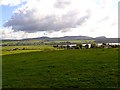
The above images may not be of the site on this page, they are loaded from Geograph.
Please Submit an Image of this site or go out and take one for us!
Click here to see more info for this site
Nearby sites
Key: Red: member's photo, Blue: 3rd party photo, Yellow: other image, Green: no photo - please go there and take one, Grey: site destroyed
Download sites to:
KML (Google Earth)
GPX (GPS waypoints)
CSV (Garmin/Navman)
CSV (Excel)
To unlock full downloads you need to sign up as a Contributory Member. Otherwise downloads are limited to 50 sites.
Turn off the page maps and other distractions
Nearby sites listing. In the following links * = Image available
3.8km ENE 63° Loch Migdale Henge (NH62429160)
4.2km W 279° Gruinards Broch or Nuraghe (NH549908)
4.7km E 98° St Demhan's Cross* Early Christian Sculptured Stone (NH636892)
6.9km NNW 346° Invershin Farm* Standing Stone (Menhir) (NH5760796742)
7.3km E 79° Kyleoag Chambered Cairn Chambered Cairn (NH662911)
7.4km ESE 113° Dun Alascaig Broch or Nuraghe (NH65698682)
7.7km WSW 257° St John the Baptist's Well (Fodderty)* Holy Well or Sacred Spring (NH514885)
8.1km E 80° Achaidh Chambered Cairn* Chambered Cairn (NH671911)
8.2km E 85° Allt nan Eun Chambered Cairn Chambered Cairn (NH672904)
8.2km E 85° Cairn, Fairy Glen, Bailenacile Cairn (NH672904)
9.6km ESE 104° Ardvannie* Chambered Cairn (NH68238740)
10.2km ESE 114° Leachonich Broch or Nuraghe (NH68128546)
10.2km NNW 332° Linsidemore* Stone Circle (NH54509918)
10.2km ESE 112° Lower Lechanich North Chambered Tomb (NH684859)
10.3km ESE 112° Lower Lechanich South Chambered Tomb (NH684858)
10.8km N 355° Auchinduich* Stone Circle (NC58450084)
12.1km NW 313° Carn Mor 3 Broch or Nuraghe (NH50399853)
12.1km N 349° Achany Chambered Cairn* Chambered Cairn (NC57100200)
12.6km E 90° Clach a' Charra* Standing Stone (Menhir) (NH7164789493)
12.8km ESE 111° Edderton 1* Class I Pictish Symbol Stone (NH70828507)
12.8km ESE 110° Edderton Stone Circle* Cairn (NH70908511)
13.2km NNW 345° Achany Stone Circle* Stone Circle (NC560029)
13.2km NNW 345° Druim Baile Fuir North Cairn (NC56030292)
13.3km NNW 344° Druim Baile Fuir West Ancient Village or Settlement (NC55780289)
13.3km NNW 346° Gruids Wood Cairn (NC56200307)
View more nearby sites and additional images


 We would like to know more about this location. Please feel free to add a brief description and any relevant information in your own language.
 Wir möchten mehr über diese Stätte erfahren. Bitte zögern Sie nicht, eine kurze Beschreibung und relevante Informationen in Deutsch hinzuzufügen.
 Nous aimerions en savoir encore un peu sur les lieux. S'il vous plaît n'hesitez pas à ajouter une courte description et tous les renseignements pertinents dans votre propre langue.
 Quisieramos informarnos un poco más de las lugares. No dude en añadir una breve descripción y otros datos relevantes en su propio idioma.