


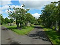
<< Our Photo Pages >> Antonine Wall, New Kilpatrick Cemetery - Misc. Earthwork in Scotland in East Dunbartonshire
Submitted by Andy B on Tuesday, 31 August 2021 Page Views: 592
Roman, Greek and ClassicalSite Name: Antonine Wall, New Kilpatrick CemeteryCountry: Scotland
NOTE: This site is 2.176 km away from the location you searched for.
County: East Dunbartonshire Type: Misc. Earthwork
Nearest Town: Bearsden
Map Ref: NS557723
Latitude: 55.922067N Longitude: 4.310789W
Condition:
| 5 | Perfect |
| 4 | Almost Perfect |
| 3 | Reasonable but with some damage |
| 2 | Ruined but still recognisable as an ancient site |
| 1 | Pretty much destroyed, possibly visible as crop marks |
| 0 | No data. |
| -1 | Completely destroyed |
| 5 | Superb |
| 4 | Good |
| 3 | Ordinary |
| 2 | Not Good |
| 1 | Awful |
| 0 | No data. |
| 5 | Can be driven to, probably with disabled access |
| 4 | Short walk on a footpath |
| 3 | Requiring a bit more of a walk |
| 2 | A long walk |
| 1 | In the middle of nowhere, a nightmare to find |
| 0 | No data. |
| 5 | co-ordinates taken by GPS or official recorded co-ordinates |
| 4 | co-ordinates scaled from a detailed map |
| 3 | co-ordinates scaled from a bad map |
| 2 | co-ordinates of the nearest village |
| 1 | co-ordinates of the nearest town |
| 0 | no data |
Be the first person to rate this site - see the 'Contribute!' box in the right hand menu.
Internal Links:
External Links:
")
More information on this and other Antonine Wall sites here.
You may be viewing yesterday's version of this page. To see the most up to date information please register for a free account.
")
")
")
Do not use the above information on other web sites or publications without permission of the contributor.
Nearby Images from Geograph Britain and Ireland:
©2020(licence)
©2015(licence)
©2015(licence)
©2015(licence)
©2015(licence)
The above images may not be of the site on this page, they are loaded from Geograph.
Please Submit an Image of this site or go out and take one for us!
Click here to see more info for this site
Nearby sites
Key: Red: member's photo, Blue: 3rd party photo, Yellow: other image, Green: no photo - please go there and take one, Grey: site destroyed
Download sites to:
KML (Google Earth)
GPX (GPS waypoints)
CSV (Garmin/Navman)
CSV (Excel)
To unlock full downloads you need to sign up as a Contributory Member. Otherwise downloads are limited to 50 sites.
Turn off the page maps and other distractions
Nearby sites listing. In the following links * = Image available
1.1km WSW 257° Bearsden Roman Bath-house* Stone Fort or Dun (NS54627208)
3.2km W 274° Castlehill Fort (Bearsden)* Hillfort (NS5248272614)
4.0km NE 37° Blochairn 1 Cairn Cairn (NS582754)
4.3km N 3° Middleton Row Stone Row / Alignment (NS561766)
4.3km NNE 30° Craigmaddie Muir 2 (Baldernock) Cairn (NS5876)
4.6km NNE 29° North Blochairn 1 Rock Art (NS58087623)
4.6km NNE 30° North Blochairn 2 Rock Art (NS58147623)
4.6km WNW 290° Whitehill 5* Rock Art (NS51387403)
4.7km WNW 289° Whitehill 4* Rock Art (NS51307398)
4.8km WNW 287° Whitehill 3* Rock Art (NS51157386)
4.8km NNE 29° North Blochairn 3* Rock Art (NS58187646)
4.8km NNE 29° Auld Wives Lift* Natural Stone / Erratic / Other Natural Feature (NS5818576458)
4.9km N 349° Echo Stone (Mugdock) Natural Stone / Erratic / Other Natural Feature (NS54937710)
5.1km NNE 33° Craigmaddie Muir* Chambered Cairn (NS58597646)
5.3km N 9° Loch Ardinning (Mugdock) Rock Art (NS567775)
5.5km WNW 285° The Cochno Stone* Rock Art (NS50457388)
5.5km WNW 286° Cochno Crags* Natural Stone / Erratic / Other Natural Feature (NS50487401)
5.6km WNW 282° Auchnacraig 4* Rock Art (NS50297362)
5.6km WNW 282° Auchnacraig 1* Rock Art (NS50287365)
5.6km WNW 285° Auchnacraig Stone Circle* Stone Circle (NS50347391)
5.7km W 281° Auchnacraig 5* Rock Art (NS501736)
5.7km SSE 166° Hunterian Museum* Museum (NS56906667)
6.1km SSE 168° Kelvingrove Museum and Art Gallery* Museum (NS5676166302)
6.2km W 271° Golden Hill Roman Fort* Stone Fort or Dun (NS49517265)
6.2km W 272° Antonine Wall remains below Golden Hill* Stone Fort or Dun (NS49467274)
View more nearby sites and additional images


 We would like to know more about this location. Please feel free to add a brief description and any relevant information in your own language.
 Wir möchten mehr über diese Stätte erfahren. Bitte zögern Sie nicht, eine kurze Beschreibung und relevante Informationen in Deutsch hinzuzufügen.
 Nous aimerions en savoir encore un peu sur les lieux. S'il vous plaît n'hesitez pas à ajouter une courte description et tous les renseignements pertinents dans votre propre langue.
 Quisieramos informarnos un poco más de las lugares. No dude en añadir una breve descripción y otros datos relevantes en su propio idioma.