


<< Text Pages >> St Maughold's Well - Holy Well or Sacred Spring in Channel Islands and Isle of Man in Isle of Man
Submitted by vicky on Monday, 29 March 2004 Page Views: 11105
Springs and Holy WellsSite Name: St Maughold's Well Alternative Name: Chibbyr VaghalCountry: Channel Islands and Isle of Man
NOTE: This site is 0.385 km away from the location you searched for.
Island: Isle of Man Type: Holy Well or Sacred Spring
Nearest Town: Ramsey Nearest Village: Maughold
Map Ref: SC49619193
Map Number: 95
Latitude: 54.300773N Longitude: 4.31262W
Condition:
| 5 | Perfect |
| 4 | Almost Perfect |
| 3 | Reasonable but with some damage |
| 2 | Ruined but still recognisable as an ancient site |
| 1 | Pretty much destroyed, possibly visible as crop marks |
| 0 | No data. |
| -1 | Completely destroyed |
| 5 | Superb |
| 4 | Good |
| 3 | Ordinary |
| 2 | Not Good |
| 1 | Awful |
| 0 | No data. |
| 5 | Can be driven to, probably with disabled access |
| 4 | Short walk on a footpath |
| 3 | Requiring a bit more of a walk |
| 2 | A long walk |
| 1 | In the middle of nowhere, a nightmare to find |
| 0 | No data. |
| 5 | co-ordinates taken by GPS or official recorded co-ordinates |
| 4 | co-ordinates scaled from a detailed map |
| 3 | co-ordinates scaled from a bad map |
| 2 | co-ordinates of the nearest village |
| 1 | co-ordinates of the nearest town |
| 0 | no data |
Be the first person to rate this site - see the 'Contribute!' box in the right hand menu.
Internal Links:
External Links:
Holy Well / Spring in Isle of Man
The Journal of Antiquities features an entry for St Maughold’s Well, Maughold, Isle of Man, which is on top of a headland overlooking the Irish Sea, beside a footpath and 350m north east of St Maughold's Churchyard. The Journal tells us this is a pre-Christian spring, adopted by a 5th century Celtic saint called Macaille, Mccald or Maughold. The Journal gives precise directions on how to reach the well, and includes background information and a list of reference sources for further information.
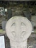
The Transceltic website also includes an entry for this well - see their page for Çhibbyr Maghal - St Maughold's Well which tells us this is a stunning spot and "Maughold churchyard has within it the remains of three ancient Keeills. The present church dates from around the 11th to 12th century. A large number of Celtic Crosses and Norse carvings dating from the 6th to 13th centuries are housed in a collection within the churchyard. There was also once an ancient pre-historic tomb on the site. A journey to Maughold Head and St Maughold’s Well is complimented by visiting Maughold churchyard".
You may be viewing yesterday's version of this page. To see the most up to date information please register for a free account.
Do not use the above information on other web sites or publications without permission of the contributor.
Nearby Images from Flickr


The above images may not be of the site on this page, but were taken nearby. They are loaded from Flickr so please click on them for image credits.
Click here to see more info for this site
Nearby sites
Click here to view sites on an interactive map of the areaKey: Red: member's photo, Blue: 3rd party photo, Yellow: other image, Green: no photo - please go there and take one, Grey: site destroyed
Download sites to:
KML (Google Earth)
GPX (GPS waypoints)
CSV (Garmin/Navman)
CSV (Excel)
To unlock full downloads you need to sign up as a Contributory Member. Otherwise downloads are limited to 50 sites.
Turn off the page maps and other distractions
Nearby sites listing. In the following links * = Image available
2.6km SW 224° Ballagory Horned Cairn* Cairn (SC47759012)
4.3km SW 230° Cashtal-yn-Ard* Chambered Tomb (SC46228923)
4.8km WNW 290° Killeaba Mound* Natural Stone / Erratic / Other Natural Feature
6.6km W 269° Glen Auldyn Cist* Cist (SC4392)
7.6km SSW 213° Spiral stone (Ballaragh)* Rock Art (SC4520085670)
7.7km WNW 300° Cronk Aust Cist* Cist (SC4396)
9.4km SW 215° King Orry's Grave* Chambered Tomb (SC43898439)
10.4km NNW 331° Thor Cross, Bride* Ancient Cross (NX449012)
10.6km W 280° Cronk Sumark* Vitrified Fort (SC392941)
12.0km W 269° Oaie ny Foawr (Sulby) Round Barrow(s) (SC376922)
12.4km SSW 211° Cloven Stones* Chambered Tomb (SC42928141)
14.3km SSW 207° Lonan Church Crosses Ancient Cross (SC42737937)
14.4km SSW 207° Glebe Well (Lonan Church) Holy Well or Sacred Spring (SC42577937)
14.6km WSW 252° Druidale* Ancient Village or Settlement (SC356878)
16.0km WNW 282° Runic Cross (Ballaugh Old Church)* Ancient Cross
16.0km WNW 292° Kirk Patrick Burial Mound Artificial Mound (SC350985)
16.1km W 273° Magher ny Clogh Mooar* Standing Stone (Menhir) (SC335933)
16.3km WNW 287° Ballateare Viking burial mound Round Barrow(s)
16.8km SSW 213° St Peter's Church (Onchan) Ancient Cross (SC40057814)
17.3km W 273° Orrisdale* Cairn (SC323935)
17.9km SW 216° White Lady Stone* Standing Stone (Menhir) (SC38597783)
18.5km W 260° Cronk Guckley mounds* Round Barrow(s) (SC31238945)
19.3km W 260° Michael Standing Stone and rock art* Standing Stone (Menhir) (SC30468908)
19.6km SW 214° Manx Museum* Museum
20.1km SW 233° Keill Vreeshey (Crosby) Sculptured Stone (SC332802)
View more nearby sites and additional images


 We would like to know more about this location. Please feel free to add a brief description and any relevant information in your own language.
 Wir möchten mehr über diese Stätte erfahren. Bitte zögern Sie nicht, eine kurze Beschreibung und relevante Informationen in Deutsch hinzuzufügen.
 Nous aimerions en savoir encore un peu sur les lieux. S'il vous plaît n'hesitez pas à ajouter une courte description et tous les renseignements pertinents dans votre propre langue.
 Quisieramos informarnos un poco más de las lugares. No dude en añadir una breve descripción y otros datos relevantes en su propio idioma.