


<< Our Photo Pages >> Lady's Well (Callington) - Holy Well or Sacred Spring in England in Cornwall
Submitted by jamesrattue on Monday, 12 October 2015 Page Views: 2460
Springs and Holy WellsSite Name: Lady's Well (Callington) Alternative Name: Pipe WellCountry: England County: Cornwall Type: Holy Well or Sacred Spring
Nearest Town: Callington Nearest Village: Callington
Map Ref: SX359696
Latitude: 50.503146N Longitude: 4.315403W
Condition:
| 5 | Perfect |
| 4 | Almost Perfect |
| 3 | Reasonable but with some damage |
| 2 | Ruined but still recognisable as an ancient site |
| 1 | Pretty much destroyed, possibly visible as crop marks |
| 0 | No data. |
| -1 | Completely destroyed |
| 5 | Superb |
| 4 | Good |
| 3 | Ordinary |
| 2 | Not Good |
| 1 | Awful |
| 0 | No data. |
| 5 | Can be driven to, probably with disabled access |
| 4 | Short walk on a footpath |
| 3 | Requiring a bit more of a walk |
| 2 | A long walk |
| 1 | In the middle of nowhere, a nightmare to find |
| 0 | No data. |
| 5 | co-ordinates taken by GPS or official recorded co-ordinates |
| 4 | co-ordinates scaled from a detailed map |
| 3 | co-ordinates scaled from a bad map |
| 2 | co-ordinates of the nearest village |
| 1 | co-ordinates of the nearest town |
| 0 | no data |
Internal Links:
External Links:
 (PID:139258)")
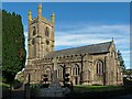
The spring flows strongly from a stone well-house against a house wall down Well Street right in the middle of Callington, and can be accessed by a short flight of stone steps - or could be were it not for the horribly ugly railings that thoughtfully prevent the good citizens of the town from falling in it on dark nights. A plaque informs visitors that the well was once the main water supply and that the well-house was constructed in 1816. The church, large though it is, was until relatively recently only a chapel-of-ease to St Dominic not far away; it's dedicated to the Virgin Mary, which fits in with the old name of the well. 139247
You may be viewing yesterday's version of this page. To see the most up to date information please register for a free account.
Do not use the above information on other web sites or publications without permission of the contributor.
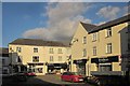
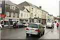
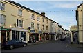
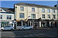
Nearby Images from Geograph Britain and Ireland:
©2014(licence)
©2022(licence)
©2011(licence)
©2018(licence)
©2012(licence)
The above images may not be of the site on this page, they are loaded from Geograph.
Please Submit an Image of this site or go out and take one for us!
Click here to see more info for this site
Nearby sites
Key: Red: member's photo, Blue: 3rd party photo, Yellow: other image, Green: no photo - please go there and take one, Grey: site destroyed
Download sites to:
KML (Google Earth)
GPX (GPS waypoints)
CSV (Garmin/Navman)
CSV (Excel)
To unlock full downloads you need to sign up as a Contributory Member. Otherwise downloads are limited to 50 sites.
Turn off the page maps and other distractions
Nearby sites listing. In the following links * = Image available
1.5km E 100° Dupath Well* Holy Well or Sacred Spring (SX374693)
1.6km SW 228° Frogwell* Holy Well or Sacred Spring (SX347686)
1.6km SE 130° Castlewitch Henge* Henge (SX37086854)
2.4km NE 40° Kit Hill Long Barrow (SX37487135)
2.7km SW 217° Cadson Bury* Hillfort (SX342675)
3.2km NW 317° Lower Manaton Holy Well or Sacred Spring (SX3377072033)
3.6km SSW 210° Collects Well* Holy Well or Sacred Spring (SX3399466483)
5.4km NW 310° St Melor's Well* Holy Well or Sacred Spring (SX319732)
5.7km NW 315° Linkinhorne Round* Misc. Earthwork (SX31927376)
6.7km SW 221° Quethiock Cross* Ancient Cross (SX31296471)
6.9km ESE 121° St Indract's Well* Holy Well or Sacred Spring (SX417659)
7.0km WNW 283° St John's Well (Caradon)* Holy Well or Sacred Spring (SX291714)
7.3km W 276° Roundabury* Hillfort (SX28627056)
8.0km N 359° Rezare Holy Well* Holy Well or Sacred Spring (SX3607977615)
8.7km W 275° Caradon Hill cairns* Barrow Cemetery (SX272707)
9.1km W 272° Caradon Hill stone row Stone Row / Alignment (SX26797016)
9.5km SSE 149° St Mary the Virgin (Cornwall)* Holy Well or Sacred Spring (SX4055461327)
9.5km SSE 153° Holy Well near Saltash Holy Well or Sacred Spring (SX400610)
9.7km WNW 294° Notter Tor Ancient Village or Settlement (SX27157377)
9.7km SSW 206° Padderbury Top Ancient Village or Settlement (SX3139661023)
9.8km NNW 346° St Michael's Well (Lezant)* Holy Well or Sacred Spring
9.9km WNW 282° Minions Settlement* Ancient Village or Settlement (SX262719)
10.0km W 264° Trethevy Quoit* Burial Chamber or Dolmen (SX2593668813)
10.0km W 277° Minions Mound* Round Barrow(s) (SX26017112)
10.0km N 353° St Brigid's Well Holy Well or Sacred Spring (SX350796)
View more nearby sites and additional images


 We would like to know more about this location. Please feel free to add a brief description and any relevant information in your own language.
 Wir möchten mehr über diese Stätte erfahren. Bitte zögern Sie nicht, eine kurze Beschreibung und relevante Informationen in Deutsch hinzuzufügen.
 Nous aimerions en savoir encore un peu sur les lieux. S'il vous plaît n'hesitez pas à ajouter une courte description et tous les renseignements pertinents dans votre propre langue.
 Quisieramos informarnos un poco más de las lugares. No dude en añadir una breve descripción y otros datos relevantes en su propio idioma.