


<< Our Photo Pages >> Stèle À Bonnet D'Evêque - Standing Stone (Menhir) in France in Bretagne:Finistère (29)
Submitted by TheCaptain on Tuesday, 28 December 2004 Page Views: 3220
Neolithic and Bronze AgeSite Name: Stèle À Bonnet D'Evêque Alternative Name: Stèle dite le Bonnet d'EvêqueCountry: France Département: Bretagne:Finistère (29) Type: Standing Stone (Menhir)
Nearest Town: Quimper Nearest Village: Plonéour-Lanvern
Latitude: 47.903261N Longitude: 4.283086W
Condition:
| 5 | Perfect |
| 4 | Almost Perfect |
| 3 | Reasonable but with some damage |
| 2 | Ruined but still recognisable as an ancient site |
| 1 | Pretty much destroyed, possibly visible as crop marks |
| 0 | No data. |
| -1 | Completely destroyed |
| 5 | Superb |
| 4 | Good |
| 3 | Ordinary |
| 2 | Not Good |
| 1 | Awful |
| 0 | No data. |
| 5 | Can be driven to, probably with disabled access |
| 4 | Short walk on a footpath |
| 3 | Requiring a bit more of a walk |
| 2 | A long walk |
| 1 | In the middle of nowhere, a nightmare to find |
| 0 | No data. |
| 5 | co-ordinates taken by GPS or official recorded co-ordinates |
| 4 | co-ordinates scaled from a detailed map |
| 3 | co-ordinates scaled from a bad map |
| 2 | co-ordinates of the nearest village |
| 1 | co-ordinates of the nearest town |
| 0 | no data |
Internal Links:
External Links:
I have visited· I would like to visit
paulcall has visited here
")
You may be viewing yesterday's version of this page. To see the most up to date information please register for a free account.
Do not use the above information on other web sites or publications without permission of the contributor.
has found this location on Google Street View:
Nearby Images from Flickr


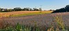
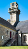
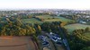
The above images may not be of the site on this page, but were taken nearby. They are loaded from Flickr so please click on them for image credits.
Click here to see more info for this site
Nearby sites
Click here to view sites on an interactive map of the areaKey: Red: member's photo, Blue: 3rd party photo, Yellow: other image, Green: no photo - please go there and take one, Grey: site destroyed
Download sites to:
KML (Google Earth)
GPX (GPS waypoints)
CSV (Garmin/Navman)
CSV (Excel)
To unlock full downloads you need to sign up as a Contributory Member. Otherwise downloads are limited to 50 sites.
Turn off the page maps and other distractions
Nearby sites listing. In the following links * = Image available
429m SSE 148° Trois Dolmens Burial Chamber or Dolmen
1.2km SSW 194° Menhir de Keriforn Standing Stone (Menhir)
2.4km E 80° Ti ar Poés menhir* Standing Stone (Menhir)
3.9km W 274° Penhors stèle* Standing Stone (Menhir)
4.1km E 95° Dolmen de Rostual Burial Chamber or Dolmen
4.7km WSW 243° Menhir de Kerguelleg Standing Stone (Menhir)
4.7km NW 315° Menhirs de Kerloazec* Standing Stone (Menhir)
4.7km E 98° Menhir de Kerguillec Standing Stone (Menhir)
5.3km SW 230° Chapelle Saint-Vio menhir* Standing Stone (Menhir)
5.5km NNW 340° Menhir de Kerloazec 1 Standing Stone (Menhir)
5.5km S 169° La Vieille Metairie* Standing Stone (Menhir)
5.6km SE 146° Menhir de Guiric* Standing Stone (Menhir)
5.6km NNW 337° Dolmen de Penquélenne* Burial Chamber or Dolmen
5.6km NNW 340° Menhir de Kerloazec 2 Standing Stone (Menhir)
5.6km WNW 289° Menhir de Croaspilo Standing Stone (Menhir)
5.7km SSW 208° Kermenhir mégalithe Standing Stone (Menhir)
6.2km SSW 196° Beuzec Menhir* Standing Stone (Menhir)
6.2km SSW 213° Chapelle Notre Dame de Tronoën Stèle* Standing Stone (Menhir)
6.4km NNW 332° Lespurit-Quélen menhir* Standing Stone (Menhir)
6.5km SSW 203° Lanvenaël menhir* Standing Stone (Menhir)
6.6km NNW 341° Menhir de Kerven (Peumérit) Standing Stone (Menhir)
6.6km NNW 341° Ruot Nevez menhir Standing Stone (Menhir)
6.6km SSW 197° Kerugou dolmen* Burial Chamber or Dolmen
6.7km NW 320° Saint-Kodelig menhir* Standing Stone (Menhir)
6.9km SSE 154° Menhir de Kernuz* Standing Stone (Menhir)
View more nearby sites and additional images


 We would like to know more about this location. Please feel free to add a brief description and any relevant information in your own language.
 Wir möchten mehr über diese Stätte erfahren. Bitte zögern Sie nicht, eine kurze Beschreibung und relevante Informationen in Deutsch hinzuzufügen.
 Nous aimerions en savoir encore un peu sur les lieux. S'il vous plaît n'hesitez pas à ajouter une courte description et tous les renseignements pertinents dans votre propre langue.
 Quisieramos informarnos un poco más de las lugares. No dude en añadir una breve descripción y otros datos relevantes en su propio idioma.