
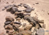

<< Our Photo Pages >> St Indract's Well - Holy Well or Sacred Spring in England in Cornwall
Submitted by Thorgrim on Monday, 29 March 2004 Page Views: 7718
Springs and Holy WellsSite Name: St Indract's WellCountry: England
NOTE: This site is 2.19 km away from the location you searched for.
County: Cornwall Type: Holy Well or Sacred Spring
Nearest Town: Callington Nearest Village: Chapel Farm
Map Ref: SX417659 Landranger Map Number: 201
Latitude: 50.471495N Longitude: 4.232114W
Condition:
| 5 | Perfect |
| 4 | Almost Perfect |
| 3 | Reasonable but with some damage |
| 2 | Ruined but still recognisable as an ancient site |
| 1 | Pretty much destroyed, possibly visible as crop marks |
| 0 | No data. |
| -1 | Completely destroyed |
| 5 | Superb |
| 4 | Good |
| 3 | Ordinary |
| 2 | Not Good |
| 1 | Awful |
| 0 | No data. |
| 5 | Can be driven to, probably with disabled access |
| 4 | Short walk on a footpath |
| 3 | Requiring a bit more of a walk |
| 2 | A long walk |
| 1 | In the middle of nowhere, a nightmare to find |
| 0 | No data. |
| 5 | co-ordinates taken by GPS or official recorded co-ordinates |
| 4 | co-ordinates scaled from a detailed map |
| 3 | co-ordinates scaled from a bad map |
| 2 | co-ordinates of the nearest village |
| 1 | co-ordinates of the nearest town |
| 0 | no data |
Internal Links:
External Links:
I have visited· I would like to visit
deepblue would like to visit
cazzyjane has visited here
")
Have you visited this site? Please add a comment below.
You may be viewing yesterday's version of this page. To see the most up to date information please register for a free account.
")
Do not use the above information on other web sites or publications without permission of the contributor.
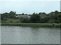
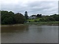
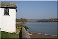
Nearby Images from Geograph Britain and Ireland:
©2023(licence)
©2013(licence)
©2009(licence)
©2023(licence)
©2018(licence)
The above images may not be of the site on this page, they are loaded from Geograph.
Please Submit an Image of this site or go out and take one for us!
Click here to see more info for this site
Nearby sites
Key: Red: member's photo, Blue: 3rd party photo, Yellow: other image, Green: no photo - please go there and take one, Grey: site destroyed
Download sites to:
KML (Google Earth)
GPX (GPS waypoints)
CSV (Garmin/Navman)
CSV (Excel)
To unlock full downloads you need to sign up as a Contributory Member. Otherwise downloads are limited to 50 sites.
Turn off the page maps and other distractions
Nearby sites listing. In the following links * = Image available
4.7km SSW 192° St Mary the Virgin (Cornwall)* Holy Well or Sacred Spring (SX4055461327)
5.2km SSW 197° Holy Well near Saltash Holy Well or Sacred Spring (SX400610)
5.3km WNW 298° Castlewitch Henge* Henge (SX37086854)
5.5km NW 307° Dupath Well* Holy Well or Sacred Spring (SX374693)
6.9km WNW 301° Lady's Well (Callington)* Holy Well or Sacred Spring (SX359696)
6.9km NW 321° Kit Hill Long Barrow (SX37487135)
7.5km WNW 289° Frogwell* Holy Well or Sacred Spring (SX347686)
7.6km W 280° Cadson Bury* Hillfort (SX342675)
7.7km W 273° Collects Well* Holy Well or Sacred Spring (SX3399466483)
7.9km S 187° Trehan Cross* Ancient Cross (SX405581)
9.0km E 99° Roborough Down Earthworks* Hillfort (SX50556415)
9.2km E 100° Second Roborough Down Earthworks* Hillfort (SX50736407)
9.2km E 100° Third Roborough Down Earthworks* Misc. Earthwork (SX5077364013)
9.6km ENE 75° Crapstone Down Barrows Barrow Cemetery (SX511681)
9.9km E 81° Roborough Rocks* Rock Outcrop (SX515672)
10.0km NW 306° Lower Manaton Holy Well or Sacred Spring (SX3377072033)
10.0km NE 36° St John's Well (Tavistock)* Holy Well or Sacred Spring (SX478739)
10.1km SW 216° Venton Gwavas* Holy Well or Sacred Spring (SX355579)
10.4km W 262° Quethiock Cross* Ancient Cross (SX31296471)
11.0km NE 42° Whitchurch Common Wayside Cross Ancient Cross (SX49297385)
11.4km WSW 243° Padderbury Top Ancient Village or Settlement (SX3139661023)
11.8km SSW 199° Lady Well (Shevlock)* Holy Well or Sacred Spring (SX37425488)
12.1km SSW 205° Stumpy Cross* Ancient Cross (SX36285504)
12.2km NW 305° St Melor's Well* Holy Well or Sacred Spring (SX319732)
12.3km E 97° Dewerstone* Causewayed Enclosure (SX53876399)
View more nearby sites and additional images


 We would like to know more about this location. Please feel free to add a brief description and any relevant information in your own language.
 Wir möchten mehr über diese Stätte erfahren. Bitte zögern Sie nicht, eine kurze Beschreibung und relevante Informationen in Deutsch hinzuzufügen.
 Nous aimerions en savoir encore un peu sur les lieux. S'il vous plaît n'hesitez pas à ajouter une courte description et tous les renseignements pertinents dans votre propre langue.
 Quisieramos informarnos un poco más de las lugares. No dude en añadir una breve descripción y otros datos relevantes en su propio idioma.