


<< Our Photo Pages >> Castell Perthi-mawr - Hillfort in Wales in Ceredigion
Submitted by Lanceabit on Sunday, 06 April 2008 Page Views: 5888
Iron Age and Later PrehistorySite Name: Castell Perthi-mawr Alternative Name: Castell CilcenninCountry: Wales
NOTE: This site is 2.59 km away from the location you searched for.
County: Ceredigion Type: Hillfort
Nearest Town: Aberaeron Nearest Village: Cilcennin
Map Ref: SN528589
Latitude: 52.208605N Longitude: 4.155702W
Condition:
| 5 | Perfect |
| 4 | Almost Perfect |
| 3 | Reasonable but with some damage |
| 2 | Ruined but still recognisable as an ancient site |
| 1 | Pretty much destroyed, possibly visible as crop marks |
| 0 | No data. |
| -1 | Completely destroyed |
| 5 | Superb |
| 4 | Good |
| 3 | Ordinary |
| 2 | Not Good |
| 1 | Awful |
| 0 | No data. |
| 5 | Can be driven to, probably with disabled access |
| 4 | Short walk on a footpath |
| 3 | Requiring a bit more of a walk |
| 2 | A long walk |
| 1 | In the middle of nowhere, a nightmare to find |
| 0 | No data. |
| 5 | co-ordinates taken by GPS or official recorded co-ordinates |
| 4 | co-ordinates scaled from a detailed map |
| 3 | co-ordinates scaled from a bad map |
| 2 | co-ordinates of the nearest village |
| 1 | co-ordinates of the nearest town |
| 0 | no data |
Internal Links:
External Links:
I have visited· I would like to visit
Hayden visited on 15th Apr 2021 - their rating: Cond: 2 Amb: 4 Access: 4
")
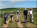
An iron age hillfort lying just south west of the near by cairns of Trychrug. It has two defence walls which are dry stone and the remains of a 6m roundhouse lie just below the turf. The internall area of the hillfort is roughly 112m by 60m and the openings between the two defence walls are staggered for a zig zag effect.
You may be viewing yesterday's version of this page. To see the most up to date information please register for a free account.
")
")
")
")
Do not use the above information on other web sites or publications without permission of the contributor.
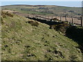
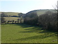
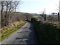
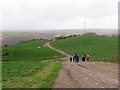
Nearby Images from Geograph Britain and Ireland:
©2008(licence)
©2008(licence)
©2008(licence)
©2020(licence)
©2014(licence)
The above images may not be of the site on this page, they are loaded from Geograph.
Please Submit an Image of this site or go out and take one for us!
Click here to see more info for this site
Nearby sites
Key: Red: member's photo, Blue: 3rd party photo, Yellow: other image, Green: no photo - please go there and take one, Grey: site destroyed
Download sites to:
KML (Google Earth)
GPX (GPS waypoints)
CSV (Garmin/Navman)
CSV (Excel)
To unlock full downloads you need to sign up as a Contributory Member. Otherwise downloads are limited to 50 sites.
Turn off the page maps and other distractions
Nearby sites listing. In the following links * = Image available
1.7km NE 53° Trichrug cairns Round Cairn (SN542599)
2.7km SSW 206° Pen-Y-Gaer (Ceredigion) Hillfort (SN51545648)
2.8km SE 129° Castell Trefilan* Artificial Mound (SN5489557101)
4.4km SE 142° Pen-Clawdd-Mawr Hillfort (SN55455535)
4.8km NW 315° Castell Dinerth* Promontory Fort / Cliff Castle (SN4949062370)
4.9km E 95° Pen-Y-Gaer (Nantcwnlle)* Hillfort (SN57735833)
6.1km NNE 12° Llech Gron* Standing Stone (Menhir) (SN5424664851)
6.8km WSW 238° Cwm Castell Hillfort (SN4694055440)
6.8km NW 309° St David's Church Hillfort* Hillfort (SN4761063370)
7.4km S 176° Gaer Fach (Cribyn) Ancient Village or Settlement (SN53135147)
7.5km WNW 298° Tyn-y-coed the Second Well* Holy Well or Sacred Spring (SN4626462558)
7.5km WNW 298° Tyn-y-coed Well* Holy Well or Sacred Spring (SN4626062559)
7.5km S 172° Cribyn Clota Hillfort (SN53625146)
7.7km NNW 341° Llanon Defended Enclosure* Ancient Village or Settlement (SN5051066250)
7.9km WNW 296° Aberaeron Chalybeate Well* Holy Well or Sacred Spring (SN458626)
8.1km S 184° Gaer Maesmynach* Hillfort (SN52005087)
8.2km SSW 210° Castell Moeddyn Ancient Village or Settlement (SN48495195)
8.2km WNW 293° Pant-teg Enclosure* Hillfort (SN4533062300)
8.8km SSE 149° St Sulien's Church Carved Stone* Early Christian Sculptured Stone (SN5714951242)
8.8km SSE 147° St Sulien's Church Enclosure Ancient Village or Settlement (SN57445137)
9.2km SSW 214° Castell Moeddyn Fach Ancient Village or Settlement (SN47495143)
9.6km SE 140° Coed-Parc Gaer Hillfort (SN58795143)
9.8km N 4° Castell Mawr (Llanrhystud) Hillfort (SN5373068660)
9.8km SE 127° Ffynnon-Wen* Holy Well or Sacred Spring (SN60535283)
10.0km N 4° Castell Bach (Llanrhystud)* Hillfort (SN5388068870)
View more nearby sites and additional images


 We would like to know more about this location. Please feel free to add a brief description and any relevant information in your own language.
 Wir möchten mehr über diese Stätte erfahren. Bitte zögern Sie nicht, eine kurze Beschreibung und relevante Informationen in Deutsch hinzuzufügen.
 Nous aimerions en savoir encore un peu sur les lieux. S'il vous plaît n'hesitez pas à ajouter une courte description et tous les renseignements pertinents dans votre propre langue.
 Quisieramos informarnos un poco más de las lugares. No dude en añadir una breve descripción y otros datos relevantes en su propio idioma.