


<< Our Photo Pages >> Y Foel Promontory Fort - Promontory Fort / Cliff Castle in Wales in Ceredigion
Submitted by Hayden on Tuesday, 20 April 2021 Page Views: 396
Date UncertainSite Name: Y Foel Promontory FortCountry: Wales
NOTE: This site is 0.409 km away from the location you searched for.
County: Ceredigion Type: Promontory Fort / Cliff Castle
Nearest Village: Lanrhystud
Map Ref: SN5418069310
Latitude: 52.302496N Longitude: 4.140019W
Condition:
| 5 | Perfect |
| 4 | Almost Perfect |
| 3 | Reasonable but with some damage |
| 2 | Ruined but still recognisable as an ancient site |
| 1 | Pretty much destroyed, possibly visible as crop marks |
| 0 | No data. |
| -1 | Completely destroyed |
| 5 | Superb |
| 4 | Good |
| 3 | Ordinary |
| 2 | Not Good |
| 1 | Awful |
| 0 | No data. |
| 5 | Can be driven to, probably with disabled access |
| 4 | Short walk on a footpath |
| 3 | Requiring a bit more of a walk |
| 2 | A long walk |
| 1 | In the middle of nowhere, a nightmare to find |
| 0 | No data. |
| 5 | co-ordinates taken by GPS or official recorded co-ordinates |
| 4 | co-ordinates scaled from a detailed map |
| 3 | co-ordinates scaled from a bad map |
| 2 | co-ordinates of the nearest village |
| 1 | co-ordinates of the nearest town |
| 0 | no data |
Internal Links:
External Links:
I have visited· I would like to visit
Hayden visited on 16th Apr 2021 - their rating: Cond: 2 Amb: 4 Access: 4
")
Very little information is to found about this site other than it was discovered by CUCAP in the 1970s.
You may be viewing yesterday's version of this page. To see the most up to date information please register for a free account.
")
Do not use the above information on other web sites or publications without permission of the contributor.
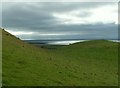
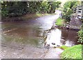
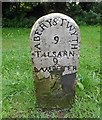
Nearby Images from Geograph Britain and Ireland:
©2007(licence)
©2007(licence)
©2005(licence)
©2019(licence)
©2014(licence)
The above images may not be of the site on this page, they are loaded from Geograph.
Please Submit an Image of this site or go out and take one for us!
Click here to see more info for this site
Nearby sites
Key: Red: member's photo, Blue: 3rd party photo, Yellow: other image, Green: no photo - please go there and take one, Grey: site destroyed
Download sites to:
KML (Google Earth)
GPX (GPS waypoints)
CSV (Garmin/Navman)
CSV (Excel)
To unlock full downloads you need to sign up as a Contributory Member. Otherwise downloads are limited to 50 sites.
Turn off the page maps and other distractions
Nearby sites listing. In the following links * = Image available
507m SW 232° Pentre-isaf Misc. Earthwork (SN5377069010)
532m SSW 213° Castell Bach (Llanrhystud)* Hillfort (SN5388068870)
790m SSW 213° Castell Mawr (Llanrhystud) Hillfort (SN5373068660)
937m WNW 294° Pengarreg Defended Enclosure Hillfort (SN5333069710)
1.1km ENE 75° Gaer Penrhôs* Ancient Village or Settlement (SN5520569555)
1.9km ENE 65° Gaer (Gilfachafael)* Ancient Village or Settlement (SN55907005)
4.5km NNE 14° Pen Glog* Cairn (SN554736)
4.5km S 177° Llech Gron* Standing Stone (Menhir) (SN5424664851)
4.8km SW 228° Llanon Defended Enclosure* Ancient Village or Settlement (SN5051066250)
5.6km ENE 76° The Dominicus Stone Early Christian Sculptured Stone (SN597705)
8.4km SSW 212° Castell Dinerth* Promontory Fort / Cliff Castle (SN4949062370)
8.8km E 94° Ty n-yr-eithin* Cairn (SN630685)
8.8km SW 226° St David's Church Hillfort* Hillfort (SN4761063370)
9.3km NE 46° Castell Pantmawr Hillfort (SN611756)
9.4km S 178° Trichrug cairns Round Cairn (SN542599)
10.2km ENE 58° Llanilar Hillfort (SN62997454)
10.3km ENE 57° Pen-Y-Castell Enclosure Ancient Village or Settlement (SN62997468)
10.4km SW 228° Tyn-y-coed the Second Well* Holy Well or Sacred Spring (SN4626462558)
10.4km SW 228° Tyn-y-coed Well* Holy Well or Sacred Spring (SN4626062559)
10.5km S 186° Castell Perthi-mawr* Hillfort (SN528589)
10.6km NNE 22° Castell Tan Y Bwlch Castle* Promontory Fort / Cliff Castle (SN5851079000)
10.7km SW 230° Aberaeron Chalybeate Well* Holy Well or Sacred Spring (SN458626)
10.9km ENE 75° Gaer Fawr (Lledrod)* Hillfort (SN648718)
11.3km SW 230° Pant-teg Enclosure* Hillfort (SN4533062300)
11.5km SSE 160° Pen-Y-Gaer (Nantcwnlle)* Hillfort (SN57735833)
View more nearby sites and additional images


 We would like to know more about this location. Please feel free to add a brief description and any relevant information in your own language.
 Wir möchten mehr über diese Stätte erfahren. Bitte zögern Sie nicht, eine kurze Beschreibung und relevante Informationen in Deutsch hinzuzufügen.
 Nous aimerions en savoir encore un peu sur les lieux. S'il vous plaît n'hesitez pas à ajouter une courte description et tous les renseignements pertinents dans votre propre langue.
 Quisieramos informarnos un poco más de las lugares. No dude en añadir una breve descripción y otros datos relevantes en su propio idioma.