


<< Text Pages >> Beinn a Mhadaidh Enclosures - Ancient Village or Settlement in Scotland in Sutherland
Submitted by coldrum on Thursday, 01 May 2008 Page Views: 2833
Multi-periodSite Name: Beinn a Mhadaidh EnclosuresCountry: Scotland
NOTE: This site is 3.705 km away from the location you searched for.
County: Sutherland Type: Ancient Village or Settlement
Nearest Town: Kinbrace
Map Ref: NC759413
Latitude: 58.342588N Longitude: 4.121641W
Condition:
| 5 | Perfect |
| 4 | Almost Perfect |
| 3 | Reasonable but with some damage |
| 2 | Ruined but still recognisable as an ancient site |
| 1 | Pretty much destroyed, possibly visible as crop marks |
| 0 | No data. |
| -1 | Completely destroyed |
| 5 | Superb |
| 4 | Good |
| 3 | Ordinary |
| 2 | Not Good |
| 1 | Awful |
| 0 | No data. |
| 5 | Can be driven to, probably with disabled access |
| 4 | Short walk on a footpath |
| 3 | Requiring a bit more of a walk |
| 2 | A long walk |
| 1 | In the middle of nowhere, a nightmare to find |
| 0 | No data. |
| 5 | co-ordinates taken by GPS or official recorded co-ordinates |
| 4 | co-ordinates scaled from a detailed map |
| 3 | co-ordinates scaled from a bad map |
| 2 | co-ordinates of the nearest village |
| 1 | co-ordinates of the nearest town |
| 0 | no data |
Be the first person to rate this site - see the 'Contribute!' box in the right hand menu.
Internal Links:
External Links:
Ancient Village or Settlement in Sutherland
Enclosures on Beinn a Mhadaidh.
http://www.fishing-hunting-scotland.com/syre.htm
You may be viewing yesterday's version of this page. To see the most up to date information please register for a free account.
Do not use the above information on other web sites or publications without permission of the contributor.
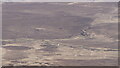
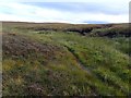
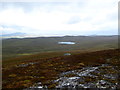
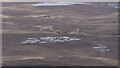
Nearby Images from Geograph Britain and Ireland:
©2023(licence)
©2018(licence)
©2015(licence)
©2023(licence)
©2009(licence)
The above images may not be of the site on this page, they are loaded from Geograph.
Please Submit an Image of this site or go out and take one for us!
Click here to see more info for this site
Nearby sites
Key: Red: member's photo, Blue: 3rd party photo, Yellow: other image, Green: no photo - please go there and take one, Grey: site destroyed
Download sites to:
KML (Google Earth)
GPX (GPS waypoints)
CSV (Garmin/Navman)
CSV (Excel)
To unlock full downloads you need to sign up as a Contributory Member. Otherwise downloads are limited to 50 sites.
Turn off the page maps and other distractions
Nearby sites listing. In the following links * = Image available
315m ESE 107° Beinn a Mhadaidh Enclosure 2 Ancient Village or Settlement (NC762412)
423m SE 133° Beinn a Mhadaidh Enclosure 1 Ancient Village or Settlement (NC762410)
1.1km W 263° Rimsdale Hill Enclosure Ancient Village or Settlement (NC748412)
1.2km WSW 259° Hut Circle Rimsdale Hill Ancient Village or Settlement (NC747411)
1.3km SW 236° Rimsdale Hill Enclosure 1 Ancient Village or Settlement (NC748406)
1.3km WSW 242° Rimsdale Hill Enclosure 2 Ancient Village or Settlement (NC747407)
1.8km SW 234° Rimsdale Hill Tumulus Barrow Cemetery (NC744403)
3.5km SE 131° Hut circle and Field sytem Ben Griam Mor Ancient Village or Settlement (NC785389)
3.9km SE 134° Ben Griam Mor, Hut Circles and Field systems Ancient Village or Settlement (NC786385)
4.0km SE 135° Ben Griam Mor Burnt Mound Artificial Mound (NC786384)
5.2km SSW 200° Cnoc na h-Uide Hut Circle Ancient Village or Settlement (NC740365)
6.6km SSE 157° Badanloch* Multiple Stone Rows / Avenue (NC78263516)
6.8km NW 319° Inshlampie Broch or Nuraghe (NC71594657)
7.1km E 91° Ben Griam beg Fort Hillfort (NC830410)
7.2km NW 319° Skail Chambered Cairn* Chambered Cairn (NC7129846898)
7.3km E 89° Ben Griam Beg* Hillfort (NC832412)
7.4km NW 321° St Maelrubha's Cross (Skail) Early Christian Sculptured Stone (NC7147047220)
7.4km WNW 290° Langdale, Sutherland Class I Pictish Symbol Stone (NC6944)
7.7km SSW 212° Loch Rimsdale* Multiple Stone Rows / Avenue (NC7162034865)
8.1km W 280° Syre A Stone Circle (NC6843)
8.1km W 280° Syre B Stone Circle (NC6843)
8.3km WSW 252° Clach an Righ* Stone Circle (NC67933903)
8.3km WSW 237° Cnoc na Gamhna Hut Circles 5 Ancient Village or Settlement (NC688370)
8.3km WSW 252° Dalharrold Hut Circle* Ancient Village or Settlement (NC67883899)
8.4km E 97° Ben Griam Beg Hut Circle Ancient Village or Settlement (NC842400)
View more nearby sites and additional images


 We would like to know more about this location. Please feel free to add a brief description and any relevant information in your own language.
 Wir möchten mehr über diese Stätte erfahren. Bitte zögern Sie nicht, eine kurze Beschreibung und relevante Informationen in Deutsch hinzuzufügen.
 Nous aimerions en savoir encore un peu sur les lieux. S'il vous plaît n'hesitez pas à ajouter une courte description et tous les renseignements pertinents dans votre propre langue.
 Quisieramos informarnos un poco más de las lugares. No dude en añadir una breve descripción y otros datos relevantes en su propio idioma.