Featured: Lost Secrets - an adventure during Neolithic times

Lost Secrets - an adventure during Neolithic times

Random Image


Bosworlas Lehau

The Henge Monuments of the British Isles: Myth and Archaeology

The Henge Monuments of the British Isles: Myth and Archaeology

Who's Online

There are currently, 390 guests and 2 members online.

You are a guest. To join in, please register for free by clicking here

Sponsors

<< Our Photo Pages >> Llandegai Henge Complex - Henge in Wales in Gwynedd

Submitted by TimPrevett on Saturday, 23 July 2005  Page Views: 16318

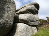
Neolithic and Bronze AgeSite Name: Llandegai Henge Complex Alternative Name: Llandygai
Country: Wales County: Gwynedd Type: Henge
Nearest Town: Bangor  Nearest Village: Llandegai
Map Ref: SH59407100
Latitude: 53.217398N  Longitude: 4.107177W
Condition:
5Perfect
4Almost Perfect
3Reasonable but with some damage
2Ruined but still recognisable as an ancient site
1Pretty much destroyed, possibly visible as crop marks
0No data.
-1Completely destroyed
1 Ambience:
5Superb
4Good
3Ordinary
2Not Good
1Awful
0No data.
1 Access:
5Can be driven to, probably with disabled access
4Short walk on a footpath
3Requiring a bit more of a walk
2A long walk
1In the middle of nowhere, a nightmare to find
0No data.
1 Accuracy:
5co-ordinates taken by GPS or official recorded co-ordinates
4co-ordinates scaled from a detailed map
3co-ordinates scaled from a bad map
2co-ordinates of the nearest village
1co-ordinates of the nearest town
0no data
5

Internal Links:
External Links:

Llandegai Henge Complex
Llandegai Henge Complex submitted by AngieLake : This view to west (-ish) from the cricket pitch car park near the service road to the industrial estate, would have been towards the red blob on the www.eryri-npa.gov.uk map (see link on site page), which shows the largest circular outline (the henge?) just a couple of blocks further west. The cursus runs E-W (ish) parallel to this view, a little way to the south of this position. (Vote or comment on this photo)
Henge in Gwynedd. According to A Guide to Ancient and Historic Wales: Gwynedd, Frances Lynch says this is completely destroyed, under an industrial estate; but the BBC link speaks of it in the present tense. It appears the true answer is somewhere in between. The Bing maps aerial shot shows a circular feature still extant.

Discovered in 1959 by aerial photography, there are / were two henges, associated barrows, and cursus.

http://www.rcahmw.org.uk/os/llandegai.shtml

Note: Currently being excavated. Online dig diary with weekly updates, see comment
You may be viewing yesterday's version of this page. To see the most up to date information please register for a free account.


Llandegai Henge Complex
Llandegai Henge Complex submitted by Postman : Plan of the Llandegai area including new finds to the south? (Vote or comment on this photo)

Llandegai Henge Complex
Llandegai Henge Complex submitted by AngieLake : The Plan of the cropmarks seen during an aerial survey in 1959, scanned from printout from website mentioned in comment on site page 5th Aug 2013. (I'm sure the original copyright holders would not begrudge us the chance to make sense of this important complex of henges and cursus.) Caption reads: "This remarkable complex of cropmarks was discovered by J.K.S. St. Joseph in the long dry summer... (Vote or comment on this photo)

Llandegai Henge Complex
Llandegai Henge Complex submitted by AngieLake : The old aerial survey photo of cropmarks of features in this henge and cursus complex. See link to website on site page comment of Mon 5th August 2013. (Scanned from printout taken from their pages. I'm sure they won't mind us having this on our site page for information.) (Vote or comment on this photo)

Llandegai Henge Complex
Llandegai Henge Complex submitted by AngieLake : Somewhere in the centre of the industrial estate, a plan of industrial units, this shot taken through windscreen. (I was hoping to find an archaeology plan of the complex, but didn't see one. My windscreen wasn't that dirty, btw - it must be the board!) (Vote or comment on this photo)

Llandegai Henge Complex
Llandegai Henge Complex submitted by TimPrevett : Nothing to see here now... except the industrial estate...

Do not use the above information on other web sites or publications without permission of the contributor.
Click here to see more info for this site

Nearby sites

Click here to view sites on an interactive OS map

Key: Red: member's photo, Blue: 3rd party photo, Yellow: other image, Green: no photo - please go there and take one, Grey: site destroyed

Download sites to:
KML (Google Earth)
GPX (GPS waypoints)
CSV (Garmin/Navman)
CSV (Excel)

To unlock full downloads you need to sign up as a Contributory Member. Otherwise downloads are limited to 50 sites.


Turn off the page maps and other distractions

Nearby sites listing. In the following links * = Image available
 0m E 90° Llandegai Cursus* Cursus (SH594710)
 299m E 88° Llandegai Cursus Cursus (SH597710)
 598m E 88° Llandegai Bronze Age Settlement* Ancient Village or Settlement (SH600710)
 2.3km SSE 155° Pen Dinas Camp* Hillfort (SH603689)
 2.3km NW 317° Gorsedd Stones, Bangor* Modern Stone Circle etc (SH5785272766)
 2.8km SE 125° Rhiw Goch Enclosed Hut Circle Settlement* Ancient Village or Settlement (SH61696931)
 3.9km W 276° Menai Bridge Gorsedd Circle* Modern Stone Circle etc (SH55517153)
 4.0km SE 137° Maes Bleddyn Hut Circle Settlement* Ancient Village or Settlement (SH6200768009)
 4.0km WSW 252° Goetre Uchaf Barrow* Round Barrow(s) (SH5556069900)
 4.2km NW 312° Pen-Y-Maen* Standing Stone (Menhir) (SH564739)
 4.2km SSE 163° Sling (Llandegai)* Chambered Tomb (SH60556695)
 4.6km SE 131° Fortified hut settlement above Rachub* Hillfort (SH62826790)
 4.9km SE 128° Cairn cemetery, W. shoulder of Moel Faban* Cairn (SH63156789)
 4.9km S 182° Carnedd Moel Y Ci* Round Cairn (SH591661)
 5.0km S 186° Ty'n Llidiard Hut Circle Settlement* Ancient Village or Settlement (SH5873066090)
 5.0km ESE 124° Moel Faban* Cairn (SH63486811)
 5.0km NW 305° Ty-Gwyn* Standing Stone (Menhir) (SH5536273949)
 5.1km SE 136° Pen Y Gaer (Bethesda)* Hillfort (SH62826725)
 5.1km SE 136° Pen y Gaer* Hillfort (SH62826725)
 5.1km ESE 120° Bwlch ym Mhwll-le* Cairn (SH63746835)
 5.2km ESE 113° Hut Circle at Twll Pant Hiriol* Ancient Village or Settlement (SH641688)
 5.2km SE 126° Moel Faban Arrow Stone* Carving (SH63576780)
 5.3km NNE 13° Anglesey Eisteddfod Circle* Modern Stone Circle etc (SH607761)
 5.6km W 280° Ty Mawr Tomb* Passage Grave (SH5388672144)
 5.7km ESE 101° Moel Wnion (Gwynedd)* Cairn (SH64966971)
View more nearby sites and additional images

<< The Boat Stone

Acharn Standing Stone >>

Please add your thoughts on this site

Metallurgical Reports on British and Irish Bronze Age Implements

Metallurgical Reports on British and Irish Bronze Age Implements

Sponsors

Auto-Translation (Google)

Translate from English into:

"Llandegai Henge Complex" | Login/Create an Account | 6 News and Comments
  
Go back to top of page    Comments are owned by the poster. We aren't responsible for their content.
Recent Excavations at Llandygai, near Bangor, North Wales, Full excavation report by Andy B on Monday, 10 August 2015
(User Info | Send a Message)
An excavation in 2005 carried out by Gwynedd Archaeological Trust investigated about 23 hectares of a 35 hectare site to the south of Bangor, Gwynedd. This revealed features dating from the Early Neolithic to the medieval period...

http://www.coflein.gov.uk/pdf/PBC_01_01/ (147 page PDF)
[ Reply to This ]

Re: Llandegai Henge - Pit circle outside entrance by AngieLake on Monday, 10 August 2015
(User Info | Send a Message)
I have a handwritten copy of this evidence, which I'd added to a print out from Megalithic Portal's site page in September 2005.

"At Llandegai, a henge very like Stonehenge with its external ditch, five pits were arranged in a tiny circle right outside the entrance, and, like the stones that guarded the entrances to chambered tombs and long barrows, a small pillar stood in one of them.
There may be a more sinister implication in the cremation of a small child in one pit exactly on the axis of the entrance. Sacrifice is feasible.
Child burials, strangely treated, were quite frequent in this part of Wales during the Bronze Age, and in Wessex there was a very unpleasant offering of a child at Woodhenge."

I believe it is by Aubrey Burl, from his book 'The Rites of the Gods'. It is here somewhere, but I cannot find it to check.

On our site page there's a copy of a plan showing the henge ditches outlined in red, and the higher one seems to have this small circular feature at its entrance. (There's a clickable link to a clearer version here: http://www.eryri-npa.gov.uk/addysg-education/snowdonia-from-the-air/patterns-of-prehistory/early-burial-and-ritual )
[ Reply to This ]

Re: Llandegai Henge Complex by AngieLake on Monday, 05 August 2013
(User Info | Send a Message)
A useful link I'd found a while ago, and saved pages from, is:

http://www.eryri-npa.gov.uk/addysg-education/snowdonia-from-the-air/patterns-of-prehistory/early-burial-and-ritual

Just over halfway down the page an aerial photo of cropmarks and a great plan.
[ Reply to This ]

Re: Llandegai Henge Complex - Dig Happening by archaeo on Saturday, 29 November 2008
(User Info | Send a Message)
The digs are due to development on the location. It is being overbuilt, hence the recent excavations. There is a map here:
http://www.heneb.co.uk/llandegaiweblog/overallplan2.html
Those dig borders handily overlaid on the development borders in Google Earth, illustrating the original monument locations. For the two henges:
53.2192, -4.1071
53.2174, -4.1094


[ Reply to This ]

Re: Llandegai Henge Complex - Dig Happening by Anonymous on Saturday, 23 July 2005
I had a look in the dig diary. Interesting but no pictures of scantly clad young archaeologists up to their knees in mud yet. I live in hope!
[ Reply to This ]

Re: Llandegai Henge Complex - Dig Happening by Andy B on Saturday, 23 July 2005
(User Info | Send a Message)
Gwynedd Archaeological Trust is currently undertaking a major excavation
ahead of development near Llandygai, on the outskirts of Bangor, north
Wales, close to the location of major excavations of the late 1960s
which uncovered evidence of a major prehistoric and early medieval
landscape, one of the most important excavated sites in north Wales (see
Archaeologia Cambrensis, 2004, vol 150).

The current work, which is being funded by the Welsh Development Agency,
has so far uncovered evidence of an early neolithic house, two burnt
mounds and a late prehistoric and possibly Romano-British settlement
(comprising two round houses and a series of enclosures).

You can keep up-to-date with the ongoing results of the excavation by
logging on to the dig diary which will be updated each week until the
autumn. For further details please go to http://www.heneb.co.uk and follow
'Llandygai dig'.

http://www.heneb.co.uk/llandegaiweblog/llandygaiintro.html
[ Reply to This ]

Your Name: Anonymous [ Register Now ]
Subject:


Add your comment or contribution to this page. Spam or offensive posts are deleted immediately, don't even bother

<<< What is five plus one as a number? (Please type the answer to this question in the little box on the left)
You can also embed videos and other things. For Youtube please copy and paste the 'embed code'.
For Google Street View please include Street View in the text.
Create a web link like this: <a href="https://www.megalithic.co.uk">This is a link</a>  

Allowed HTML is:
<p> <b> <i> <a> <img> <em> <br> <strong> <blockquote> <tt> <li> <ol> <ul> <object> <param> <embed> <iframe>

We would like to know more about this location. Please feel free to add a brief description and any relevant information in your own language.
Wir möchten mehr über diese Stätte erfahren. Bitte zögern Sie nicht, eine kurze Beschreibung und relevante Informationen in Deutsch hinzuzufügen.
Nous aimerions en savoir encore un peu sur les lieux. S'il vous plaît n'hesitez pas à ajouter une courte description et tous les renseignements pertinents dans votre propre langue.
Quisieramos informarnos un poco más de las lugares. No dude en añadir una breve descripción y otros datos relevantes en su propio idioma.