


<< Our Photo Pages >> Third Roborough Down Earthworks - Misc. Earthwork in England in Devon
Submitted by IanP24 on Friday, 12 June 2020 Page Views: 762
Iron Age and Later PrehistorySite Name: Third Roborough Down EarthworksCountry: England
NOTE: This site is 3.8 km away from the location you searched for.
County: Devon Type: Misc. Earthwork
Nearest Town: Plymouth Nearest Village: Roborough
Map Ref: SX5077364013
Latitude: 50.456918N Longitude: 4.103599W
Condition:
| 5 | Perfect |
| 4 | Almost Perfect |
| 3 | Reasonable but with some damage |
| 2 | Ruined but still recognisable as an ancient site |
| 1 | Pretty much destroyed, possibly visible as crop marks |
| 0 | No data. |
| -1 | Completely destroyed |
| 5 | Superb |
| 4 | Good |
| 3 | Ordinary |
| 2 | Not Good |
| 1 | Awful |
| 0 | No data. |
| 5 | Can be driven to, probably with disabled access |
| 4 | Short walk on a footpath |
| 3 | Requiring a bit more of a walk |
| 2 | A long walk |
| 1 | In the middle of nowhere, a nightmare to find |
| 0 | No data. |
| 5 | co-ordinates taken by GPS or official recorded co-ordinates |
| 4 | co-ordinates scaled from a detailed map |
| 3 | co-ordinates scaled from a bad map |
| 2 | co-ordinates of the nearest village |
| 1 | co-ordinates of the nearest town |
| 0 | no data |
Internal Links:
External Links:
I have visited· I would like to visit
IanP24 has visited here
")
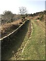
This is a circular earthwork approximately 15m diameter. It is located on Roborough Down about 250m ESE of the main Roborough Down Earthwork (see nearby sites on our page), on the Eastern side of the A386. It is a short walk from a nearby car park and the immediately surrounding gorse, bracken and brambles are roughly trimmed by somebody so that it is accessible and visible.
The main circle is approximately 15m diameter and comprises a steep, stony, grass covered bank approximately 1m high. The circle is quite uniform, intact and level, with no observable breeches or entry point. Inside is a smaller circle approximately 7m diameter, with a bank approximately 0.5m high. The interior floor is level.
This circle is more or less hidden by gorse and bracken till you are at its edge, then stepping through a gap in the undergrowth the trimmed circle is suddenly revealed. The condition and regularity of this circle is unsettling, also there is no discernable entry point. It is a substantial and notable ancient earthwork, but I feel it may not be of the same antiquity as other nearby earthworks.
You may be viewing yesterday's version of this page. To see the most up to date information please register for a free account.
")
")
")
")
Do not use the above information on other web sites or publications without permission of the contributor.
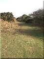
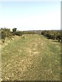
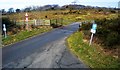
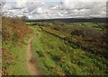
Nearby Images from Geograph Britain and Ireland:
©2021(licence)
©2021(licence)
©2018(licence)
©2012(licence)
©2021(licence)
The above images may not be of the site on this page, they are loaded from Geograph.
Please Submit an Image of this site or go out and take one for us!
Click here to see more info for this site
Nearby sites
Key: Red: member's photo, Blue: 3rd party photo, Yellow: other image, Green: no photo - please go there and take one, Grey: site destroyed
Download sites to:
KML (Google Earth)
GPX (GPS waypoints)
CSV (Garmin/Navman)
CSV (Excel)
To unlock full downloads you need to sign up as a Contributory Member. Otherwise downloads are limited to 50 sites.
Turn off the page maps and other distractions
Nearby sites listing. In the following links * = Image available
71m NW 321° Second Roborough Down Earthworks* Hillfort (SX50736407)
261m WNW 300° Roborough Down Earthworks* Hillfort (SX50556415)
3.1km E 89° Dewerstone* Causewayed Enclosure (SX53876399)
3.3km N 11° Roborough Rocks* Rock Outcrop (SX515672)
3.7km E 82° Wigford Down 1* Stone Circle (SX5442464421)
4.0km ENE 75° Wigford Down 4* Cairn (SX5469364969)
4.0km ENE 75° Wigford Down 5* Cairn (SX5470264962)
4.0km ENE 74° Wigford Down 9 Cairn (SX5469065050)
4.1km N 3° Crapstone Down Barrows Barrow Cemetery (SX511681)
4.6km E 95° Shaugh Moor Cairns* Cairn (SX5531763467)
4.6km E 80° Cadover Cross* Ancient Cross (SX553647)
4.7km E 95° Shaugh Moor North Cairn Circle Cairn (SX5541063490)
4.7km E 96° Shaugh Moor Circle* Stone Circle (SX554634)
4.7km E 97° Shaugh Moor Settlement* Ancient Village or Settlement (SX554633)
4.7km E 96° Shaugh Moor South Cairn Circle* Cairn (SX5541863425)
4.7km E 95° Shaugh Moor row* Stone Row / Alignment (SX5543063443)
4.7km E 95° Shaugh Moor Platform Cairn Circle Cairn (SX5548063470)
4.7km NE 52° Marchant's Cross* Ancient Cross (SX54626681)
4.8km ESE 107° Hawk's Tor (Shaugh Moor) Cave or Rock Shelter (SX55396250)
4.9km ESE 109° Shaugh Moor South Stone Circle (SX554623)
5.1km E 97° Saddlesborough Ring Cairn (SX55876321)
5.3km ENE 76° Brisworthy Cup Stone* Rock Art (SX55986516)
5.4km ESE 110° Collard Tor W* Stone Row / Alignment (SX5583362045)
5.4km ESE 110° Collard Tor circle Stone Circle (SX5584062030)
5.4km ESE 110° Collard Tor E* Stone Row / Alignment (SX55856204)
View more nearby sites and additional images


 We would like to know more about this location. Please feel free to add a brief description and any relevant information in your own language.
 Wir möchten mehr über diese Stätte erfahren. Bitte zögern Sie nicht, eine kurze Beschreibung und relevante Informationen in Deutsch hinzuzufügen.
 Nous aimerions en savoir encore un peu sur les lieux. S'il vous plaît n'hesitez pas à ajouter une courte description et tous les renseignements pertinents dans votre propre langue.
 Quisieramos informarnos un poco más de las lugares. No dude en añadir una breve descripción y otros datos relevantes en su propio idioma.