 with our Megalithic Portal iPhone app")


<< Text Pages >> Llandegai Cursus - Cursus in Wales in Carmarthenshire
Submitted by EssexMan on Wednesday, 07 April 2010 Page Views: 3610
Neolithic and Bronze AgeSite Name: Llandegai CursusCountry: Wales
NOTE: This site is 0.141 km away from the location you searched for.
County: Carmarthenshire Type: Cursus
Nearest Town: Bangor Nearest Village: Llandegai
Map Ref: SH597710 Landranger Map Number: 114
Latitude: 53.217477N Longitude: 4.102688W
Condition:
| 5 | Perfect |
| 4 | Almost Perfect |
| 3 | Reasonable but with some damage |
| 2 | Ruined but still recognisable as an ancient site |
| 1 | Pretty much destroyed, possibly visible as crop marks |
| 0 | No data. |
| -1 | Completely destroyed |
| 5 | Superb |
| 4 | Good |
| 3 | Ordinary |
| 2 | Not Good |
| 1 | Awful |
| 0 | No data. |
| 5 | Can be driven to, probably with disabled access |
| 4 | Short walk on a footpath |
| 3 | Requiring a bit more of a walk |
| 2 | A long walk |
| 1 | In the middle of nowhere, a nightmare to find |
| 0 | No data. |
| 5 | co-ordinates taken by GPS or official recorded co-ordinates |
| 4 | co-ordinates scaled from a detailed map |
| 3 | co-ordinates scaled from a bad map |
| 2 | co-ordinates of the nearest village |
| 1 | co-ordinates of the nearest town |
| 0 | no data |
Internal Links:
External Links:
Cruciform Long Enclosure in Caernarfonshire
Status: Certain
NMR No. PRN 222
Extent: 900mx14m
Terminal type: Round
Note: This location marks one terminal (end) of a cursus monument. The location of the other terminal can be found in the Nearby Site list below.
You may be viewing yesterday's version of this page. To see the most up to date information please register for a free account.
")
")
")
")
Do not use the above information on other web sites or publications without permission of the contributor.
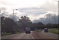
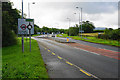
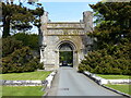
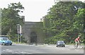
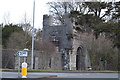
Nearby Images from Geograph Britain and Ireland:
©2013(licence)
©2015(licence)
©2023(licence)
©2008(licence)
©2015(licence)
The above images may not be of the site on this page, they are loaded from Geograph.
Please Submit an Image of this site or go out and take one for us!
Click here to see more info for this site
Nearby sites
Key: Red: member's photo, Blue: 3rd party photo, Yellow: other image, Green: no photo - please go there and take one, Grey: site destroyed
Download sites to:
KML (Google Earth)
GPX (GPS waypoints)
CSV (Garmin/Navman)
CSV (Excel)
To unlock full downloads you need to sign up as a Contributory Member. Otherwise downloads are limited to 50 sites.
Turn off the page maps and other distractions
Nearby sites listing. In the following links * = Image available
299m W 268° Llandegai Cursus* Cursus (SH594710)
299m W 268° Llandegai Henge Complex* Henge (SH59407100)
299m E 88° Llandegai Bronze Age Settlement* Ancient Village or Settlement (SH600710)
2.2km SSE 162° Pen Dinas Camp* Hillfort (SH603689)
2.6km NW 312° Gorsedd Stones, Bangor* Modern Stone Circle etc (SH5785272766)
2.6km SE 129° Rhiw Goch Enclosed Hut Circle Settlement* Ancient Village or Settlement (SH61696931)
3.8km SE 141° Maes Bleddyn Hut Circle Settlement* Ancient Village or Settlement (SH6200768009)
4.1km SSE 166° Sling (Llandegai)* Chambered Tomb (SH60556695)
4.2km W 276° Menai Bridge Gorsedd Circle* Modern Stone Circle etc (SH55517153)
4.3km WSW 253° Goetre Uchaf Barrow* Round Barrow(s) (SH5556069900)
4.4km NW 310° Pen-Y-Maen* Standing Stone (Menhir) (SH564739)
4.4km SE 133° Fortified hut settlement above Rachub* Hillfort (SH62826790)
4.6km SE 130° Cairn cemetery, W. shoulder of Moel Faban* Cairn (SH63156789)
4.7km SE 126° Moel Faban* Cairn (SH63486811)
4.8km ESE 122° Bwlch ym Mhwll-le* Cairn (SH63746835)
4.9km SE 139° Pen y Gaer* Hillfort (SH62826725)
4.9km SE 139° Pen Y Gaer (Bethesda)* Hillfort (SH62826725)
4.9km ESE 115° Hut Circle at Twll Pant Hiriol* Ancient Village or Settlement (SH641688)
4.9km S 185° Carnedd Moel Y Ci* Round Cairn (SH591661)
5.0km S 189° Ty'n Llidiard Hut Circle Settlement* Ancient Village or Settlement (SH5873066090)
5.0km SE 128° Moel Faban Arrow Stone* Carving (SH63576780)
5.2km N 9° Anglesey Eisteddfod Circle* Modern Stone Circle etc (SH607761)
5.2km WNW 303° Ty-Gwyn* Standing Stone (Menhir) (SH5536273949)
5.4km ESE 102° Moel Wnion (Gwynedd)* Cairn (SH64966971)
5.5km E 91° Cairn N of Moel Wnion* Cairn (SH65197071)
View more nearby sites and additional images


 We would like to know more about this location. Please feel free to add a brief description and any relevant information in your own language.
 Wir möchten mehr über diese Stätte erfahren. Bitte zögern Sie nicht, eine kurze Beschreibung und relevante Informationen in Deutsch hinzuzufügen.
 Nous aimerions en savoir encore un peu sur les lieux. S'il vous plaît n'hesitez pas à ajouter une courte description et tous les renseignements pertinents dans votre propre langue.
 Quisieramos informarnos un poco más de las lugares. No dude en añadir una breve descripción y otros datos relevantes en su propio idioma.