 with our Megalithic Portal iPhone app")


<< Text Pages >> St Anne's Well (Strathaven) - Holy Well or Sacred Spring in Scotland in South Lanarkshire
Submitted by Anne T on Monday, 08 January 2018 Page Views: 1519
Springs and Holy WellsSite Name: St Anne''s Well (Strathaven)Country: Scotland
NOTE: This site is 5.223 km away from the location you searched for.
County: South Lanarkshire Type: Holy Well or Sacred Spring
Nearest Town: Strathaven
Map Ref: NS70394438
Latitude: 55.675555N Longitude: 4.062588W
Condition:
| 5 | Perfect |
| 4 | Almost Perfect |
| 3 | Reasonable but with some damage |
| 2 | Ruined but still recognisable as an ancient site |
| 1 | Pretty much destroyed, possibly visible as crop marks |
| 0 | No data. |
| -1 | Completely destroyed |
| 5 | Superb |
| 4 | Good |
| 3 | Ordinary |
| 2 | Not Good |
| 1 | Awful |
| 0 | No data. |
| 5 | Can be driven to, probably with disabled access |
| 4 | Short walk on a footpath |
| 3 | Requiring a bit more of a walk |
| 2 | A long walk |
| 1 | In the middle of nowhere, a nightmare to find |
| 0 | No data. |
| 5 | co-ordinates taken by GPS or official recorded co-ordinates |
| 4 | co-ordinates scaled from a detailed map |
| 3 | co-ordinates scaled from a bad map |
| 2 | co-ordinates of the nearest village |
| 1 | co-ordinates of the nearest town |
| 0 | no data |
Internal Links:
External Links:
Holy Well or Sacred Spring in South Lanarkshire
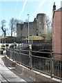
The Northern Antiquarian (TNA) features a page for this seemingly long lost well - see their entry for St. Anne’s Well, Strathaven, Lanarkshire which includes an image of the location of the well on the 1865 OS map, local photographs of the what appeared to be the still extant spring and descriptions from 19th and 20th century references.
TNA adds a quote from Downie's 1979 book: "A small lane off Todshill went down to a cluster of houses called St. Anne’s Well nestling on the sloping ground beside the mill dam. In 1911 these houses were acquired and demolished by the Town Improvement Committee. A row of houses backing backing on to Powmillon Burn were also demolished at the same time and a retaining wall with railings erected, so opening up a very fine view of the castle and burn etc.” but then say: "…So it seems that the spring of water that Lara, Aisha, Gordon and I came across was obviously not the same place, but exists just below the roadside where the disused railway line is. It’s close to St Anne’s Well – but is not the same water source."
Note: Do you know if this well still exists? Do you have any information, photographs or illustrations to add?
You may be viewing yesterday's version of this page. To see the most up to date information please register for a free account.
Do not use the above information on other web sites or publications without permission of the contributor.
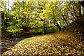
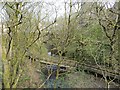
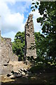
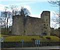
Nearby Images from Geograph Britain and Ireland:
©2015(licence)
©2014(licence)
©2015(licence)
©2013(licence)
©2013(licence)
The above images may not be of the site on this page, they are loaded from Geograph.
Please Submit an Image of this site or go out and take one for us!
Click here to see more info for this site
Nearby sites
Key: Red: member's photo, Blue: 3rd party photo, Yellow: other image, Green: no photo - please go there and take one, Grey: site destroyed
Download sites to:
KML (Google Earth)
GPX (GPS waypoints)
CSV (Garmin/Navman)
CSV (Excel)
To unlock full downloads you need to sign up as a Contributory Member. Otherwise downloads are limited to 50 sites.
Turn off the page maps and other distractions
Nearby sites listing. In the following links * = Image available
1.2km NW 315° Three Stanes (Strathaven) Standing Stones (NS69574524)
5.2km NNW 332° Shawton (Chapeltown) Standing Stone (Menhir) (NS68124906)
10.8km SSE 148° Standingstone Hill (Lesmahagow) Standing Stone (Menhir) (NS759351)
11.5km NE 55° Dalserf Sculptured Stone (NS79985071)
12.5km E 89° Blackhill (Hazelbank) Standing Stone (Menhir) (NS82904423)
12.9km E 96° Clarkston (Dillarburn) Standing Stone (Menhir) (NS832426)
13.8km NNW 327° Law Knowe* Cairn (NS63175613)
13.9km SW 231° Loanfoot* Chambered Cairn (NS592360)
14.4km ENE 74° Braidwood (Carluke) Standing Stone (Menhir) (NS84354799)
15.6km WSW 242° The Dagon Stone* Standing Stone (Menhir) (NS56333746)
16.2km S 174° Muirkirk Stane* Standing Stone (Menhir) (NS71622821)
16.2km WNW 288° West Revoch Stone Row / Alignment (NS55104995)
16.9km NNW 347° Bargeddie Food Vessel Cemetery Barrow Cemetery (NS672610)
17.0km E 91° St Patrick's Well (Lanark) Holy Well or Sacred Spring (NS8744443652)
17.5km WNW 287° Ballageich Hill* Cairn (NS53745005)
18.6km NNW 336° Hamilton Farm (Cambuslang) Cairn (NS633616)
19.4km WSW 241° Gallow Law (Hillend) Cairn (NS5313535382)
20.3km WSW 247° Molmont Stone Circle (NS514371)
20.5km NW 309° Rouken Glen Park* Rock Art (NS54795771)
22.2km NNW 330° Arns Well (Glasgow) Holy Well or Sacred Spring (NS59966406)
22.9km NNW 331° St Mungo's Well (Dovehill) Holy Well or Sacred Spring (NS5998464788)
23.1km NW 314° Boydstone Road (Eastwood) Standing Stone (Menhir) (NS541608)
23.2km NNW 333° Lady Well (Glasgow)* Holy Well or Sacred Spring (NS6037765327)
23.2km NNW 330° Stock Well (Glasgow) Holy Well or Sacred Spring (NS594649)
23.3km WNW 298° Duncarnock Hillfort Hillfort (NS50105590)
View more nearby sites and additional images


 We would like to know more about this location. Please feel free to add a brief description and any relevant information in your own language.
 Wir möchten mehr über diese Stätte erfahren. Bitte zögern Sie nicht, eine kurze Beschreibung und relevante Informationen in Deutsch hinzuzufügen.
 Nous aimerions en savoir encore un peu sur les lieux. S'il vous plaît n'hesitez pas à ajouter une courte description et tous les renseignements pertinents dans votre propre langue.
 Quisieramos informarnos un poco más de las lugares. No dude en añadir una breve descripción y otros datos relevantes en su propio idioma.