

<< Our Photo Pages >> Pen-Y-Gaer (Llanrhidian Lower) - Hillfort in Wales in South Glamorgan
Submitted by coldrum on Tuesday, 12 October 2010 Page Views: 5047
Iron Age and Later PrehistorySite Name: Pen-Y-Gaer (Llanrhidian Lower)Country: Wales
NOTE: This site is 3.818 km away from the location you searched for.
County: South Glamorgan Type: Hillfort
Nearest Town: Swansea Nearest Village: Pen-Clawwd
Map Ref: SS53659552
Latitude: 51.639388N Longitude: 4.116305W
Condition:
| 5 | Perfect |
| 4 | Almost Perfect |
| 3 | Reasonable but with some damage |
| 2 | Ruined but still recognisable as an ancient site |
| 1 | Pretty much destroyed, possibly visible as crop marks |
| 0 | No data. |
| -1 | Completely destroyed |
| 5 | Superb |
| 4 | Good |
| 3 | Ordinary |
| 2 | Not Good |
| 1 | Awful |
| 0 | No data. |
| 5 | Can be driven to, probably with disabled access |
| 4 | Short walk on a footpath |
| 3 | Requiring a bit more of a walk |
| 2 | A long walk |
| 1 | In the middle of nowhere, a nightmare to find |
| 0 | No data. |
| 5 | co-ordinates taken by GPS or official recorded co-ordinates |
| 4 | co-ordinates scaled from a detailed map |
| 3 | co-ordinates scaled from a bad map |
| 2 | co-ordinates of the nearest village |
| 1 | co-ordinates of the nearest town |
| 0 | no data |
Be the first person to rate this site - see the 'Contribute!' box in the right hand menu.
Internal Links:
External Links:
I have visited· I would like to visit
TheCaptain has visited here
 (PID:109131)")
Described as an "Irregular oval hilltop enclosure, c.98m by 120m, defined by banks and scarps."
Source: Coflein
You may be viewing yesterday's version of this page. To see the most up to date information please register for a free account.
 (PID:109132)")
Do not use the above information on other web sites or publications without permission of the contributor.
TheCaptain has found this location on Google Street View:
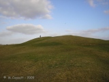
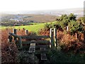
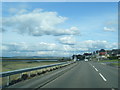
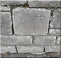
Nearby Images from Geograph Britain and Ireland:
©2014(licence)
©2014(licence)
©2022(licence)
©2023(licence)
©2015(licence)
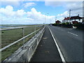
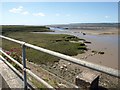
The above images may not be of the site on this page, they are loaded from Geograph.
Please Submit an Image of this site or go out and take one for us!
Click here to see more info for this site
Nearby sites
Key: Red: member's photo, Blue: 3rd party photo, Yellow: other image, Green: no photo - please go there and take one, Grey: site destroyed
Download sites to:
KML (Google Earth)
GPX (GPS waypoints)
CSV (Garmin/Navman)
CSV (Excel)
To unlock full downloads you need to sign up as a Contributory Member. Otherwise downloads are limited to 50 sites.
Turn off the page maps and other distractions
Nearby sites listing. In the following links * = Image available
4.4km SW 222° Cil ifor Top* Hillfort (SS506923)
4.7km S 185° Tooth Cave* Cave or Rock Shelter (SS531909)
4.9km SSW 210° Pen-y-Crug Barrow* Round Barrow(s) (SS51099137)
5.1km SW 228° Llanrhidian Lower Stone* Standing Stone (Menhir) (SS49769223)
5.1km SW 228° Llanrhidian Upper Stone* Standing Stone (Menhir) (SS49769221)
5.5km S 177° Cat Hole Cave* Cave or Rock Shelter (SS53779002)
5.6km S 179° Church Hill Earthwork* Misc. Earthwork (SS53628987)
5.7km S 178° Parc le Breos* Chambered Tomb (SS53738984)
5.8km SE 142° Bishopston Burch Cairn (SS571909)
6.0km ENE 58° Gorseinon Gorsedd Circle* Modern Stone Circle etc (SS5882998591)
6.1km SW 233° Oldwalls (E) Standing Stone* Standing Stone (Menhir) (SS48689200)
6.3km SSE 163° Trinity Well, Ilston* Holy Well or Sacred Spring (SS55308946)
6.3km SW 234° Oldwalls (W) Standing Stone* Standing Stone (Menhir) (SS48429197)
6.4km S 172° Gower Heritage centre* Museum (SS543892)
6.4km NW 317° Llanelli Gorsedd Circle - 2000* Modern Stone Circle etc (SN4937600347)
6.5km NNW 331° Llanelli Gorsedd Circle - 1962* Modern Stone Circle etc (SN5071301291)
6.5km SSW 194° Cefn Bryn Ring Cairn Ring Cairn (SS51918922)
6.5km SSW 194° Cefn Bryn Burnt Mound Misc. Earthwork (SS51898922)
6.5km SSW 194° Cefn Bryn Burnt Mound 2 Misc. Earthwork (SS51888922)
6.6km SW 222° Cefn Bryn Cairn 1* Ring Cairn (SS4906690726)
6.7km SW 220° Maen Ceti* Chambered Tomb (SS49149055)
6.7km SSW 214° Holy Well (Cefn Bryn)* Holy Well or Sacred Spring (SS49769003)
6.8km SW 220° Maen Ceti cairn Ring Cairn (SS491905)
6.8km SW 221° Cefn Bryn Great Cairn* Round Cairn (SS49029056)
6.8km SW 218° Cefn Bryn Cairn 3* Ring Cairn (SS493903)
View more nearby sites and additional images


 We would like to know more about this location. Please feel free to add a brief description and any relevant information in your own language.
 Wir möchten mehr über diese Stätte erfahren. Bitte zögern Sie nicht, eine kurze Beschreibung und relevante Informationen in Deutsch hinzuzufügen.
 Nous aimerions en savoir encore un peu sur les lieux. S'il vous plaît n'hesitez pas à ajouter une courte description et tous les renseignements pertinents dans votre propre langue.
 Quisieramos informarnos un poco más de las lugares. No dude en añadir una breve descripción y otros datos relevantes en su propio idioma.