


<< Other Photo Pages >> Museum of Barnstaple and North Devon - Museum in England in Devon
Submitted by vicky on Sunday, 02 November 2003 Page Views: 7476
MuseumsSite Name: Museum of Barnstaple and North DevonCountry: England
NOTE: This site is 0.134 km away from the location you searched for.
County: Devon Type: Museum
Nearest Town: Barnstaple
Map Ref: SS5586732983 Landranger Map Number: 180
Latitude: 51.078017N Longitude: 4.058928W
Condition:
| 5 | Perfect |
| 4 | Almost Perfect |
| 3 | Reasonable but with some damage |
| 2 | Ruined but still recognisable as an ancient site |
| 1 | Pretty much destroyed, possibly visible as crop marks |
| 0 | No data. |
| -1 | Completely destroyed |
| 5 | Superb |
| 4 | Good |
| 3 | Ordinary |
| 2 | Not Good |
| 1 | Awful |
| 0 | No data. |
| 5 | Can be driven to, probably with disabled access |
| 4 | Short walk on a footpath |
| 3 | Requiring a bit more of a walk |
| 2 | A long walk |
| 1 | In the middle of nowhere, a nightmare to find |
| 0 | No data. |
| 5 | co-ordinates taken by GPS or official recorded co-ordinates |
| 4 | co-ordinates scaled from a detailed map |
| 3 | co-ordinates scaled from a bad map |
| 2 | co-ordinates of the nearest village |
| 1 | co-ordinates of the nearest town |
| 0 | no data |
Internal Links:
External Links:
Museum in Devon Collections and displays cover the natural and human history from prehistory to the Victorian period.
Address: The Square, EX32 8LN
Phone: 01271 346747
Opening Hours: Tuesday to Saturday 10.00 am - 4.30 pm
Admission: Free
Website: Devon Museums.
You may be viewing yesterday's version of this page. To see the most up to date information please register for a free account.
Do not use the above information on other web sites or publications without permission of the contributor.
davidmorgan has found this location on Google Street View:
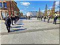
Nearby Images from Geograph Britain and Ireland:
©2021(licence)

©2021(licence)

©2021(licence)

©2022(licence)

©2023(licence)
The above images may not be of the site on this page, they are loaded from Geograph.
Please Submit an Image of this site or go out and take one for us!
Click here to see more info for this site
Nearby sites
Key: Red: member's photo, Blue: 3rd party photo, Yellow: other image, Green: no photo - please go there and take one, Grey: site destroyed
Download sites to:
KML (Google Earth)
GPX (GPS waypoints)
CSV (Garmin/Navman)
CSV (Excel)
To unlock full downloads you need to sign up as a Contributory Member. Otherwise downloads are limited to 50 sites.
Turn off the page maps and other distractions
Nearby sites listing. In the following links * = Image available
1.2km NNW 346° Ladywell (Pilton)* Holy Well or Sacred Spring (SS556342)
1.3km WSW 256° Dripping Well (Barnstaple)* Holy Well or Sacred Spring (SS546327)
1.3km NNW 334° Pilton Long Stone* Standing Stone (Menhir) (SS55313421)
2.4km NNE 23° Burridge Camp Ancient Village or Settlement (SS569352)
3.2km S 188° Holy Well (Tawstock)* Holy Well or Sacred Spring (SS553298)
6.7km W 268° Yelland* Multiple Stone Rows / Avenue (SS4912532889)
8.4km WNW 300° St. Brannoc's Holy Well (Braunton)* Holy Well or Sacred Spring (SS487374)
8.8km NW 305° Knowle Castle* Hillfort (SS488383)
9.4km ENE 72° Stoke Rivers fort* Ancient Village or Settlement (SS649356)
9.8km N 349° Centery Farm Tumuli* Barrow Cemetery (SS543427)
10.7km N 4° Berry Down Barrow Cemetery (SS569436)
10.9km SE 132° St. Urith's well* Holy Well or Sacred Spring (SS638255)
11.1km ENE 74° Mockham Down Camp* Hillfort (SS66683582)
11.3km NNE 14° Mattocks Down Barrow* Long Barrow (SS589439)
11.4km SSE 150° Brightley Barton Camp Hillfort (SS6124822911)
11.7km NNE 19° Mattocks Down Stone* Standing Stone (Menhir) (SS60084388)
11.7km NNE 19° Mattocks Down Stone Row Stone Row / Alignment (SS6004643921)
11.7km NNE 20° Mattocks Down circle Stone Circle (SS602439)
11.8km NNE 21° Higher Mattocks Down stone* Standing Stone (Menhir) (SS60344387)
12.4km SSW 209° Berry Castle (Huntshaw Wood)* Hillfort (SS49502228)
12.9km WNW 296° St Helen's Well (Croyde)* Holy Well or Sacred Spring (SS4440538970)
13.3km NE 48° Friendship Farm Tumuli* Round Barrow(s) (SS660416)
13.3km NE 37° Blackmoor Gate Barrows Barrow Cemetery (SS642434)
13.4km WSW 253° Shell Middens at Westward Ho!* Ancient Village or Settlement (SS429294)
13.5km NNE 34° Kentisbury Down* Standing Stones (SS637440)
View more nearby sites and additional images


 We would like to know more about this location. Please feel free to add a brief description and any relevant information in your own language.
 Wir möchten mehr über diese Stätte erfahren. Bitte zögern Sie nicht, eine kurze Beschreibung und relevante Informationen in Deutsch hinzuzufügen.
 Nous aimerions en savoir encore un peu sur les lieux. S'il vous plaît n'hesitez pas à ajouter une courte description et tous les renseignements pertinents dans votre propre langue.
 Quisieramos informarnos un poco más de las lugares. No dude en añadir una breve descripción y otros datos relevantes en su propio idioma.