 with our Megalithic Portal iPhone app")


<< Text Pages >> Dólmen de Llano de Zafarraya - Burial Chamber or Dolmen in Spain in Andalucía
Submitted by ShamrockStone on Saturday, 07 December 2019 Page Views: 643
Neolithic and Bronze AgeSite Name: Dólmen de Llano de ZafarrayaCountry: Spain
NOTE: This site is 13.623 km away from the location you searched for.
Region: Andalucía Type: Burial Chamber or Dolmen
Nearest Village: Ventas de Zafarraya
Latitude: 36.946170N Longitude: 4.0643W
Condition:
| 5 | Perfect |
| 4 | Almost Perfect |
| 3 | Reasonable but with some damage |
| 2 | Ruined but still recognisable as an ancient site |
| 1 | Pretty much destroyed, possibly visible as crop marks |
| 0 | No data. |
| -1 | Completely destroyed |
| 5 | Superb |
| 4 | Good |
| 3 | Ordinary |
| 2 | Not Good |
| 1 | Awful |
| 0 | No data. |
| 5 | Can be driven to, probably with disabled access |
| 4 | Short walk on a footpath |
| 3 | Requiring a bit more of a walk |
| 2 | A long walk |
| 1 | In the middle of nowhere, a nightmare to find |
| 0 | No data. |
| 5 | co-ordinates taken by GPS or official recorded co-ordinates |
| 4 | co-ordinates scaled from a detailed map |
| 3 | co-ordinates scaled from a bad map |
| 2 | co-ordinates of the nearest village |
| 1 | co-ordinates of the nearest town |
| 0 | no data |
Be the first person to rate this site - see the 'Contribute!' box in the right hand menu.
Internal Links:
External Links:
Burial Chamber (Dolmen) in Andalucía
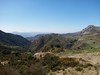
It is told that the Dólmen de Llano de Zafarraya is located at the foot of Sierra Tejeda, in the Majada del Puerco, near the farmhouse of Valdeiglesias, southeast of the Llano de Zafarraya, in the province of Granada. The coordinates belong to the former Valdeiglesias farm.
You may be viewing yesterday's version of this page. To see the most up to date information please register for a free account.
Do not use the above information on other web sites or publications without permission of the contributor.
Nearby Images from Flickr
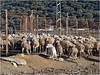

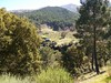
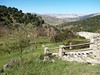
The above images may not be of the site on this page, but were taken nearby. They are loaded from Flickr so please click on them for image credits.
Click here to see more info for this site
Nearby sites
Click here to view sites on an interactive map of the areaKey: Red: member's photo, Blue: 3rd party photo, Yellow: other image, Green: no photo - please go there and take one, Grey: site destroyed
Download sites to:
KML (Google Earth)
GPX (GPS waypoints)
CSV (Garmin/Navman)
CSV (Excel)
To unlock full downloads you need to sign up as a Contributory Member. Otherwise downloads are limited to 50 sites.
Turn off the page maps and other distractions
Nearby sites listing. In the following links * = Image available
15.5km ENE 63° Los Bermejales 1* Burial Chamber or Dolmen
15.8km ENE 69° Los Bermejales 4* Cist
15.8km ENE 69° Los Bermejales 5* Cist
16.6km WSW 240° Necrópolis de la Peña de Hierro Cist
16.6km ENE 70° Los Bermejales 7* Burial Chamber or Dolmen
28.3km SE 136° Caves of Nerja* Cave or Rock Shelter
29.0km W 259° Dólmen del Tajillo del Moro* Burial Chamber or Dolmen
29.5km W 259° Peñas de Cabrera* Rock Art
29.5km SW 226° Dolmen Cerro de la Corona* Burial Chamber or Dolmen
33.5km W 269° Aratispi Ancient Village or Settlement
33.6km NNW 342° Necrópolis de Sierra Martilla* Rock Cut Tomb
34.5km WSW 253° Necrópolis de Las Chaperas Burial Chamber or Dolmen
39.3km WNW 290° Necrópolis de la Angostura* Burial Chamber or Dolmen
39.8km SE 125° Necrópolis Fenicio-Púnica Puente de Noy* Rock Cut Tomb
40.2km WNW 290° La Peña de los Enamorados* Natural Stone / Erratic / Other Natural Feature
40.6km WNW 291° Piedras Blancas* Rock Cut Tomb
42.3km W 272° El Tornillo Del Torcal* Natural Stone / Erratic / Other Natural Feature
42.9km WNW 283° Cueva del Romeral* Chambered Cairn
43.7km WNW 282° Dólmenes de Antequera centro de visitantes* Museum
43.7km N 10° Necrópolis de El Castellón* Barrow Cemetery
43.9km WNW 282° Cueva de Menga* Chambered Cairn
43.9km WNW 281° Cueva de Viera* Chambered Tomb
44.5km NNE 12° Peña de los Gitanos* Burial Chamber or Dolmen
45.2km NE 44° Zona Arqueológica de Medina Elvira Ancient Village or Settlement
45.3km WNW 282° Villa Romana de la Estación Ancient Village or Settlement
View more nearby sites and additional images


 We would like to know more about this location. Please feel free to add a brief description and any relevant information in your own language.
 Wir möchten mehr über diese Stätte erfahren. Bitte zögern Sie nicht, eine kurze Beschreibung und relevante Informationen in Deutsch hinzuzufügen.
 Nous aimerions en savoir encore un peu sur les lieux. S'il vous plaît n'hesitez pas à ajouter une courte description et tous les renseignements pertinents dans votre propre langue.
 Quisieramos informarnos un poco más de las lugares. No dude en añadir una breve descripción y otros datos relevantes en su propio idioma.