


<< Text Pages >> Penmon Deer Park Settlement - Ancient Village or Settlement in Wales in Anglesey
Submitted by coldrum on Wednesday, 27 January 2010 Page Views: 4176
Multi-periodSite Name: Penmon Deer Park SettlementCountry: Wales
NOTE: This site is 2.283 km away from the location you searched for.
County: Anglesey Type: Ancient Village or Settlement
Map Ref: SH6290981114
Latitude: 53.309169N Longitude: 4.059024W
Condition:
| 5 | Perfect |
| 4 | Almost Perfect |
| 3 | Reasonable but with some damage |
| 2 | Ruined but still recognisable as an ancient site |
| 1 | Pretty much destroyed, possibly visible as crop marks |
| 0 | No data. |
| -1 | Completely destroyed |
| 5 | Superb |
| 4 | Good |
| 3 | Ordinary |
| 2 | Not Good |
| 1 | Awful |
| 0 | No data. |
| 5 | Can be driven to, probably with disabled access |
| 4 | Short walk on a footpath |
| 3 | Requiring a bit more of a walk |
| 2 | A long walk |
| 1 | In the middle of nowhere, a nightmare to find |
| 0 | No data. |
| 5 | co-ordinates taken by GPS or official recorded co-ordinates |
| 4 | co-ordinates scaled from a detailed map |
| 3 | co-ordinates scaled from a bad map |
| 2 | co-ordinates of the nearest village |
| 1 | co-ordinates of the nearest town |
| 0 | no data |
Be the first person to rate this site - see the 'Contribute!' box in the right hand menu.
Internal Links:
External Links:
Ancient Settlement in Anglesey (Sir Ynys Mon)
"Earthworks of a later Prehistoric type walled settlement with a second less substantial example immediately to the south. Similar sites are recorded some 60m to the west (NPRN 400727) and about 150m to the south-west (NPRN 400728).
The settlement consists of a roundhouse about 8.0m across set at the western end of an irregular oval enclosure some 18-20m across. To the south two roundhouses, 8.0m and 6.0m in diameter, are attached to a smaller walled enclosure. Traces of what appears to be an isolated roundhouse have been noted a little way to the west.
These settlement features may be associated with the old field boundaries and cultivation terraces in Penmon Park (see NPRN 302861)."
Source: Coflein.
You may be viewing yesterday's version of this page. To see the most up to date information please register for a free account.
Do not use the above information on other web sites or publications without permission of the contributor.
Nearby Images from Geograph Britain and Ireland:
©2016(licence)
©2007(licence)
©2007(licence)
©2007(licence)
©2007(licence)
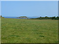
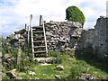
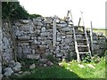
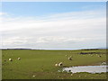
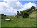
The above images may not be of the site on this page, they are loaded from Geograph.
Please Submit an Image of this site or go out and take one for us!
Click here to see more info for this site
Nearby sites
Key: Red: member's photo, Blue: 3rd party photo, Yellow: other image, Green: no photo - please go there and take one, Grey: site destroyed
Download sites to:
KML (Google Earth)
GPX (GPS waypoints)
CSV (Garmin/Navman)
CSV (Excel)
To unlock full downloads you need to sign up as a Contributory Member. Otherwise downloads are limited to 50 sites.
Turn off the page maps and other distractions
Nearby sites listing. In the following links * = Image available
194m SW 231° Tyddyn Rheinallt Settlement Ancient Village or Settlement (SH6275580995)
367m SSE 147° St Seiriol's Well* Holy Well or Sacred Spring (SH631808)
424m SSE 166° Penmon Priory and Church* Ancient Cross (SH630807)
940m SSW 210° Penmon Park Settlement Ancient Village or Settlement (SH6241280315)
1.1km S 182° Tan-Y-Fron* Ancient Village or Settlement (SH6284479994)
4.3km W 273° Din Sylwy* Hillfort (SH586815)
5.5km SSW 202° Anglesey Eisteddfod Circle* Modern Stone Circle etc (SH607761)
6.3km WSW 255° Llanddona* Standing Stone (Menhir) (SH5675879673)
6.7km WSW 237° Cremlyn 1* Standing Stone (Menhir) (SH572776)
6.7km SW 235° Cremlyn 2* Standing Stone (Menhir) (SH573774)
8.7km WSW 242° Hendrefor* Chambered Tomb (SH551773)
9.2km SSE 157° Maes Y Gaer* Hillfort (SH663725)
9.5km WSW 252° Mynydd Llwydiarth Hillfort (SH5378978520)
9.6km W 261° Traeth Coch Pentraeth Standing Stone* Marker Stone (SH534799)
9.7km SW 220° Pen-Y-Maen* Standing Stone (Menhir) (SH564739)
9.7km SSW 209° Gorsedd Stones, Bangor* Modern Stone Circle etc (SH5785272766)
10.2km SE 134° Dinas Settlement* Ancient Village or Settlement (SH700738)
10.2km SSE 151° Bod-Silin Cairns* Barrow Cemetery (SH67647205)
10.3km SE 139° Garreg Fawr* Carving (SH6939373132)
10.4km SW 225° Ty-Gwyn* Standing Stone (Menhir) (SH5536273949)
10.4km WSW 253° The Three Leaps* Stone Row / Alignment (SH5283878407)
10.4km SSE 149° Nant y Felin-fach Cairn* Cairn (SH68027203)
10.4km SSE 152° Wern-y-Pandy Settlement* Ancient Village or Settlement (SH676718)
10.4km SSE 153° Anafon Valley Cairns* Cairn (SH67397166)
10.5km SSE 165° Cras (Gwynedd)* Cairn (SH65397089)
View more nearby sites and additional images


 We would like to know more about this location. Please feel free to add a brief description and any relevant information in your own language.
 Wir möchten mehr über diese Stätte erfahren. Bitte zögern Sie nicht, eine kurze Beschreibung und relevante Informationen in Deutsch hinzuzufügen.
 Nous aimerions en savoir encore un peu sur les lieux. S'il vous plaît n'hesitez pas à ajouter une courte description et tous les renseignements pertinents dans votre propre langue.
 Quisieramos informarnos un poco más de las lugares. No dude en añadir una breve descripción y otros datos relevantes en su propio idioma.