 with our Megalithic Portal iPhone app")

<< Text Pages >> Pen-Y-Castell Enclosure - Ancient Village or Settlement in Wales in Ceredigion
Submitted by coldrum on Thursday, 14 October 2010 Page Views: 5477
Multi-periodSite Name: Pen-Y-Castell EnclosureCountry: Wales
NOTE: This site is 0.664 km away from the location you searched for.
County: Ceredigion Type: Ancient Village or Settlement
Map Ref: SN62997468
Latitude: 52.353014N Longitude: 4.013091W
Condition:
| 5 | Perfect |
| 4 | Almost Perfect |
| 3 | Reasonable but with some damage |
| 2 | Ruined but still recognisable as an ancient site |
| 1 | Pretty much destroyed, possibly visible as crop marks |
| 0 | No data. |
| -1 | Completely destroyed |
| 5 | Superb |
| 4 | Good |
| 3 | Ordinary |
| 2 | Not Good |
| 1 | Awful |
| 0 | No data. |
| 5 | Can be driven to, probably with disabled access |
| 4 | Short walk on a footpath |
| 3 | Requiring a bit more of a walk |
| 2 | A long walk |
| 1 | In the middle of nowhere, a nightmare to find |
| 0 | No data. |
| 5 | co-ordinates taken by GPS or official recorded co-ordinates |
| 4 | co-ordinates scaled from a detailed map |
| 3 | co-ordinates scaled from a bad map |
| 2 | co-ordinates of the nearest village |
| 1 | co-ordinates of the nearest town |
| 0 | no data |
Be the first person to rate this site - see the 'Contribute!' box in the right hand menu.
Internal Links:
External Links:
Ancient Village or Settlement in Ceredigion
From Coflein:
"Trapezoidal earthwork enclosure, 59m e/w x 56m n/s, sited on ground sloping to the north below Pen y Castell hillfort. Noted from the ground by J L Davies in 1974 and subsequently photographed from the air. "
https://www.coflein.gov.uk/en/site/400287
You may be viewing yesterday's version of this page. To see the most up to date information please register for a free account.
Do not use the above information on other web sites or publications without permission of the contributor.
Nearby Images from Geograph Britain and Ireland:
©2023(licence)
©2023(licence)
©2018(licence)
©2023(licence)

©2006(licence)
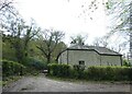
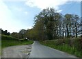
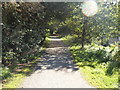
The above images may not be of the site on this page, they are loaded from Geograph.
Please Submit an Image of this site or go out and take one for us!
Click here to see more info for this site
Nearby sites
Key: Red: member's photo, Blue: 3rd party photo, Yellow: other image, Green: no photo - please go there and take one, Grey: site destroyed
Download sites to:
KML (Google Earth)
GPX (GPS waypoints)
CSV (Garmin/Navman)
CSV (Excel)
To unlock full downloads you need to sign up as a Contributory Member. Otherwise downloads are limited to 50 sites.
Turn off the page maps and other distractions
Nearby sites listing. In the following links * = Image available
140m S 178° Llanilar Hillfort (SN62997454)
2.1km WNW 294° Castell Pantmawr Hillfort (SN611756)
3.4km SSE 146° Gaer Fawr (Lledrod)* Hillfort (SN648718)
4.5km NNW 339° Old Warren Hill Hillfort (SN615789)
5.3km SW 217° The Dominicus Stone Early Christian Sculptured Stone (SN597705)
5.7km E 95° Coed Ty'n y Cwm* Hillfort (SN687740)
6.2km S 178° Ty n-yr-eithin* Cairn (SN630685)
6.2km NW 312° Castell Tan Y Bwlch Castle* Promontory Fort / Cliff Castle (SN5851079000)
6.9km NNW 333° Y Garreg Fawr* Chambered Tomb (SN59998093)
7.0km NNW 333° Llanbadarn Fawr Celtic Crosses* Ancient Cross (SN59918101)
7.2km NW 319° Pen Dinas (Aberystwyth)* Hillfort (SN5842080211)
7.4km NNW 331° Ffynnon Badarn* Holy Well or Sacred Spring (SN5951181263)
7.6km SE 132° Llanwnnws Inscribed Stone Early Christian Sculptured Stone (SN68516950)
7.6km W 260° Pen Glog* Cairn (SN554736)
8.2km ESE 120° Nant Byr Isaf Cairn (SN70037044)
8.4km SW 235° Gaer (Gilfachafael)* Ancient Village or Settlement (SN55907005)
8.5km NW 322° Aberystwyth Gorsedd Circle* Modern Stone Circle etc (SN5794681533)
8.5km NW 325° Ceredigion Museum* Museum (SN583818)
8.6km ESE 123° Garreg Lwyd Ancient Village or Settlement (SN70106972)
8.8km N 356° Plas Gogerddan Barrow* Round Barrow(s) (SN62658348)
8.8km SSE 148° St Ffraid's Well* Holy Well or Sacred Spring (SN67436705)
8.8km N 356° Plas Gogerddan* Stone Row / Alignment (SN626835)
9.1km N 354° Gorgerddan Round Barrow(s) (SN62328373)
9.2km N 355° Gorgerddan Enclosure Ancient Village or Settlement (SN62418387)
9.3km SW 235° Gaer Penrhôs* Ancient Village or Settlement (SN5520569555)
View more nearby sites and additional images


 We would like to know more about this location. Please feel free to add a brief description and any relevant information in your own language.
 Wir möchten mehr über diese Stätte erfahren. Bitte zögern Sie nicht, eine kurze Beschreibung und relevante Informationen in Deutsch hinzuzufügen.
 Nous aimerions en savoir encore un peu sur les lieux. S'il vous plaît n'hesitez pas à ajouter une courte description et tous les renseignements pertinents dans votre propre langue.
 Quisieramos informarnos un poco más de las lugares. No dude en añadir una breve descripción y otros datos relevantes en su propio idioma.