


<< Our Photo Pages >> Fice's Well - Holy Well or Sacred Spring in England in Devon
Submitted by KiwiBetsy on Monday, 25 September 2006 Page Views: 5553
Springs and Holy WellsSite Name: Fice's WellCountry: England
NOTE: This site is 0.738 km away from the location you searched for.
County: Devon Type: Holy Well or Sacred Spring
Nearest Town: Princetown
Map Ref: SX5773075865
Latitude: 50.565167N Longitude: 4.010178W
Condition:
| 5 | Perfect |
| 4 | Almost Perfect |
| 3 | Reasonable but with some damage |
| 2 | Ruined but still recognisable as an ancient site |
| 1 | Pretty much destroyed, possibly visible as crop marks |
| 0 | No data. |
| -1 | Completely destroyed |
| 5 | Superb |
| 4 | Good |
| 3 | Ordinary |
| 2 | Not Good |
| 1 | Awful |
| 0 | No data. |
| 5 | Can be driven to, probably with disabled access |
| 4 | Short walk on a footpath |
| 3 | Requiring a bit more of a walk |
| 2 | A long walk |
| 1 | In the middle of nowhere, a nightmare to find |
| 0 | No data. |
| 5 | co-ordinates taken by GPS or official recorded co-ordinates |
| 4 | co-ordinates scaled from a detailed map |
| 3 | co-ordinates scaled from a bad map |
| 2 | co-ordinates of the nearest village |
| 1 | co-ordinates of the nearest town |
| 0 | no data |
Internal Links:
External Links:
I have visited· I would like to visit
SolarMegalith would like to visit
graemefield visited on 6th Sep 2017 - their rating: Cond: 4 Amb: 4 Access: 3
cazzyjane have visited here
")
From Tavistock head east on the B3357. When the road forks to the right (to Princetown) go straight ahead. Almost immediately after this intersection, there is a wide gateway on the left with room to pull off the road, and a public footpath sign. Park and take the footpath north across three fields. The well lies to the east of the footpath at the end of the third (possibly the beginning of the fourth) field. There is a signpost beside the footpath pointing to the well.
You may be viewing yesterday's version of this page. To see the most up to date information please register for a free account.
")
")
")
")
Do not use the above information on other web sites or publications without permission of the contributor.
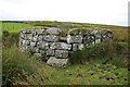
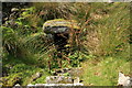
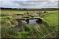
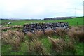
Nearby Images from Geograph Britain and Ireland:
©2009(licence)
©2009(licence)
©2009(licence)
©2005(licence)
©2009(licence)
The above images may not be of the site on this page, they are loaded from Geograph.
Please Submit an Image of this site or go out and take one for us!
Click here to see more info for this site
Nearby sites
Key: Red: member's photo, Blue: 3rd party photo, Yellow: other image, Green: no photo - please go there and take one, Grey: site destroyed
Download sites to:
KML (Google Earth)
GPX (GPS waypoints)
CSV (Garmin/Navman)
CSV (Excel)
To unlock full downloads you need to sign up as a Contributory Member. Otherwise downloads are limited to 50 sites.
Turn off the page maps and other distractions
Nearby sites listing. In the following links * = Image available
811m W 274° Mis Tor Farm Cairn (SX56927594)
1.9km ESE 108° Holming Beam Stone* Ancient Mine, Quarry or other Industry (SX5947975229)
2.0km SW 223° Yellowmeade Farm* Cairn (SX56357446)
2.3km WSW 246° Merrivale settlement* Ancient Village or Settlement (SX5555174979)
2.4km WSW 242° Merrivale Centre Row* Multiple Stone Rows / Avenue (SX55567478)
2.4km WSW 243° Merrivale NE circle* Stone Circle (SX55547481)
2.5km WSW 242° Merrivale Cists* Burial Chamber or Dolmen (SX5549074762)
2.5km WSW 242° Merrivale* Multiple Stone Rows / Avenue (SX55487477)
2.5km WSW 243° Merrivale North Row* Multiple Stone Rows / Avenue (SX55457479)
2.5km WSW 243° Merrivale Centre N* Cairn (SX55437477)
2.6km WSW 241° Merrivale Stone Slabs 1 and 2* Stone Row / Alignment (SX55457470)
2.6km WSW 243° Merrivale Centre S* Cairn (SX55407477)
2.6km WSW 243° Merrivale SW row 3* Stone Row / Alignment (SX5539474761)
2.6km WSW 245° Merrivale N circle* Stone Circle (SX5532674841)
2.7km WSW 244° Merrivale NW* Stone Circle (SX55307475)
2.7km WSW 241° Merrivale circle* Stone Circle (SX55357463)
2.7km WSW 240° Merrivale Second Menhir and Cairn* Standing Stone (Menhir) (SX55377459)
2.7km WSW 240° Merrivale Menhir* Standing Stone (Menhir) (SX55367459)
2.7km WSW 243° Cairn south of Stone Row B (Merrivale)* Cairn (SX553747)
2.7km WSW 240° Merrivale row 4* Stone Row / Alignment (SX5535674586)
2.7km WSW 240° Merrivale 5* Stone Row / Alignment (SX5534974592)
2.7km WSW 240° Merrivale 6* Stone Row / Alignment (SX5534474590)
2.7km E 98° Beardown Farm Cist (SX60407540)
2.7km SSE 150° High Moorland Visitor Centre* Museum (SX59037348)
2.8km S 179° Meavy Head Settlement Ancient Village or Settlement (SX577731)
View more nearby sites and additional images


 We would like to know more about this location. Please feel free to add a brief description and any relevant information in your own language.
 Wir möchten mehr über diese Stätte erfahren. Bitte zögern Sie nicht, eine kurze Beschreibung und relevante Informationen in Deutsch hinzuzufügen.
 Nous aimerions en savoir encore un peu sur les lieux. S'il vous plaît n'hesitez pas à ajouter une courte description et tous les renseignements pertinents dans votre propre langue.
 Quisieramos informarnos un poco más de las lugares. No dude en añadir una breve descripción y otros datos relevantes en su propio idioma.