


<< Our Photo Pages >> Gaer Fawr (Lledrod) - Hillfort in Wales in Ceredigion
Submitted by caradoc68 on Wednesday, 11 July 2018 Page Views: 1683
Iron Age and Later PrehistorySite Name: Gaer Fawr (Lledrod)Country: Wales
NOTE: This site is 1.51 km away from the location you searched for.
County: Ceredigion Type: Hillfort
Nearest Town: Llanilar Nearest Village: Lledrod
Map Ref: SN648718
Latitude: 52.327587N Longitude: 3.985373W
Condition:
| 5 | Perfect |
| 4 | Almost Perfect |
| 3 | Reasonable but with some damage |
| 2 | Ruined but still recognisable as an ancient site |
| 1 | Pretty much destroyed, possibly visible as crop marks |
| 0 | No data. |
| -1 | Completely destroyed |
| 5 | Superb |
| 4 | Good |
| 3 | Ordinary |
| 2 | Not Good |
| 1 | Awful |
| 0 | No data. |
| 5 | Can be driven to, probably with disabled access |
| 4 | Short walk on a footpath |
| 3 | Requiring a bit more of a walk |
| 2 | A long walk |
| 1 | In the middle of nowhere, a nightmare to find |
| 0 | No data. |
| 5 | co-ordinates taken by GPS or official recorded co-ordinates |
| 4 | co-ordinates scaled from a detailed map |
| 3 | co-ordinates scaled from a bad map |
| 2 | co-ordinates of the nearest village |
| 1 | co-ordinates of the nearest town |
| 0 | no data |
Internal Links:
External Links:
 (PID:183655)")
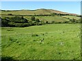
The monument comprises the remains of a hillfort, which probably dates to the Iron Age period (c. 800 BC - AD 74, the Roman conquest of Wales). Hillforts are usually Iocated on hilltops and surrounded by a single or multiple earthworks of massive proportions, and must have formed symbols of power within the landscape, while their function may have had as much to do with ostentation and display as defence. The defences on north and east of the monument consist of an inner bank now c.2.5m high above what appears to be a rock-cut ditch. There are slight traces of an outer bank. On south and west the defences consist of a scarped hillside which is very steep. There is a simple inturned entrance at the east end.
The monument is of national importance for its potential to enhance our knowledge of later prehistoric defensive organisation and settlement. The site forms an important element within the wider later prehistoric context and within the surrounding landscape. The site is well preserved and retains considerable archaeological potential. There is a strong probability of the presence of evidence relating to chronology, building techniques and functional detail.
The scheduled area comprises the remains described and areas around them within which related evidence may be expected to survive.
Source: Cadw
You may be viewing yesterday's version of this page. To see the most up to date information please register for a free account.
 (PID:183656)")
 (PID:183654)")
Do not use the above information on other web sites or publications without permission of the contributor.
Nearby Images from Geograph Britain and Ireland:
©2006(licence)
©2010(licence)
©2023(licence)
©2023(licence)
©2021(licence)
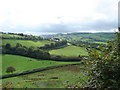
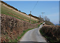
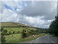
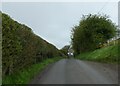
The above images may not be of the site on this page, they are loaded from Geograph.
Please Submit an Image of this site or go out and take one for us!
Click here to see more info for this site
Nearby sites
Key: Red: member's photo, Blue: 3rd party photo, Yellow: other image, Green: no photo - please go there and take one, Grey: site destroyed
Download sites to:
KML (Google Earth)
GPX (GPS waypoints)
CSV (Garmin/Navman)
CSV (Excel)
To unlock full downloads you need to sign up as a Contributory Member. Otherwise downloads are limited to 50 sites.
Turn off the page maps and other distractions
Nearby sites listing. In the following links * = Image available
3.3km NW 325° Llanilar Hillfort (SN62997454)
3.4km NNW 326° Pen-Y-Castell Enclosure Ancient Village or Settlement (SN62997468)
3.8km SSW 207° Ty n-yr-eithin* Cairn (SN630685)
4.4km ESE 120° Llanwnnws Inscribed Stone Early Christian Sculptured Stone (SN68516950)
4.5km ENE 59° Coed Ty'n y Cwm* Hillfort (SN687740)
5.2km WSW 254° The Dominicus Stone Early Christian Sculptured Stone (SN597705)
5.3km NW 314° Castell Pantmawr Hillfort (SN611756)
5.4km ESE 103° Nant Byr Isaf Cairn (SN70037044)
5.4km SSE 150° St Ffraid's Well* Holy Well or Sacred Spring (SN67436705)
5.7km ESE 110° Garreg Lwyd Ancient Village or Settlement (SN70106972)
6.8km ESE 115° Pen y Ffrwd* Hillfort (SN709688)
7.0km E 101° Banc-Y-Geufron* Cairn (SN71637033)
7.3km E 83° Castle Grogwynion* Hillfort (SN72107249)
7.8km NNW 334° Old Warren Hill Hillfort (SN615789)
8.6km S 175° Castell Flemish* Hillfort (SN6538863195)
9.0km WSW 257° Gaer (Gilfachafael)* Ancient Village or Settlement (SN55907005)
9.4km E 97° Carreg Samson, Llethr* Standing Stone (Menhir) (SN74157038)
9.5km W 279° Pen Glog* Cairn (SN554736)
9.5km NW 317° Castell Tan Y Bwlch Castle* Promontory Fort / Cliff Castle (SN5851079000)
9.8km WSW 255° Gaer Penrhôs* Ancient Village or Settlement (SN5520569555)
10.3km NNW 331° Y Garreg Fawr* Chambered Tomb (SN59998093)
10.4km NNW 331° Llanbadarn Fawr Celtic Crosses* Ancient Cross (SN59918101)
10.5km NW 321° Pen Dinas (Aberystwyth)* Hillfort (SN5842080211)
10.6km ESE 116° Pen-y-Bannau* Hillfort (SN74196689)
10.7km ENE 59° Devil's Punch Bowl* Natural Stone / Erratic / Other Natural Feature (SN7417177025)
View more nearby sites and additional images


 We would like to know more about this location. Please feel free to add a brief description and any relevant information in your own language.
 Wir möchten mehr über diese Stätte erfahren. Bitte zögern Sie nicht, eine kurze Beschreibung und relevante Informationen in Deutsch hinzuzufügen.
 Nous aimerions en savoir encore un peu sur les lieux. S'il vous plaît n'hesitez pas à ajouter une courte description et tous les renseignements pertinents dans votre propre langue.
 Quisieramos informarnos un poco más de las lugares. No dude en añadir una breve descripción y otros datos relevantes en su propio idioma.