 with our Megalithic Portal iPhone app")

<< Our Photo Pages >> St. Conal's stone - Rock Art in Scotland in Dumfries and Galloway
Submitted by Enki on Monday, 05 September 2016 Page Views: 2195
Rock ArtSite Name: St. Conal's stoneCountry: Scotland
NOTE: This site is 5.398 km away from the location you searched for.
County: Dumfries and Galloway Type: Rock Art
Nearest Town: Kirkconnel
Map Ref: NS7044715674
Latitude: 55.417803N Longitude: 4.048228W
Condition:
| 5 | Perfect |
| 4 | Almost Perfect |
| 3 | Reasonable but with some damage |
| 2 | Ruined but still recognisable as an ancient site |
| 1 | Pretty much destroyed, possibly visible as crop marks |
| 0 | No data. |
| -1 | Completely destroyed |
| 5 | Superb |
| 4 | Good |
| 3 | Ordinary |
| 2 | Not Good |
| 1 | Awful |
| 0 | No data. |
| 5 | Can be driven to, probably with disabled access |
| 4 | Short walk on a footpath |
| 3 | Requiring a bit more of a walk |
| 2 | A long walk |
| 1 | In the middle of nowhere, a nightmare to find |
| 0 | No data. |
| 5 | co-ordinates taken by GPS or official recorded co-ordinates |
| 4 | co-ordinates scaled from a detailed map |
| 3 | co-ordinates scaled from a bad map |
| 2 | co-ordinates of the nearest village |
| 1 | co-ordinates of the nearest town |
| 0 | no data |
Internal Links:
External Links:
I have visited· I would like to visit
Enki has visited here
")
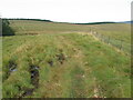
Cup-marked stone in Upper Nithsdale, said to mark the site where St. Connel/Conal encountered St. Kentigern (Mungo) following the latter's exile from Glasgow and was converted to a disciple of Kentigern.
The stone has several cup-marks on the top and the south-facing side, with a smaller stone or fragment beside it on the north side making an ideal seat from which to observe the excellent southerly views over the valley and St. Conal's Kirk and Well. St. Conal's cross, said to mark his burial site, is not far away a little farther up the hill to the north.
The wide vista is very suggestive that the stone may have functioned as an observational platform to record astronomical events.
Access is difficult and the stone is not easy to find in the long grass and bracken. From Kirkland Farm, take the track on the left through the wood towards Glenwharrie, then cut north around the forested area before heading northwest towards the television mast visible on the summit.
You may be viewing yesterday's version of this page. To see the most up to date information please register for a free account.
")
")
Do not use the above information on other web sites or publications without permission of the contributor.
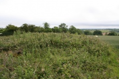
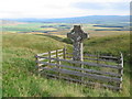
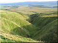
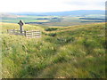
Nearby Images from Geograph Britain and Ireland:
©2006(licence)
©2020(licence)
©2020(licence)

©2020(licence)
©2020(licence)
The above images may not be of the site on this page, they are loaded from Geograph.
Please Submit an Image of this site or go out and take one for us!
Click here to see more info for this site
Nearby sites
Key: Red: member's photo, Blue: 3rd party photo, Yellow: other image, Green: no photo - please go there and take one, Grey: site destroyed
Download sites to:
KML (Google Earth)
GPX (GPS waypoints)
CSV (Garmin/Navman)
CSV (Excel)
To unlock full downloads you need to sign up as a Contributory Member. Otherwise downloads are limited to 50 sites.
Turn off the page maps and other distractions
Nearby sites listing. In the following links * = Image available
8.3km ESE 119° Crawick Multiverse* Modern Stone Circle etc (NS7763311439)
12.6km N 4° Muirkirk Stane* Standing Stone (Menhir) (NS71622821)
17.0km SSW 197° Mungo's Well (Carsphairn) Holy Well or Sacred Spring (NX6492799555)
17.3km WSW 249° Nith Lodge Stone Circle (NS540100)
18.6km WSW 247° Beoch Stone Circle Stone Circle (NS530090)
20.2km NNE 14° Standingstone Hill (Lesmahagow) Standing Stone (Menhir) (NS759351)
20.9km SW 224° Water of Deugh* Chambered Cairn (NS55420114)
21.1km NE 55° Wildshaw Burn* Stone Circle (NS882271)
21.2km SSE 165° St. Conal's Well* Holy Well or Sacred Spring (NX75399508)
21.2km SW 224° Brownhill Burn* Cairn (NS55210089)
21.2km ENE 67° Blackhill Hillfort (NS9032423216)
21.2km SSW 211° Gold Wells (Carsphairn) Holy Well or Sacred Spring (NX5896497793)
21.6km SE 145° Honeyhole White Cairn* Cairn (NX82389757)
21.7km WNW 295° Ballochmyle* Rock Art (NS5111725565)
22.9km SSW 193° Round Craigs* Cairn (NX64519355)
23.1km S 189° Stellhead N* Cairn (NX66089297)
23.2km NNW 329° Loanfoot* Chambered Cairn (NS592360)
23.2km S 189° Stellhead S* Cairn (NX66059285)
23.4km SE 126° Mary's Well (East Morton) Holy Well or Sacred Spring (NS88870123)
23.5km SSW 192° Chalybeate Well (Dalry)* Holy Well or Sacred Spring (NX6488792815)
23.8km ENE 73° Kirkton Fort* Hillfort (NS935218)
23.9km SSE 148° Grennan Hill Hillfort (NX82549507)
24.1km SW 225° Lamford Burn* Cairn (NX52829916)
24.5km SSW 194° Stroanfreggan Craig* Hillfort (NX63709206)
24.6km SSE 150° Tynron Doon* Hillfort (NX8197093927)
View more nearby sites and additional images


 We would like to know more about this location. Please feel free to add a brief description and any relevant information in your own language.
 Wir möchten mehr über diese Stätte erfahren. Bitte zögern Sie nicht, eine kurze Beschreibung und relevante Informationen in Deutsch hinzuzufügen.
 Nous aimerions en savoir encore un peu sur les lieux. S'il vous plaît n'hesitez pas à ajouter une courte description et tous les renseignements pertinents dans votre propre langue.
 Quisieramos informarnos un poco más de las lugares. No dude en añadir una breve descripción y otros datos relevantes en su propio idioma.