

<< Text Pages >> North Tawton A Cursus - Cursus in England in Devon
Submitted by EssexMan on Wednesday, 07 April 2010 Page Views: 2704
Neolithic and Bronze AgeSite Name: North Tawton A CursusCountry: England County: Devon Type: Cursus
Nearest Town: Exeter Nearest Village: North Tawton
Map Ref: SS649017 Landranger Map Number: 191
Latitude: 50.799068N Longitude: 3.91845W
Condition:
| 5 | Perfect |
| 4 | Almost Perfect |
| 3 | Reasonable but with some damage |
| 2 | Ruined but still recognisable as an ancient site |
| 1 | Pretty much destroyed, possibly visible as crop marks |
| 0 | No data. |
| -1 | Completely destroyed |
| 5 | Superb |
| 4 | Good |
| 3 | Ordinary |
| 2 | Not Good |
| 1 | Awful |
| 0 | No data. |
| 5 | Can be driven to, probably with disabled access |
| 4 | Short walk on a footpath |
| 3 | Requiring a bit more of a walk |
| 2 | A long walk |
| 1 | In the middle of nowhere, a nightmare to find |
| 0 | No data. |
| 5 | co-ordinates taken by GPS or official recorded co-ordinates |
| 4 | co-ordinates scaled from a detailed map |
| 3 | co-ordinates scaled from a bad map |
| 2 | co-ordinates of the nearest village |
| 1 | co-ordinates of the nearest town |
| 0 | no data |
Internal Links:
External Links:
Long Enclosure in Devon
Status: Possible
Extent: 80mx12m
Terminal type: Trapezoidal
You may be viewing yesterday's version of this page. To see the most up to date information please register for a free account.
Do not use the above information on other web sites or publications without permission of the contributor.
Nearby Images from Geograph Britain and Ireland:
©2013(licence)
©2013(licence)
©2019(licence)
©2013(licence)
©2007(licence)
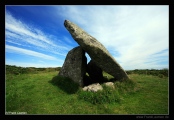
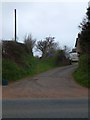
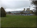
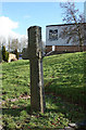
The above images may not be of the site on this page, they are loaded from Geograph.
Please Submit an Image of this site or go out and take one for us!
Click here to see more info for this site
Nearby sites
Key: Red: member's photo, Blue: 3rd party photo, Yellow: other image, Green: no photo - please go there and take one, Grey: site destroyed
Download sites to:
KML (Google Earth)
GPX (GPS waypoints)
CSV (Garmin/Navman)
CSV (Excel)
To unlock full downloads you need to sign up as a Contributory Member. Otherwise downloads are limited to 50 sites.
Turn off the page maps and other distractions
Nearby sites listing. In the following links * = Image available
3.6km E 95° North Tawton B Cursus Cursus (SS685013)
5.8km E 89° Bow Henge* Henge (SS70750160)
6.5km ENE 62° Bow Timber Circle Timber Circle (SS707046)
7.1km SSW 193° Belstone Boundary Marker* Marker Stone (SX6314994770)
7.2km S 175° St Andrew's Cross (South Tawton)* Ancient Cross (SX65289453)
7.4km SSE 168° Oxenham Cross* Ancient Cross (SX6625194414)
7.5km SSE 166° Ring Hill Cross* Ancient Cross (SX66559440)
7.6km S 176° Moon's Cross* Ancient Cross (SX6525194125)
7.6km S 186° Sticklepath Boundary Marker* Marker Stone (SX6388694135)
7.6km S 186° Lady Well (Sticklepath)* Holy Well or Sacred Spring (SX6390494124)
7.7km S 185° Sticklepath Methodist Chapel Cross* Ancient Cross (SX6404694079)
7.9km SSE 161° Ringhole Copse Cross* Ancient Cross (SX6721794162)
8.1km S 177° South Zeal Cross* Ancient Cross (SX6505793594)
8.2km S 177° Oxenham Arms* Standing Stone (Menhir) (SX65119354)
8.2km E 96° Puddock's Well* Holy Well or Sacred Spring (SS731006)
8.5km S 179° South Zeal Stone Row* Stone Row / Alignment (SX648932)
8.5km SSE 167° Addiscott Cross* Ancient Cross (SX6666993344)
8.6km S 177° Ramsley Stone Row / Alignment (SX651931)
8.7km SSW 198° Holy Well (Belstone)* Holy Well or Sacred Spring (SX6202393468)
8.7km SSW 198° Belstone Ring Cross* Ancient Cross (SX6192793500)
8.8km SSW 209° East Hill Promontory Fort* Promontory Fort / Cliff Castle (SX604941)
9.1km S 174° West Wyke Farm Cross* Ancient Cross (SX6564692638)
9.1km S 174° West Wykes Farm Tau and Latin Crosses* Ancient Cross (SX6567992638)
9.2km S 188° Sticklepath stone circle* Stone Circle (SX63439264)
9.2km S 181° Eight Rocks* Stone Circle (SX645925)
View more nearby sites and additional images


 We would like to know more about this location. Please feel free to add a brief description and any relevant information in your own language.
 Wir möchten mehr über diese Stätte erfahren. Bitte zögern Sie nicht, eine kurze Beschreibung und relevante Informationen in Deutsch hinzuzufügen.
 Nous aimerions en savoir encore un peu sur les lieux. S'il vous plaît n'hesitez pas à ajouter une courte description et tous les renseignements pertinents dans votre propre langue.
 Quisieramos informarnos un poco más de las lugares. No dude en añadir una breve descripción y otros datos relevantes en su propio idioma.