


<< Text Pages >> Kincraig Chambered Cairn - Chambered Cairn in Scotland in Highlands
Submitted by PeteCrane5 on Monday, 25 September 2023 Page Views: 318
Neolithic and Bronze AgeSite Name: Kincraig Chambered CairnCountry: Scotland
NOTE: This site is 2.837 km away from the location you searched for.
County: Highlands Type: Chambered Cairn
Nearest Village: Kincraig
Map Ref: NH83140660
Latitude: 57.135393N Longitude: 3.932434W
Condition:
| 5 | Perfect |
| 4 | Almost Perfect |
| 3 | Reasonable but with some damage |
| 2 | Ruined but still recognisable as an ancient site |
| 1 | Pretty much destroyed, possibly visible as crop marks |
| 0 | No data. |
| -1 | Completely destroyed |
| 5 | Superb |
| 4 | Good |
| 3 | Ordinary |
| 2 | Not Good |
| 1 | Awful |
| 0 | No data. |
| 5 | Can be driven to, probably with disabled access |
| 4 | Short walk on a footpath |
| 3 | Requiring a bit more of a walk |
| 2 | A long walk |
| 1 | In the middle of nowhere, a nightmare to find |
| 0 | No data. |
| 5 | co-ordinates taken by GPS or official recorded co-ordinates |
| 4 | co-ordinates scaled from a detailed map |
| 3 | co-ordinates scaled from a bad map |
| 2 | co-ordinates of the nearest village |
| 1 | co-ordinates of the nearest town |
| 0 | no data |
Internal Links:
External Links:
I have visited· I would like to visit
PeteCrane5 has visited here
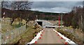
This cairn lies in an area of rough grazing easily accessed from the Kincraig farm road using the A9 underpass south of Kincraig Primary School.
The cairn has been heavily robbed with main feature being a a two compartment burial chamber with some remains of the outer oval of the cairn.
More detail from Canmore here.
You may be viewing yesterday's version of this page. To see the most up to date information please register for a free account.
")
Do not use the above information on other web sites or publications without permission of the contributor.
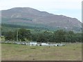
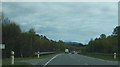
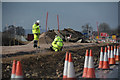
Nearby Images from Geograph Britain and Ireland:
©2015(licence)
©2016(licence)
©2017(licence)
©2016(licence)
©2016(licence)
The above images may not be of the site on this page, they are loaded from Geograph.
Please Submit an Image of this site or go out and take one for us!
Click here to see more info for this site
Nearby sites
Key: Red: member's photo, Blue: 3rd party photo, Yellow: other image, Green: no photo - please go there and take one, Grey: site destroyed
Download sites to:
KML (Google Earth)
GPX (GPS waypoints)
CSV (Garmin/Navman)
CSV (Excel)
To unlock full downloads you need to sign up as a Contributory Member. Otherwise downloads are limited to 50 sites.
Turn off the page maps and other distractions
Nearby sites listing. In the following links * = Image available
2.3km SSW 208° Dunachton* Class I Pictish Symbol Stone (NH820046)
2.4km NNE 31° Delfour* Cairn (NH844086)
4.6km NE 43° Ballinluig Cairn* Chambered Cairn (NH86380989)
7.2km SW 228° Lynchat* Souterrain (Fogou, Earth House) (NH77670193)
9.5km NE 42° Aviemore* Stone Circle (NH89681347)
9.6km SW 226° Kingussie Standing Stones (NH761001)
11.7km NE 39° Grenish* Stone Circle (NH90781550)
12.7km NE 35° Avielochan* Chambered Tomb (NH908167)
12.7km SW 234° Altlarie* Cairn (NN726995)
13.2km NE 48° Pityoulish Standing Stone* Standing Stone (Menhir) (NH93251521)
13.9km NE 49° Lynchurn Class I Pictish Symbol Stone (NH93841551)
15.3km WSW 245° Sidhean Mor Dail A' Chaorainn* Hillfort (NH69060039)
16.6km NE 34° Deishar* Round Cairn (NH928201)
16.9km WSW 243° Glenbanchor Cairn (NN678994)
17.7km NE 36° Drumuillie* Round Cairn (NH940206)
19.7km NE 42° Tullochgorum Stones* Standing Stones (NH96702101)
19.8km NE 41° Tullochgorum Cairn* Stone Circle (NH96482130)
19.8km NE 39° Toum Cairn* Cairn (NH9601621757)
21.4km NE 34° Easter Gallovie* Round Cairn (NH956240)
22.5km NE 37° Clury* Round Cairn (NH972242)
23.0km NE 43° Auchendean Hill Cairn* Chambered Cairn (NH99232312)
23.3km NE 43° Curr Wood* Round Cairn (NH995233)
24.8km NE 40° Ballintomb* Class I Pictish Symbol Stone (NH995253)
25.0km NE 41° Dulnain Bridge* Natural Stone / Erratic / Other Natural Feature (NJ00182498)
25.4km NE 43° Tom Nan Carragh* Standing Stones (NJ0110824642)
View more nearby sites and additional images


 We would like to know more about this location. Please feel free to add a brief description and any relevant information in your own language.
 Wir möchten mehr über diese Stätte erfahren. Bitte zögern Sie nicht, eine kurze Beschreibung und relevante Informationen in Deutsch hinzuzufügen.
 Nous aimerions en savoir encore un peu sur les lieux. S'il vous plaît n'hesitez pas à ajouter une courte description et tous les renseignements pertinents dans votre propre langue.
 Quisieramos informarnos un poco más de las lugares. No dude en añadir una breve descripción y otros datos relevantes en su propio idioma.