 with our Megalithic Portal iPhone app")


<< Our Photo Pages >> Berrisbrook Standing Stones - Standing Stone (Menhir) in Wales in Carmarthenshire
Submitted by geoffstickland on Monday, 18 October 2021 Page Views: 565
Neolithic and Bronze AgeSite Name: Berrisbrook Standing StonesCountry: Wales County: Carmarthenshire Type: Standing Stone (Menhir)
Nearest Town: Llandovery Nearest Village: Oorthyrhyd
Map Ref: SN71603761
Latitude: 52.022005N Longitude: 3.872697W
Condition:
| 5 | Perfect |
| 4 | Almost Perfect |
| 3 | Reasonable but with some damage |
| 2 | Ruined but still recognisable as an ancient site |
| 1 | Pretty much destroyed, possibly visible as crop marks |
| 0 | No data. |
| -1 | Completely destroyed |
| 5 | Superb |
| 4 | Good |
| 3 | Ordinary |
| 2 | Not Good |
| 1 | Awful |
| 0 | No data. |
| 5 | Can be driven to, probably with disabled access |
| 4 | Short walk on a footpath |
| 3 | Requiring a bit more of a walk |
| 2 | A long walk |
| 1 | In the middle of nowhere, a nightmare to find |
| 0 | No data. |
| 5 | co-ordinates taken by GPS or official recorded co-ordinates |
| 4 | co-ordinates scaled from a detailed map |
| 3 | co-ordinates scaled from a bad map |
| 2 | co-ordinates of the nearest village |
| 1 | co-ordinates of the nearest town |
| 0 | no data |
Internal Links:
External Links:
I have visited· I would like to visit
geoffstickland has visited here
")
The stones form a stone pair.
You may be viewing yesterday's version of this page. To see the most up to date information please register for a free account.
Do not use the above information on other web sites or publications without permission of the contributor.
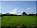
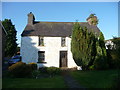
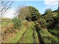
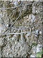
Nearby Images from Geograph Britain and Ireland:
©2009(licence)
©2012(licence)
©2014(licence)
©2014(licence)
©2015(licence)
The above images may not be of the site on this page, they are loaded from Geograph.
Please Submit an Image of this site or go out and take one for us!
Click here to see more info for this site
Nearby sites
Key: Red: member's photo, Blue: 3rd party photo, Yellow: other image, Green: no photo - please go there and take one, Grey: site destroyed
Download sites to:
KML (Google Earth)
GPX (GPS waypoints)
CSV (Garmin/Navman)
CSV (Excel)
To unlock full downloads you need to sign up as a Contributory Member. Otherwise downloads are limited to 50 sites.
Turn off the page maps and other distractions
Nearby sites listing. In the following links * = Image available
1.9km NNW 342° Nant-Iwrch Cairn* Ring Cairn (SN71043946)
4.0km E 91° Troed y Rhiw (Cilycwm)* Misc. Earthwork (SN75643746)
4.1km E 87° Pen Y Gaer (Cilycwm)* Hillfort (SN75683773)
5.5km N 357° Rhiw Garegog Scoop Grave 1 Misc. Earthwork (SN71414314)
5.6km N 357° Rhiw Garegog Scoop Grave 2 Misc. Earthwork (SN71474323)
5.7km NNW 337° Maes-yr-haidd Round Barrow II* Cairn (SN6954242882)
5.7km NNW 338° Maes-yr-haidd Round Barrow I* Cairn (SN6960042991)
5.8km WNW 295° Dolaucothi* Ancient Mine, Quarry or other Industry (SN66384025)
5.9km N 355° Rhiw Garegog Round barrows* Round Barrow(s) (SN71214346)
5.9km N 355° Rhiw Garegog Standing Stone II* Standing Stone (Menhir) (SN71264349)
5.9km ESE 113° Llandovery Roman Fort - Alabum* Hillfort (SN76973514)
5.9km N 354° Rhiw Garegog Ditch* Misc. Earthwork (SN71184352)
5.9km WNW 296° Carreg Pumsaint* Standing Stone (Menhir) (SN66334035)
5.9km N 354° Rhiw Gwaregog Standing Stone Standing Stone (Menhir) (SN71184354)
6.0km SSW 205° Bryndyfan Standing Stone* Standing Stone (Menhir) (SN6886732240)
6.0km N 355° Rhiwgaregog Standing Stone (recumbent)* Standing Stone (Menhir) (SN71274364)
6.3km S 188° Cwmbran Camp* Hillfort (SN70593135)
6.5km E 79° Pen Y Gaer (Cynghordy)* Hillfort (SN77993869)
6.6km ENE 58° Dinas Bach (Llanfair ar y Bryn)* Hillfort (SN77354093)
7.3km ESE 105° Cefn Crug Iron Age Defended enclosure* Hillfort (SN786355)
7.4km NNE 14° Mynydd Mallaen* Standing Stone (Menhir) (SN73564471)
7.5km ENE 62° Gwynfaes Maenhir* Standing Stone (Menhir) (SN78334097)
7.6km N 10° Maen Bach* Standing Stone (Menhir) (SN73084507)
7.7km ENE 57° PEN-Y-RHIW FACH CAIRN Round Barrow(s) (SN78234165)
7.9km N 3° Crugiau Merched, Cairn 1* Cairn (SN72214553)
View more nearby sites and additional images


 We would like to know more about this location. Please feel free to add a brief description and any relevant information in your own language.
 Wir möchten mehr über diese Stätte erfahren. Bitte zögern Sie nicht, eine kurze Beschreibung und relevante Informationen in Deutsch hinzuzufügen.
 Nous aimerions en savoir encore un peu sur les lieux. S'il vous plaît n'hesitez pas à ajouter une courte description et tous les renseignements pertinents dans votre propre langue.
 Quisieramos informarnos un poco más de las lugares. No dude en añadir una breve descripción y otros datos relevantes en su propio idioma.