


<< Our Photo Pages >> Dolwyddelan Ancient Trackway - Ancient Trackway in Wales in Conwy
Submitted by TAlanJones on Wednesday, 31 January 2024 Page Views: 111
Multi-periodSite Name: Dolwyddelan Ancient Trackway Alternative Name: Ffynnon Elen ancient trackwayCountry: Wales
NOTE: This site is 1.973 km away from the location you searched for.
County: Conwy Type: Ancient Trackway
Nearest Town: Blaenau Ffestiniog Nearest Village: Dolwyddelan
Map Ref: SH7366652467
Latitude: 53.054482N Longitude: 3.886344W
Condition:
| 5 | Perfect |
| 4 | Almost Perfect |
| 3 | Reasonable but with some damage |
| 2 | Ruined but still recognisable as an ancient site |
| 1 | Pretty much destroyed, possibly visible as crop marks |
| 0 | No data. |
| -1 | Completely destroyed |
| 5 | Superb |
| 4 | Good |
| 3 | Ordinary |
| 2 | Not Good |
| 1 | Awful |
| 0 | No data. |
| 5 | Can be driven to, probably with disabled access |
| 4 | Short walk on a footpath |
| 3 | Requiring a bit more of a walk |
| 2 | A long walk |
| 1 | In the middle of nowhere, a nightmare to find |
| 0 | No data. |
| 5 | co-ordinates taken by GPS or official recorded co-ordinates |
| 4 | co-ordinates scaled from a detailed map |
| 3 | co-ordinates scaled from a bad map |
| 2 | co-ordinates of the nearest village |
| 1 | co-ordinates of the nearest town |
| 0 | no data |
Internal Links:
External Links:
")
This narrow 50m long trackway that leads from the A470 at Dolwyddelan to the Ffynnon Elen sacred well is thought to be a remnant of a more ancient trackway that linked settlements in Capel Currig with Dolwyddelan. The well of Ffynnon Elen is thought to have attracted the attention of the Roman military during their occupation in the 1st/2nd Cent AD (there were Auxiliary forts at Capel Curig and Trawsfynydd) However, the advent of Christianity in the 5th/6th Cent appears to have been the onset of the Well's appeal as a spiritual place of healing.
Today the trackway allows visitors access to the well site, which was restored in 2015.
You may be viewing yesterday's version of this page. To see the most up to date information please register for a free account.
")
Do not use the above information on other web sites or publications without permission of the contributor.
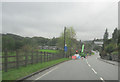
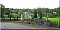
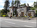
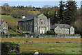
Nearby Images from Geograph Britain and Ireland:
©2011(licence)
©2007(licence)
©2014(licence)
©2024(licence)
©2014(licence)
The above images may not be of the site on this page, they are loaded from Geograph.
Please Submit an Image of this site or go out and take one for us!
Click here to see more info for this site
Nearby sites
Key: Red: member's photo, Blue: 3rd party photo, Yellow: other image, Green: no photo - please go there and take one, Grey: site destroyed
Download sites to:
KML (Google Earth)
GPX (GPS waypoints)
CSV (Garmin/Navman)
CSV (Excel)
To unlock full downloads you need to sign up as a Contributory Member. Otherwise downloads are limited to 50 sites.
Turn off the page maps and other distractions
Nearby sites listing. In the following links * = Image available
74m WNW 295° Ffynnon Elan* Holy Well or Sacred Spring (SH736525)
2.6km NNW 348° Cefn Glas Hut Circle Settlement* Ancient Village or Settlement (SH7318055010)
2.6km N 355° Cefn Glas Barrow Cemetery* Barrow Cemetery (SH735551)
2.8km SSE 159° Y Ro Wen Cairn* Cairn (SH746498)
3.0km N 358° Hut Circle Settlement N of Cefn Glas* Ancient Village or Settlement (SH7362055450)
3.6km N 4° Cefn Glas Round Cairn* Round Cairn (SH7401056010)
3.7km N 1° Bryn y Gefeiliau Ancient Trackway* Ancient Trackway (SH7379856215)
3.8km NW 304° Carnedd Moel Siabod* Cairn (SH70535469)
5.0km SW 217° Moel Farlwyd Hut Circle* Ancient Village or Settlement (SH7058448535)
5.1km SW 215° Cairn West of Llynnau Barlwyd* Cairn (SH70624831)
5.2km SW 216° Hut Circle West of Llynnau Barlwyd* Ancient Village or Settlement (SH70504830)
5.3km N 353° Carnedd Coed Bryn Brethynau* Round Cairn (SH7319057750)
5.6km ESE 108° St Tudclud (Penmachno)* Early Christian Sculptured Stone (SH78995059)
5.7km ESE 107° St Tudclud's Well (Penmachno)* Holy Well or Sacred Spring (SH791506)
5.9km NNW 346° Clogwyn Mawr Hut Circle* Ancient Village or Settlement (SH7240058200)
6.3km NNW 338° Creigiau'r Gelli Cairn Cairn (SH715584)
6.5km NW 307° Dyffryn Mymbyr Round Barrow(s) (SH68565648)
6.5km NW 307° Dyffryn Mymbyr* Standing Stone (Menhir) (SH68565648)
6.7km ESE 105° Y Foel Cairns* Cairn (SH80125056)
7.0km E 85° Roman Bridge (Penmachno)* Ancient Trackway (SH8067552919)
7.1km NW 326° Nant y Gors Hut Circle Settlement* Ancient Village or Settlement (SH6982058413)
7.1km NW 326° Nant y Gors Cairn and Cist* Cairn (SH6980458433)
7.2km WNW 285° Nant-y-Llys* Cairn (SH66725450)
7.5km SSW 198° Pen Mawr Afon Du Bach* Natural Stone / Erratic / Other Natural Feature (SH71144543)
7.7km SSE 148° Bryn Owen Cairn* Cairn (SH776458)
View more nearby sites and additional images


 We would like to know more about this location. Please feel free to add a brief description and any relevant information in your own language.
 Wir möchten mehr über diese Stätte erfahren. Bitte zögern Sie nicht, eine kurze Beschreibung und relevante Informationen in Deutsch hinzuzufügen.
 Nous aimerions en savoir encore un peu sur les lieux. S'il vous plaît n'hesitez pas à ajouter une courte description et tous les renseignements pertinents dans votre propre langue.
 Quisieramos informarnos un poco más de las lugares. No dude en añadir una breve descripción y otros datos relevantes en su propio idioma.