


<< Text Pages >> Ffridd Round Barrows - Round Barrow(s) in Wales in Powys
Submitted by TAlanJones on Saturday, 30 March 2024 Page Views: 29
Neolithic and Bronze AgeSite Name: Ffridd Round Barrows Alternative Name: Afon Dulas Round BarrowsCountry: Wales
NOTE: This site is 1.556 km away from the location you searched for.
County: Powys Type: Round Barrow(s)
Nearest Town: Machynlleth
Map Ref: SH7514002080
Latitude: 52.602116N Longitude: 3.845076W
Condition:
| 5 | Perfect |
| 4 | Almost Perfect |
| 3 | Reasonable but with some damage |
| 2 | Ruined but still recognisable as an ancient site |
| 1 | Pretty much destroyed, possibly visible as crop marks |
| 0 | No data. |
| -1 | Completely destroyed |
| 5 | Superb |
| 4 | Good |
| 3 | Ordinary |
| 2 | Not Good |
| 1 | Awful |
| 0 | No data. |
| 5 | Can be driven to, probably with disabled access |
| 4 | Short walk on a footpath |
| 3 | Requiring a bit more of a walk |
| 2 | A long walk |
| 1 | In the middle of nowhere, a nightmare to find |
| 0 | No data. |
| 5 | co-ordinates taken by GPS or official recorded co-ordinates |
| 4 | co-ordinates scaled from a detailed map |
| 3 | co-ordinates scaled from a bad map |
| 2 | co-ordinates of the nearest village |
| 1 | co-ordinates of the nearest town |
| 0 | no data |
Internal Links:
External Links:
Round Barrows in Powys
Situated on a flood plain for the Afon Dulas and Afon Dyfi these denuded round barrows no longer stand out as a pair. I was only able to recognise the typical shape of one barrow. They occupy a pastoral field that they currently share with sheep. Coflein has recorded the pair as NPRN 409382.
The barrow that I visited has a diameter of 15m+ and it's raised to about 0.5m above the natural lie of the field. Sadly I failed to spot its mate.
You may be viewing yesterday's version of this page. To see the most up to date information please register for a free account.
")
")
")
Do not use the above information on other web sites or publications without permission of the contributor.
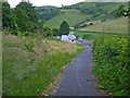
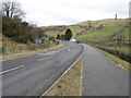
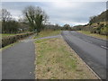
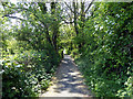
Nearby Images from Geograph Britain and Ireland:
©2006(licence)
©2009(licence)
©2009(licence)

©2023(licence)
©2018(licence)
The above images may not be of the site on this page, they are loaded from Geograph.
Please Submit an Image of this site or go out and take one for us!
Click here to see more info for this site
Nearby sites
Key: Red: member's photo, Blue: 3rd party photo, Yellow: other image, Green: no photo - please go there and take one, Grey: site destroyed
Download sites to:
KML (Google Earth)
GPX (GPS waypoints)
CSV (Garmin/Navman)
CSV (Excel)
To unlock full downloads you need to sign up as a Contributory Member. Otherwise downloads are limited to 50 sites.
Turn off the page maps and other distractions
Nearby sites listing. In the following links * = Image available
833m S 175° Gallt y Gog Hill Fort Hillfort (SH7519301248)
986m S 190° Pistyll Gwn Medicinal Well (Machynlleth)* Holy Well or Sacred Spring (SH7495101112)
1.3km S 172° Maen Llwyd (Machynlleth)* Standing Stone (Menhir) (SH7529600819)
2.0km ESE 123° Ffynnonau Penegoes* Holy Well or Sacred Spring (SH76820092)
6.5km SSW 212° Brwyno-Canol* Stone Row / Alignment (SN71569666)
7.8km E 100° Maen Llwyd (Rhosdyrnog)* Standing Stone (Menhir) (SH8277400577)
7.9km E 100° Carreg Noddfa Standing Stone (Menhir) (SH829005)
8.5km E 81° Maen Llwyd (Commins Coch)* Standing Stone (Menhir) (SH8359303171)
9.1km WSW 256° Eglwys Gwyddelod* Stone Circle (SH66260016)
9.1km WNW 292° Mynydd Pentre* Rock Art (SH6677705648)
10.5km WSW 250° Llyn Barfog Stone Standing Stone (Menhir) (SN6521298686)
10.5km WSW 250° Llyn Barfog Cairn* Cairn (SN65159868)
10.6km WSW 247° Carn March Arthur Stone* Standing Stone (Menhir) (SN6526298167)
10.7km WNW 302° Caerberllan Farm* Standing Stone (Menhir) (SH6622507979)
11.3km SSW 212° Carn Wen (Tre-Taliesin) Cairn (SN689927)
11.3km WNW 292° Bryncrug Cairn* Cairn (SH64690658)
11.5km WNW 292° Flat topped hill enclosure near Craig-Yr-Aderyn* Ancient Village or Settlement (SH646067)
11.7km WNW 292° Craig Yr Aderyn* Hillfort (SH644068)
11.7km W 264° Nant Y Bala Cairn (SH6343301213)
11.7km NNW 340° Cairns East of Cader Idris* Barrow Cemetery (SH714132)
11.7km NNW 347° Mynydd Moel Cairn* Cairn (SH728136)
12.0km SSW 203° Moel y Llyn Stone Circle* Stone Circle (SN7010091160)
12.7km NNW 332° Rhiw Gwredydd Cairns* Cairn (SH694134)
12.7km NNW 341° Llyn Gafr Standing Stone* Standing Stone (Menhir) (SH713142)
12.8km WSW 252° Happy Valley Tumulus* Round Barrow(s) (SN62809846)
View more nearby sites and additional images


 We would like to know more about this location. Please feel free to add a brief description and any relevant information in your own language.
 Wir möchten mehr über diese Stätte erfahren. Bitte zögern Sie nicht, eine kurze Beschreibung und relevante Informationen in Deutsch hinzuzufügen.
 Nous aimerions en savoir encore un peu sur les lieux. S'il vous plaît n'hesitez pas à ajouter une courte description et tous les renseignements pertinents dans votre propre langue.
 Quisieramos informarnos un poco más de las lugares. No dude en añadir una breve descripción y otros datos relevantes en su propio idioma.