


<< Our Photo Pages >> Treeland Brake - Stone Row / Alignment in England in Devon
Submitted by theCaptain on Thursday, 15 February 2001 Page Views: 4179
Neolithic and Bronze AgeSite Name: Treeland BrakeCountry: England
NOTE: This site is 1.201 km away from the location you searched for.
County: Devon Type: Stone Row / Alignment
Nearest Town: Buckfastleigh Nearest Village: Didworthy
Map Ref: SX673614 Landranger Map Number: 202
Latitude: 50.437407N Longitude: 3.869988W
Condition:
| 5 | Perfect |
| 4 | Almost Perfect |
| 3 | Reasonable but with some damage |
| 2 | Ruined but still recognisable as an ancient site |
| 1 | Pretty much destroyed, possibly visible as crop marks |
| 0 | No data. |
| -1 | Completely destroyed |
| 5 | Superb |
| 4 | Good |
| 3 | Ordinary |
| 2 | Not Good |
| 1 | Awful |
| 0 | No data. |
| 5 | Can be driven to, probably with disabled access |
| 4 | Short walk on a footpath |
| 3 | Requiring a bit more of a walk |
| 2 | A long walk |
| 1 | In the middle of nowhere, a nightmare to find |
| 0 | No data. |
| 5 | co-ordinates taken by GPS or official recorded co-ordinates |
| 4 | co-ordinates scaled from a detailed map |
| 3 | co-ordinates scaled from a bad map |
| 2 | co-ordinates of the nearest village |
| 1 | co-ordinates of the nearest town |
| 0 | no data |
Internal Links:
External Links:
")
Notes from Pastscape Monument No. 442117: "Treeland Brake Stone Row. The only record of the row is a photograph taken by Mr HG Hurrell in the late 1950s. Mr Hurrell remembers about five erect stones and about five fallen, aligned north-east to south-west. The row has been destroyed by agricultural activity by 1977. (Photograph is in the possession of S & M Register)." Also: "A colour print taken by Mr Hurrell from approximately SX 67206130 shows the stones aligned to a field corner at SX 67296147. Approximate centre of row, SX 67276141; the area is now under pasture."
Update August 2019: This now destroyed row is also featured on Prehistoric Dartmoor Walks (PDW) - see their entry for the Treeland Brake Stone Row. The row also has an entry on the Devon & Dartmoor HER: MDV5827 Treeland Break Stone Row. More information can be found in Butler's "Dartmoor Atlas of Antiquities, volume 4, page 96, map 56.11.
The row also has an entry on the Sandy G's Stone Rows of Great Britain website: Treeland Brake. Sandy adds: "a 1940’s aerial photograph of this field shows a possible prehistoric field system and for this reason this row should be considered probable", concluding: "The photograph of this site is convincing but the site was destroyed before it could be properly recorded and for this reason some doubt must be acknowledged".
You may be viewing yesterday's version of this page. To see the most up to date information please register for a free account.
Do not use the above information on other web sites or publications without permission of the contributor.
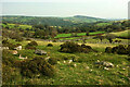
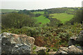
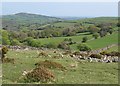
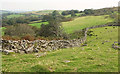
Nearby Images from Geograph Britain and Ireland:
©2021(licence)
©2021(licence)
©2011(licence)
©2020(licence)
©2021(licence)
The above images may not be of the site on this page, they are loaded from Geograph.
Please Submit an Image of this site or go out and take one for us!
Click here to see more info for this site
Nearby sites
Key: Red: member's photo, Blue: 3rd party photo, Yellow: other image, Green: no photo - please go there and take one, Grey: site destroyed
Download sites to:
KML (Google Earth)
GPX (GPS waypoints)
CSV (Garmin/Navman)
CSV (Excel)
To unlock full downloads you need to sign up as a Contributory Member. Otherwise downloads are limited to 50 sites.
![]()
![]()
Turn off the page maps and other distractions
Nearby sites listing. In the following links * = Image available
312m WSW 252° Ball Gate* Ring Cairn (SX67006131)
366m WSW 254° Corringdon Ball Tomb* Chambered Tomb (SX6694561308)
447m W 263° Brent Forehill Encircled Cairn* Cairn (SX6685461356)
463m W 261° Brent Fore Hill* Multiple Stone Rows / Avenue (SX66846134)
626m SSW 212° Corringdon Ball settlement* Ancient Village or Settlement (SX66956088)
644m WSW 251° Corringdon Ball South* Multiple Stone Rows / Avenue (SX6668461205)
646m WSW 252° Corringdon Ball S.E.* Stone Circle (SX6667961215)
660m WSW 252° Corringdon Ball Multiple Cairn Circle* Cairn (SX6666561215)
688m WSW 252° Corringdon Ball Central* Multiple Stone Rows / Avenue (SX66646120)
694m WSW 256° Corringdon Ball Cairns* Cairn (SX66626125)
714m WSW 253° Corringdon Ball N.* Stone Row / Alignment (SX66616121)
729m WSW 250° Corringdon Ball* Multiple Stone Rows / Avenue (SX6660761169)
853m N 353° Hickley Ridge Central* Cist (SX6722462250)
948m NW 310° Hickley Ridge West Cist (SX66596203)
948m W 260° Upper Glazebrook* Ancient Village or Settlement (SX66366126)
986m N 4° Hickley Ridge East* Cist (SX6740262381)
1.2km SW 220° Lower Glasscombe* Cist (SX6650660502)
1.3km WSW 242° Glasscombe Ball NE* Multiple Stone Rows / Avenue (SX6610060802)
1.4km WSW 257° Piles Hill NE* Multiple Stone Rows / Avenue (SX65886111)
1.5km WSW 240° Glasscombe Corner Stone Row* Stone Row / Alignment (SX6601660691)
1.5km WSW 238° Glasscombe Corner SW Terminal Cairn* Cairn (SX6601060646)
1.5km SSW 202° Scad Brook* Ancient Village or Settlement (SX6667759981)
1.8km WSW 237° Glasscombe Ball North (North Cairn)* Cairn (SX6578360473)
1.8km WSW 237° Glasscombe Ball North* Stone Row / Alignment (SX6573360429)
1.9km WSW 236° Glasscombe Ball North (South Cairn)* Cairn (SX65736041)
View more nearby sites and additional images


 We would like to know more about this location. Please feel free to add a brief description and any relevant information in your own language.
 Wir möchten mehr über diese Stätte erfahren. Bitte zögern Sie nicht, eine kurze Beschreibung und relevante Informationen in Deutsch hinzuzufügen.
 Nous aimerions en savoir encore un peu sur les lieux. S'il vous plaît n'hesitez pas à ajouter une courte description et tous les renseignements pertinents dans votre propre langue.
 Quisieramos informarnos un poco más de las lugares. No dude en añadir una breve descripción y otros datos relevantes en su propio idioma.