


<< Text Pages >> Oldaport Promontory Fort - Promontory Fort / Cliff Castle in England in Devon
Submitted by Andy B on Thursday, 25 May 2017 Page Views: 1503
Iron Age and Later PrehistorySite Name: Oldaport Promontory FortCountry: England
NOTE: This site is 1.864 km away from the location you searched for.
County: Devon Type: Promontory Fort / Cliff Castle
Map Ref: SX68554940
Latitude: 50.329826N Longitude: 3.848197W
Condition:
| 5 | Perfect |
| 4 | Almost Perfect |
| 3 | Reasonable but with some damage |
| 2 | Ruined but still recognisable as an ancient site |
| 1 | Pretty much destroyed, possibly visible as crop marks |
| 0 | No data. |
| -1 | Completely destroyed |
| 5 | Superb |
| 4 | Good |
| 3 | Ordinary |
| 2 | Not Good |
| 1 | Awful |
| 0 | No data. |
| 5 | Can be driven to, probably with disabled access |
| 4 | Short walk on a footpath |
| 3 | Requiring a bit more of a walk |
| 2 | A long walk |
| 1 | In the middle of nowhere, a nightmare to find |
| 0 | No data. |
| 5 | co-ordinates taken by GPS or official recorded co-ordinates |
| 4 | co-ordinates scaled from a detailed map |
| 3 | co-ordinates scaled from a bad map |
| 2 | co-ordinates of the nearest village |
| 1 | co-ordinates of the nearest town |
| 0 | no data |
Be the first person to rate this site - see the 'Contribute!' box in the right hand menu.
Internal Links:
External Links:
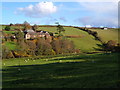
Promontory Fort in Devon
The earliest reference to Oldaport is dated c.1250, when John de la Port is said to have taken 'his name of an old fort that standeth upon the river of Erme and gave the name unto a family'. John's son William gave the property to his son in law Thomas de Heanton, whose son William was granted a licence for a chapel of ease at Oldaport in 1332. His daughter Joan brought the property as a dowry when she married Richard Somaster in the 1330s, and the property continued in the family until sold in the early to mid 17th century to Sir Warwick Hele, who seems to have let it. At some time before 1801, it was acquired by Lord Ashburton, who then leased it to Luke Pearse. It was sold to the sitting tenant John Wilson in 1860 and has had various farming owners since then.
Archaeological evidence shows that the long spur, on the side of which the farm is located, was occupied by a promontory fort in the Iron Age, c.600-100BC, while cropmarks on the ridge top, west of the farm may relate to a later Iron Age or Romano-British farmstead. In the late Saxon period, the site was chosen as a defensive burh or fort, possibly being an early 11th century addition to a sequence of burhs placed at strategic locations across England in the 9th century by King Alfred the Great. This was confirmed in 2004 by a radiocarbon date in the early 11th century for the construction of its walls.
Source: devonruralarchive.com
You may be viewing yesterday's version of this page. To see the most up to date information please register for a free account.
Do not use the above information on other web sites or publications without permission of the contributor.
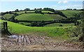
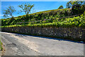
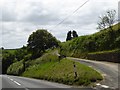
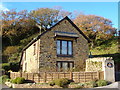
Nearby Images from Geograph Britain and Ireland:
©2015(licence)
©2022(licence)
©2016(licence)
©2006(licence)
©2006(licence)
The above images may not be of the site on this page, they are loaded from Geograph.
Please Submit an Image of this site or go out and take one for us!
Click here to see more info for this site
Nearby sites
Key: Red: member's photo, Blue: 3rd party photo, Yellow: other image, Green: no photo - please go there and take one, Grey: site destroyed
Download sites to:
KML (Google Earth)
GPX (GPS waypoints)
CSV (Garmin/Navman)
CSV (Excel)
To unlock full downloads you need to sign up as a Contributory Member. Otherwise downloads are limited to 50 sites.
Turn off the page maps and other distractions
Nearby sites listing. In the following links * = Image available
3.0km SW 216° Bigbury Tumuli* Barrow Cemetery (SX667470)
3.9km SW 234° Marwell St. Mary's Well* Holy Well or Sacred Spring (SX653472)
4.3km NE 51° Blackdown Rings Hillfort (SX720520)
5.4km SSW 208° Mount Folly Ancient Village or Settlement (SX659447)
6.1km NW 307° Holy Well, Ermington* Holy Well or Sacred Spring (SX6380853189)
6.2km W 279° Holbury Camp (Devon) Hillfort (SX62385049)
6.4km N 351° Ugborough Parish Church Prehistoric Earthwork* Ancient Village or Settlement (SX67755575)
6.7km SSW 213° Burgh Island fort Promontory Fort / Cliff Castle (SX647439)
8.3km NNW 338° Cantrell* Multiple Stone Rows / Avenue (SX6568957160)
9.0km ENE 74° Halwell Camp South West* Hillfort (SX77255165)
9.2km NNW 342° Cuckoo Ball Chambered Tomb* Chambered Tomb (SX6596058188)
9.2km ENE 72° Ritson Barrows Barrow Cemetery (SX77435204)
9.4km NNW 337° Addicombe Cairn and Enclosure* Cairn (SX651582)
9.5km NNW 343° Butterdon Hill Long Cairn* Long Barrow (SX6601258591)
9.5km NNW 348° Ugborough Beacon Cairns* Cairn (SX6675558770)
9.8km NNW 341° Butterdon Hill Cairns* Cairn (SX6560158766)
9.8km S 188° Bolt Tail Hillfort (SX670397)
9.9km NNW 341° Butterdon Stone Circle* Stone Circle (SX6562958814)
9.9km NNW 348° Ugborough Beacon Propped Stone* Natural Stone / Erratic / Other Natural Feature (SX6674859106)
9.9km NNW 340° Weatherdon Hill Cairns* Barrow Cemetery (SX65405881)
10.1km NNW 339° Weatherdon Hill (Devon) Ring Cairn (SX65165889)
10.1km NNW 343° Butterdon East* Stone Row / Alignment (SX65905920)
10.3km NNW 343° Butterdon Hill Cist* Cist (SX6578159341)
10.4km NNW 343° Butterdon Hill Barrow* Round Barrow(s) (SX6566059403)
10.5km ENE 67° Halwell Camp North East* Hillfort (SX784532)
View more nearby sites and additional images


 We would like to know more about this location. Please feel free to add a brief description and any relevant information in your own language.
 Wir möchten mehr über diese Stätte erfahren. Bitte zögern Sie nicht, eine kurze Beschreibung und relevante Informationen in Deutsch hinzuzufügen.
 Nous aimerions en savoir encore un peu sur les lieux. S'il vous plaît n'hesitez pas à ajouter une courte description et tous les renseignements pertinents dans votre propre langue.
 Quisieramos informarnos un poco más de las lugares. No dude en añadir una breve descripción y otros datos relevantes en su propio idioma.