


<< Our Photo Pages >> Pen Rhiw fawr Standing Stone - Standing Stone (Menhir) in Wales in West Glamorgan
Submitted by geoffstickland on Sunday, 06 March 2022 Page Views: 803
Modern SitesSite Name: Pen Rhiw fawr Standing StoneCountry: Wales
NOTE: This site is 1.892 km away from the location you searched for.
County: West Glamorgan Type: Standing Stone (Menhir)
Nearest Town: Ystalyfera Nearest Village: Pen Rhiw Fawr
Map Ref: SN740111
Latitude: 51.784330N Longitude: 3.828039W
Condition:
| 5 | Perfect |
| 4 | Almost Perfect |
| 3 | Reasonable but with some damage |
| 2 | Ruined but still recognisable as an ancient site |
| 1 | Pretty much destroyed, possibly visible as crop marks |
| 0 | No data. |
| -1 | Completely destroyed |
| 5 | Superb |
| 4 | Good |
| 3 | Ordinary |
| 2 | Not Good |
| 1 | Awful |
| 0 | No data. |
| 5 | Can be driven to, probably with disabled access |
| 4 | Short walk on a footpath |
| 3 | Requiring a bit more of a walk |
| 2 | A long walk |
| 1 | In the middle of nowhere, a nightmare to find |
| 0 | No data. |
| 5 | co-ordinates taken by GPS or official recorded co-ordinates |
| 4 | co-ordinates scaled from a detailed map |
| 3 | co-ordinates scaled from a bad map |
| 2 | co-ordinates of the nearest village |
| 1 | co-ordinates of the nearest town |
| 0 | no data |
Internal Links:
External Links:
I have visited· I would like to visit
geoffstickland has visited here
")
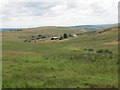
I don't know if I should submit this site as I'm pretty sure that it is modern (and not prehistoric). It is either a recently erected monument to a much loved Minister from a chapel in the valley below or a more ancient stone utilised for the purpose.It is a large stone, about 4' high and 3' thick. It is very prominent and affords impressive views across a wide area to the North and East. It is within site of the narrow road that crosses the mountain, Mynydd Uchaf. I include it as someone may ask about it? I have given it a name that reflects the nearest cairn and village, though it may have another local name.
You may be viewing yesterday's version of this page. To see the most up to date information please register for a free account.
Do not use the above information on other web sites or publications without permission of the contributor.
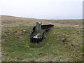
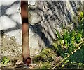
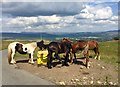
Nearby Images from Geograph Britain and Ireland:
©2007(licence)

©2020(licence)
©2022(licence)
©2019(licence)
©2020(licence)
The above images may not be of the site on this page, they are loaded from Geograph.
Please Submit an Image of this site or go out and take one for us!
Click here to see more info for this site
Nearby sites
Key: Red: member's photo, Blue: 3rd party photo, Yellow: other image, Green: no photo - please go there and take one, Grey: site destroyed
Download sites to:
KML (Google Earth)
GPX (GPS waypoints)
CSV (Garmin/Navman)
CSV (Excel)
To unlock full downloads you need to sign up as a Contributory Member. Otherwise downloads are limited to 50 sites.
Turn off the page maps and other distractions
Nearby sites listing. In the following links * = Image available
340m SE 133° Pen Rhiw Fawr Cairn* Cairn (SN7424410863)
340m W 274° Brynmelyn Quarry Cairn 2* Cairn (SN73661113)
469m W 275° Brynmelyn Quarry Cairn 1* Cairn (SN7353211152)
1.7km WSW 251° Pen Y Waun NW 2 Cairn* Cairn (SN7234810576)
1.7km WSW 253° Pen Y Waun NW 1 Cairn* Cairn (SN7231810629)
2.4km SSW 198° Cefn Gwrhyd Stone* Standing Stone (Menhir) (SN732088)
2.5km ESE 105° Ffynnon Ddrewllyd* Holy Well or Sacred Spring (SN764104)
4.2km SW 231° Nant-Y-Gaseg modern stone circle* Modern Stone Circle etc (SN7063408515)
4.4km NE 35° Derlwyn Isaf* Cairn (SN76611467)
4.5km NE 45° Dorwen* Standing Stones (SN7730414239)
4.9km WSW 255° Llety'r-crydd cairn cemetery* Barrow Cemetery (SN69200991)
5.1km W 260° Mynydd y Betws* Stone Row / Alignment (SN6893610326)
5.2km WSW 256° Bancbryn platform cairn* Cairn (SN68950998)
5.2km W 266° Plas-y-coed cairns* Barrow Cemetery (SN68771089)
5.4km W 259° Bancbryn cairn cemetery* Barrow Cemetery (SN68631021)
5.5km NE 42° Llwyncwmstabl* Cairn (SN77851509)
5.7km SSW 195° Llangiwg* Holy Well or Sacred Spring (SN72380559)
5.9km NW 323° Deg Arbedd* Cairn (SN70501591)
6.0km NE 48° Llorfa* Stone Circle (SN7861915010)
6.4km SW 220° Carn Llechart Cairn Circle* Ring Cairn (SN69730627)
6.5km SW 220° Carn Llechart Chambered Tomb* Chambered Tomb (SN69670627)
6.7km NNE 24° Carn Fadog* Cairn (SN76861721)
6.8km N 359° Garreg Lwyd Cairn* Cairn (SN74041793)
6.9km SW 218° Carn Llechart Megalithic Complex* Modern Stone Circle etc (SN69670576)
7.0km N 356° Garreg Lwyd Marker Stone* Natural Stone / Erratic / Other Natural Feature (SN73731810)
View more nearby sites and additional images


 We would like to know more about this location. Please feel free to add a brief description and any relevant information in your own language.
 Wir möchten mehr über diese Stätte erfahren. Bitte zögern Sie nicht, eine kurze Beschreibung und relevante Informationen in Deutsch hinzuzufügen.
 Nous aimerions en savoir encore un peu sur les lieux. S'il vous plaît n'hesitez pas à ajouter une courte description et tous les renseignements pertinents dans votre propre langue.
 Quisieramos informarnos un poco más de las lugares. No dude en añadir una breve descripción y otros datos relevantes en su propio idioma.