

<< Our Photo Pages >> Watling Lodge, Antonine Wall - Ancient Village or Settlement in Scotland in Falkirk
Submitted by Antonine on Sunday, 10 September 2023 Page Views: 769
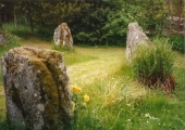
Roman, Greek and ClassicalSite Name: Watling Lodge, Antonine Wall Alternative Name: Watling Lodge West, Watling Lodge EastCountry: Scotland County: Falkirk Type: Ancient Village or Settlement
Nearest Town: Falkirk
Map Ref: NS86347982
Latitude: 55.997819N Longitude: 3.823952W
Condition:
| 5 | Perfect |
| 4 | Almost Perfect |
| 3 | Reasonable but with some damage |
| 2 | Ruined but still recognisable as an ancient site |
| 1 | Pretty much destroyed, possibly visible as crop marks |
| 0 | No data. |
| -1 | Completely destroyed |
| 5 | Superb |
| 4 | Good |
| 3 | Ordinary |
| 2 | Not Good |
| 1 | Awful |
| 0 | No data. |
| 5 | Can be driven to, probably with disabled access |
| 4 | Short walk on a footpath |
| 3 | Requiring a bit more of a walk |
| 2 | A long walk |
| 1 | In the middle of nowhere, a nightmare to find |
| 0 | No data. |
| 5 | co-ordinates taken by GPS or official recorded co-ordinates |
| 4 | co-ordinates scaled from a detailed map |
| 3 | co-ordinates scaled from a bad map |
| 2 | co-ordinates of the nearest village |
| 1 | co-ordinates of the nearest town |
| 0 | no data |
Internal Links:
External Links:
")
More: Canmore
You may be viewing yesterday's version of this page. To see the most up to date information please register for a free account.
")
")
")
")
")
")
")
")
")
")
")
Do not use the above information on other web sites or publications without permission of the contributor.
Click here to see more info for this site
Nearby sites
Key: Red: member's photo, Blue: 3rd party photo, Yellow: other image, Green: no photo - please go there and take one, Grey: site destroyed
Download sites to:
KML (Google Earth)
GPX (GPS waypoints)
CSV (Garmin/Navman)
CSV (Excel)
To unlock full downloads you need to sign up as a Contributory Member. Otherwise downloads are limited to 50 sites.
Turn off the page maps and other distractions
Nearby sites listing. In the following links * = Image available
2.9km E 89° Marion's Well (Falkirk) Holy Well or Sacred Spring (NS89267977)
6.0km NNW 328° Torwood Broch* Broch or Nuraghe (NS8333584986)
7.9km N 356° Castleton 8* Rock Art (NS86028771)
8.3km N 353° Castleton 5* Rock Art (NS85548811)
8.4km N 353° Castleton 7a* Rock Art (NS8552188188)
8.5km N 355° Castleton 2* Rock Art (NS85818831)
8.6km N 355° Castleton 1* Rock Art (NS85878840)
10.2km NE 40° Market Cross (Kincardine)* Ancient Cross (NS9312087515)
11.0km NE 39° Greenfield Park, Alloa Stone Row / Alignment (NS935882)
11.1km SE 132° Westfield Farm Refuge Stone* Early Christian Sculptured Stone (NS94377211)
11.3km NNW 334° St Ninians Cursus Cursus (NS81679012)
11.4km NNW 334° St Ninians Cursus Cursus (NS81599016)
11.4km NE 46° Gubber Hill Standing Stone (Menhir) (NS948875)
11.7km SSE 147° Hillhouse (Torphichen) Standing Stone (Menhir) (NS92456984)
12.0km WNW 300° Loch Coulter Crannog* Crannog (NS761861)
12.1km W 265° Auchinvalley Hillfort (NS742791)
12.4km NE 37° Tulliallan Castle Sculptured Stone (NS94058952)
12.7km E 101° The Boarstane (Linlithgow) Standing Stone (Menhir) (NS98757706)
12.8km NNE 20° Lady Well (Clackmannan) Holy Well or Sacred Spring (NS91129166)
12.8km ESE 123° Torphichen Churchyard Stone* Standing Stone (Menhir) (NS96847250)
12.9km SE 133° North Couston Refuge Stone* Early Christian Sculptured Stone (NS95637078)
13.0km NNE 20° Stone of Mannan* Standing Stone (Menhir) (NS91119188)
13.0km NNE 20° Mercat Cross (Clackmannan)* Ancient Cross (NS9111091889)
13.1km SSE 151° Boar Stone (Armadale)* Natural Stone / Erratic / Other Natural Feature (NS92336820)
13.3km N 10° Hawk Hill Cairn (Alloa) Cairn (NS89119282)
View more nearby sites and additional images


 We would like to know more about this location. Please feel free to add a brief description and any relevant information in your own language.
 Wir möchten mehr über diese Stätte erfahren. Bitte zögern Sie nicht, eine kurze Beschreibung und relevante Informationen in Deutsch hinzuzufügen.
 Nous aimerions en savoir encore un peu sur les lieux. S'il vous plaît n'hesitez pas à ajouter une courte description et tous les renseignements pertinents dans votre propre langue.
 Quisieramos informarnos un poco más de las lugares. No dude en añadir una breve descripción y otros datos relevantes en su propio idioma.