 with our Megalithic Portal iPhone app")


<< Our Photo Pages >> Kernalec Nevez - Standing Stone (Menhir) in France in Bretagne:Finistère (29)
Submitted by minteddy on Monday, 24 November 2014 Page Views: 4353
Neolithic and Bronze AgeSite Name: Kernalec NevezCountry: France Département: Bretagne:Finistère (29) Type: Standing Stone (Menhir)
Nearest Town: Quimperlé Nearest Village: Nevez
Latitude: 47.817418N Longitude: 3.811465W
Condition:
| 5 | Perfect |
| 4 | Almost Perfect |
| 3 | Reasonable but with some damage |
| 2 | Ruined but still recognisable as an ancient site |
| 1 | Pretty much destroyed, possibly visible as crop marks |
| 0 | No data. |
| -1 | Completely destroyed |
| 5 | Superb |
| 4 | Good |
| 3 | Ordinary |
| 2 | Not Good |
| 1 | Awful |
| 0 | No data. |
| 5 | Can be driven to, probably with disabled access |
| 4 | Short walk on a footpath |
| 3 | Requiring a bit more of a walk |
| 2 | A long walk |
| 1 | In the middle of nowhere, a nightmare to find |
| 0 | No data. |
| 5 | co-ordinates taken by GPS or official recorded co-ordinates |
| 4 | co-ordinates scaled from a detailed map |
| 3 | co-ordinates scaled from a bad map |
| 2 | co-ordinates of the nearest village |
| 1 | co-ordinates of the nearest town |
| 0 | no data |
Internal Links:
External Links:
")
You may be viewing yesterday's version of this page. To see the most up to date information please register for a free account.
")
Do not use the above information on other web sites or publications without permission of the contributor.
davidmorgan has found this location on Google Street View:
Nearby Images from Flickr

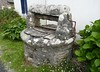
The above images may not be of the site on this page, but were taken nearby. They are loaded from Flickr so please click on them for image credits.
Click here to see more info for this site
Nearby sites
Click here to view sites on an interactive map of the areaKey: Red: member's photo, Blue: 3rd party photo, Yellow: other image, Green: no photo - please go there and take one, Grey: site destroyed
Download sites to:
KML (Google Earth)
GPX (GPS waypoints)
CSV (Garmin/Navman)
CSV (Excel)
To unlock full downloads you need to sign up as a Contributory Member. Otherwise downloads are limited to 50 sites.
Turn off the page maps and other distractions
Nearby sites listing. In the following links * = Image available
35m SW 226° Kernalec dolmen Burial Chamber or Dolmen
2.3km N 5° Kermadoué Dolmen II* Chambered Tomb
2.4km N 360° Kermadoué Dolmen* Burial Chamber or Dolmen
3.5km NNE 30° Menhir de Kerlann (Pont-Aven)* Standing Stone (Menhir)
3.5km N 8° Manoir de Kerminaoüt menhir Standing Stone (Menhir)
3.7km WNW 286° Menhir de Beg Roz Ruat Standing Stone (Menhir)
3.8km SSE 168° Dolmen de l'Île-de-Raguenez Burial Chamber or Dolmen
4.2km NE 44° Dolmen de Brucou* Burial Chamber or Dolmen
4.2km SE 132° Dolmens de Kerascoët Burial Chamber or Dolmen
4.8km NNW 333° Menhir du Château d'Eau Standing Stone (Menhir)
4.8km W 278° Kerdallé menhir Standing Stone (Menhir)
4.8km NE 49° Menhir de Kerangosquer 1* Standing Stone (Menhir)
4.9km NE 47° Menhir de Kerangosquer 2* Standing Stone (Menhir)
5.1km NNW 330° Menhir de Kergleuhant* Standing Stone (Menhir)
5.5km NNW 330° Menhir de Kérangallou* Standing Stone (Menhir)
5.9km NNE 16° Kerguillotou Dolmen* Burial Chamber or Dolmen
6.0km ENE 57° Tombeaux des Géants* Rock Cut Tomb
6.1km NW 317° Men Dogan menhirs Standing Stones
6.2km NW 316° Dolmen de Men Dogan* Burial Chamber or Dolmen
6.4km NE 56° Menhir de Bourgneuf (Pont-Aven) Standing Stone (Menhir)
6.6km E 90° Kernédiec allée couverte* Passage Grave
7.5km E 84° Kertallic 1 menhir* Standing Stone (Menhir)
7.5km E 85° Kertallic 2 menhir Standing Stone (Menhir)
7.9km NE 36° Dolmen de la Chapelle Saint-Maudé* Burial Chamber or Dolmen
8.3km E 93° Allée Couverte de Parc Biourac'h* Passage Grave
View more nearby sites and additional images


 We would like to know more about this location. Please feel free to add a brief description and any relevant information in your own language.
 Wir möchten mehr über diese Stätte erfahren. Bitte zögern Sie nicht, eine kurze Beschreibung und relevante Informationen in Deutsch hinzuzufügen.
 Nous aimerions en savoir encore un peu sur les lieux. S'il vous plaît n'hesitez pas à ajouter une courte description et tous les renseignements pertinents dans votre propre langue.
 Quisieramos informarnos un poco más de las lugares. No dude en añadir una breve descripción y otros datos relevantes en su propio idioma.