


<< Text Pages >> Craig Fawr - Cairn in Wales in Ceredigion
Submitted by coldrum on Sunday, 12 July 2009 Page Views: 3596
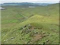
Neolithic and Bronze AgeSite Name: Craig FawrCountry: Wales
NOTE: This site is 1.45 km away from the location you searched for.
County: Ceredigion Type: Cairn
Map Ref: SN792689
Latitude: 52.304890N Longitude: 3.773139W
Condition:
| 5 | Perfect |
| 4 | Almost Perfect |
| 3 | Reasonable but with some damage |
| 2 | Ruined but still recognisable as an ancient site |
| 1 | Pretty much destroyed, possibly visible as crop marks |
| 0 | No data. |
| -1 | Completely destroyed |
| 5 | Superb |
| 4 | Good |
| 3 | Ordinary |
| 2 | Not Good |
| 1 | Awful |
| 0 | No data. |
| 5 | Can be driven to, probably with disabled access |
| 4 | Short walk on a footpath |
| 3 | Requiring a bit more of a walk |
| 2 | A long walk |
| 1 | In the middle of nowhere, a nightmare to find |
| 0 | No data. |
| 5 | co-ordinates taken by GPS or official recorded co-ordinates |
| 4 | co-ordinates scaled from a detailed map |
| 3 | co-ordinates scaled from a bad map |
| 2 | co-ordinates of the nearest village |
| 1 | co-ordinates of the nearest town |
| 0 | no data |
Be the first person to rate this site - see the 'Contribute!' box in the right hand menu.
Internal Links:
External Links:
Cairn in Ceredigion
Prehistoric cairn.
Coflein record:
https://www.coflein.gov.uk/en/site/709
You may be viewing yesterday's version of this page. To see the most up to date information please register for a free account.
Do not use the above information on other web sites or publications without permission of the contributor.
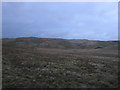
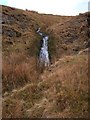
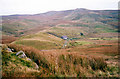
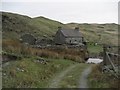
Nearby Images from Geograph Britain and Ireland:
©2012(licence)
©2006(licence)
©2008(licence)
©2009(licence)
©2013(licence)
The above images may not be of the site on this page, they are loaded from Geograph.
Please Submit an Image of this site or go out and take one for us!
Click here to see more info for this site
Nearby sites
Key: Red: member's photo, Blue: 3rd party photo, Yellow: other image, Green: no photo - please go there and take one, Grey: site destroyed
Download sites to:
KML (Google Earth)
GPX (GPS waypoints)
CSV (Garmin/Navman)
CSV (Excel)
To unlock full downloads you need to sign up as a Contributory Member. Otherwise downloads are limited to 50 sites.
Turn off the page maps and other distractions
Nearby sites listing. In the following links * = Image available
905m N 352° Waun Claerddu Cist* Cist (SN79106980)
1.1km NNE 26° Carreg Naw Llyn* Standing Stone (Menhir) (SN79716989)
1.2km NNW 336° Llan Ddu Fawr Cairn* Cairn (SN78766998)
1.5km N 354° Carn-Y-Rhyrddod* Cairn (SN7906670426)
2.0km NW 317° Blaen Marchnant Cairn (SN77857040)
2.9km WSW 258° Troed Y Rhiw 1 Cairn (SN7636468372)
3.5km NNE 27° Domen Milwyn Cairn* Round Barrow(s) (SN8083271967)
3.8km SW 227° Troed Y Rhiw 2 Cairn (SN76336634)
5.0km NE 48° Garreg Bica Standing Stone (Menhir) (SN8303372179)
5.2km WNW 285° Carreg Samson, Llethr* Standing Stone (Menhir) (SN74157038)
5.3km S 169° Crug Gynon Cairn (SN801637)
5.3km SW 220° Ffynnon Llygaid (Drefach)* Holy Well or Sacred Spring (SN7564064940)
5.3km SSW 192° Pen-Y-Bwlch E ,Cairn Cairn (SN780637)
5.3km SSW 196° Pen-Y-Bwlch W ,Cairn Cairn (SN776638)
5.4km WSW 247° Pen-y-Bannau* Hillfort (SN74196689)
5.5km SW 234° Strata Florida Sculptured Stone* Early Christian Sculptured Stone (SN74646577)
5.9km SSW 212° Glasffrwyd Holy Well* Holy Well or Sacred Spring (SN75996399)
6.2km SSW 198° Blaen Glasffrwd Cairn Field Cairn (SN771631)
6.2km SSW 200° Blaen Glas ffrwd Standing Stone Standing Stone (Menhir) (SN769631)
7.3km E 88° Esgair Beddau Cairn 1* Round Barrow(s) (SN8653469009)
7.3km E 84° Esgair Y Ty Cairn* Cairn (SN86546954)
7.3km E 88° Esgair Beddau Cairn 2* Round Barrow(s) (SN8657068982)
7.7km W 279° Banc-Y-Geufron* Cairn (SN71637033)
7.8km ESE 118° Cerrig-Y-Gadeir* Cairn (SN860650)
7.9km E 90° Lluest Aber Caethon Mound* Round Barrow(s) (SN87146876)
View more nearby sites and additional images


 We would like to know more about this location. Please feel free to add a brief description and any relevant information in your own language.
 Wir möchten mehr über diese Stätte erfahren. Bitte zögern Sie nicht, eine kurze Beschreibung und relevante Informationen in Deutsch hinzuzufügen.
 Nous aimerions en savoir encore un peu sur les lieux. S'il vous plaît n'hesitez pas à ajouter une courte description et tous les renseignements pertinents dans votre propre langue.
 Quisieramos informarnos un poco más de las lugares. No dude en añadir una breve descripción y otros datos relevantes en su propio idioma.