


<< Text Pages >> Ffynnon Newydd - Holy Well or Sacred Spring in Wales in Conwy
Submitted by coldrum on Wednesday, 27 January 2010 Page Views: 4642
Springs and Holy WellsSite Name: Ffynnon NewyddCountry: Wales County: Conwy Type: Holy Well or Sacred Spring
Map Ref: SH80196278
Latitude: 53.148643N Longitude: 3.79291W
Condition:
| 5 | Perfect |
| 4 | Almost Perfect |
| 3 | Reasonable but with some damage |
| 2 | Ruined but still recognisable as an ancient site |
| 1 | Pretty much destroyed, possibly visible as crop marks |
| 0 | No data. |
| -1 | Completely destroyed |
| 5 | Superb |
| 4 | Good |
| 3 | Ordinary |
| 2 | Not Good |
| 1 | Awful |
| 0 | No data. |
| 5 | Can be driven to, probably with disabled access |
| 4 | Short walk on a footpath |
| 3 | Requiring a bit more of a walk |
| 2 | A long walk |
| 1 | In the middle of nowhere, a nightmare to find |
| 0 | No data. |
| 5 | co-ordinates taken by GPS or official recorded co-ordinates |
| 4 | co-ordinates scaled from a detailed map |
| 3 | co-ordinates scaled from a bad map |
| 2 | co-ordinates of the nearest village |
| 1 | co-ordinates of the nearest town |
| 0 | no data |
Be the first person to rate this site - see the 'Contribute!' box in the right hand menu.
Internal Links:
External Links:
I have visited· I would like to visit
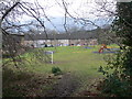
WellHopper saw from a distance on 1st Nov 2011 - their rating: Cond: 2 Amb: 3 Access: 4 This site is on private land in the gardens of a farm building. We asked for permission to visit it but were refused,
It can be seen from a public footpath that runs through the farm grounds, although you are too far away to be able to see the layout of the site or its construction since most of it appears to be below ground level.
"Stone enclosure 15ft square, walls 12ft high; ruinous slate roof, 7 steps to water; dressing room 9ft by 15ft attached. 17th century."
Source: Coflein.
You may be viewing yesterday's version of this page. To see the most up to date information please register for a free account.
Do not use the above information on other web sites or publications without permission of the contributor.
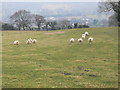
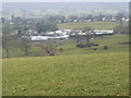
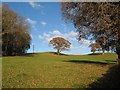
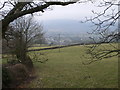
Nearby Images from Geograph Britain and Ireland:
©2010(licence)
©2010(licence)
©2016(licence)
©2010(licence)
©2010(licence)
The above images may not be of the site on this page, they are loaded from Geograph.
Please Submit an Image of this site or go out and take one for us!
Click here to see more info for this site
Nearby sites
Key: Red: member's photo, Blue: 3rd party photo, Yellow: other image, Green: no photo - please go there and take one, Grey: site destroyed
Download sites to:
KML (Google Earth)
GPX (GPS waypoints)
CSV (Garmin/Navman)
CSV (Excel)
To unlock full downloads you need to sign up as a Contributory Member. Otherwise downloads are limited to 50 sites.
Turn off the page maps and other distractions
Nearby sites listing. In the following links * = Image available
1.1km NNE 20° Ffynnon Ddoged (Llanddoged)* Holy Well or Sacred Spring (SH806638)
1.4km SSW 192° Llanrwst Gorsedd Circle* Modern Stone Circle etc (SH7985261376)
3.4km NW 316° Trefriw Chalybeate Well and Bath* Holy Well or Sacred Spring (SH7784465308)
3.8km NNW 345° Caer Oleu Hillfort (SH79296651)
5.9km NNW 326° Porth Llwyd Burial Chamber or Dolmen (SH77036777)
6.0km WNW 303° Cae Du* Cairn (SH75206616)
7.3km NW 307° Waen Bryn-Gwenith* Burial Chamber or Dolmen (SH74476738)
7.5km SE 144° Maen Pebyll* Long Barrow (SH844566)
7.6km E 99° Gwytherin Churchyard* Stone Row / Alignment (SH87676147)
8.0km NNW 340° St Mary's Church (Caerhun) Early Christian Sculptured Stone (SH77697040)
8.1km SE 144° Bryn-Cyplau Cairn Circle West Ring Cairn (SH8486156102)
8.2km SE 143° Bryn-Cyplau Cairn Circle East Ring Cairn (SH8489756103)
8.2km WNW 303° Hafodygors Wen* Ring Cairn (SH73366742)
8.3km NW 320° Pen-y-Gaer (Conwy)* Hillfort (SH750693)
8.5km SSE 168° Ty'n-y-coed Stone* Natural Stone / Erratic / Other Natural Feature (SH81775444)
8.6km W 265° Pen Llithrig Y Wrach* Cairn (SH71606232)
8.6km SW 233° Carnedd Coed Bryn Brethynau* Round Cairn (SH7319057750)
8.6km SSE 168° Capel Garmon* Chambered Tomb (SH81805432)
8.7km NE 56° St Digain (Llangernyw)* Ancient Cross (SH8749567455)
8.7km WSW 256° Maen Trichwmwd Natural Stone / Erratic / Other Natural Feature (SH7169260962)
8.7km WNW 297° Clogwyn-yr-Eryr* Stone Row / Alignment (SH72506687)
8.8km NNW 333° Maes y Castell Hut Circles* Ancient Village or Settlement (SH76357067)
8.8km WSW 256° Bwlch Cowlyd Hut Circles* Ancient Village or Settlement (SH716609)
8.8km WSW 256° Bwlch Cowlyd Cairn* Cairn (SH716608)
8.9km NE 50° Ffynnon Digain* Holy Well or Sacred Spring (SH87146833)
View more nearby sites and additional images


 We would like to know more about this location. Please feel free to add a brief description and any relevant information in your own language.
 Wir möchten mehr über diese Stätte erfahren. Bitte zögern Sie nicht, eine kurze Beschreibung und relevante Informationen in Deutsch hinzuzufügen.
 Nous aimerions en savoir encore un peu sur les lieux. S'il vous plaît n'hesitez pas à ajouter une courte description et tous les renseignements pertinents dans votre propre langue.
 Quisieramos informarnos un poco más de las lugares. No dude en añadir una breve descripción y otros datos relevantes en su propio idioma.