


<< Our Photo Pages >> Dolddeuli - Standing Stone (Menhir) in Wales in Gwynedd
Submitted by postman on Sunday, 11 November 2012 Page Views: 4123
Neolithic and Bronze AgeSite Name: DolddeuliCountry: Wales
NOTE: This site is 1.899 km away from the location you searched for.
County: Gwynedd Type: Standing Stone (Menhir)
Nearest Town: Dollgelau Nearest Village: Rhydymain
Map Ref: SH826236
Latitude: 52.797148N Longitude: 3.742669W
Condition:
| 5 | Perfect |
| 4 | Almost Perfect |
| 3 | Reasonable but with some damage |
| 2 | Ruined but still recognisable as an ancient site |
| 1 | Pretty much destroyed, possibly visible as crop marks |
| 0 | No data. |
| -1 | Completely destroyed |
| 5 | Superb |
| 4 | Good |
| 3 | Ordinary |
| 2 | Not Good |
| 1 | Awful |
| 0 | No data. |
| 5 | Can be driven to, probably with disabled access |
| 4 | Short walk on a footpath |
| 3 | Requiring a bit more of a walk |
| 2 | A long walk |
| 1 | In the middle of nowhere, a nightmare to find |
| 0 | No data. |
| 5 | co-ordinates taken by GPS or official recorded co-ordinates |
| 4 | co-ordinates scaled from a detailed map |
| 3 | co-ordinates scaled from a bad map |
| 2 | co-ordinates of the nearest village |
| 1 | co-ordinates of the nearest town |
| 0 | no data |
Internal Links:
External Links:
")
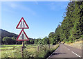
Really close to the A494 that goes from Bala to Dollgelau, on its south side just north of Rhydymain. Hidden from view by a disused railway embankment.
Permission should be sought at Dolddeuli farm for the stone is on their land, just. The fence around the fields edge diverts around the stone to keep the stone on farm land. About four to five feet tall, smooth and shapely, a very nice stone if in rather restrictive circumstances.
You may be viewing yesterday's version of this page. To see the most up to date information please register for a free account.
")
")
")
")
Do not use the above information on other web sites or publications without permission of the contributor.
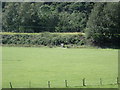
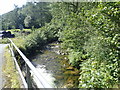
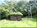
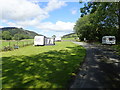
Nearby Images from Geograph Britain and Ireland:
©2019(licence)
©2019(licence)
©2019(licence)
©2019(licence)
©2015(licence)
The above images may not be of the site on this page, they are loaded from Geograph.
Please Submit an Image of this site or go out and take one for us!
Click here to see more info for this site
Nearby sites
Key: Red: member's photo, Blue: 3rd party photo, Yellow: other image, Green: no photo - please go there and take one, Grey: site destroyed
Download sites to:
KML (Google Earth)
GPX (GPS waypoints)
CSV (Garmin/Navman)
CSV (Excel)
To unlock full downloads you need to sign up as a Contributory Member. Otherwise downloads are limited to 50 sites.
Turn off the page maps and other distractions
Nearby sites listing. In the following links * = Image available
2.8km NE 38° Pant Clyd Round Cairn* Round Cairn (SH8440225764)
4.3km NNE 26° Afon Dyfrdwy (River Dee) Cairn* Cairn (SH846274)
4.3km NNE 25° Afon Dyfrdwy (River Dee) Settlement* Ancient Village or Settlement (SH845275)
5.5km WSW 249° Hill Fort West of Ystum Gwadnaeth* Hillfort (SH774218)
5.5km SSW 204° Cairn North of Nant Helygog* Cairn (SH802186)
5.6km SSW 204° Marchnad Mawr Ring Cairn* Ring Cairn (SH802185)
5.7km SSW 205° Marchnad Mawr Round Cairn* Round Cairn (SH801185)
5.7km SSW 203° Marchnad Mawr Settlement* Ancient Village or Settlement (SH802184)
5.8km W 275° Cors Y Garnedd Round Barrow* Round Barrow(s) (SH768242)
6.7km WSW 256° Y Garreg Fawr (the Great Stone)* Modern Stone Circle etc (SH760221)
7.3km NW 318° Rhiw Felen Hut Circle* Ancient Village or Settlement (SH778291)
7.3km W 266° Cairn east of Mynydd Ty Isaf* Cairn (SH7529723251)
7.4km W 266° Mynydd Ty Isaf Cairn Cemetery* Barrow Cemetery (SH7515023273)
7.5km W 265° Ring Cairn SW of Mynydd Ty Isaf* Ring Cairn (SH7511123193)
7.6km W 266° Cairn West of Mynydd Ty Isaf* Cairn (SH7503023291)
7.6km W 260° Ffynnon-Y-Capel Holy Well or Sacred Spring (SH75102248)
7.7km SW 220° Y Foel Caerynwch Cairn* Cairn (SH775178)
8.1km WSW 250° Moel Offrwm* Hillfort (SH749210)
8.2km WSW 257° Tyddyn Bach Round Barrow* Round Barrow(s) (SH74572196)
8.4km WSW 248° Caer Isaf Moel-Offrwm* Hillfort (SH747206)
8.7km NE 50° Boncyn Crwn* Cairn (SH894290)
8.8km NE 51° Boncyn Pennant Groes* Artificial Mound (SH896289)
9.3km N 353° Bancian Duon Hut Circle Settlement* Ancient Village or Settlement (SH81653283)
9.5km N 355° Cairn SE of Bryn Cau* Cairn (SH8195233050)
9.6km W 264° Carreg Coed Y Brenin* Modern Stone Circle etc (SH730229)
View more nearby sites and additional images


 We would like to know more about this location. Please feel free to add a brief description and any relevant information in your own language.
 Wir möchten mehr über diese Stätte erfahren. Bitte zögern Sie nicht, eine kurze Beschreibung und relevante Informationen in Deutsch hinzuzufügen.
 Nous aimerions en savoir encore un peu sur les lieux. S'il vous plaît n'hesitez pas à ajouter une courte description et tous les renseignements pertinents dans votre propre langue.
 Quisieramos informarnos un poco más de las lugares. No dude en añadir una breve descripción y otros datos relevantes en su propio idioma.