


<< Text Pages >> Garreg Bica - Standing Stone (Menhir) in Wales in Ceredigion
Submitted by DavidHoyle on Wednesday, 28 July 2021 Page Views: 277
Neolithic and Bronze AgeSite Name: Garreg BicaCountry: Wales
NOTE: This site is 1.196 km away from the location you searched for.
County: Ceredigion Type: Standing Stone (Menhir)
Map Ref: SN8303372179
Latitude: 52.335186N Longitude: 3.718091W
Condition:
| 5 | Perfect |
| 4 | Almost Perfect |
| 3 | Reasonable but with some damage |
| 2 | Ruined but still recognisable as an ancient site |
| 1 | Pretty much destroyed, possibly visible as crop marks |
| 0 | No data. |
| -1 | Completely destroyed |
| 5 | Superb |
| 4 | Good |
| 3 | Ordinary |
| 2 | Not Good |
| 1 | Awful |
| 0 | No data. |
| 5 | Can be driven to, probably with disabled access |
| 4 | Short walk on a footpath |
| 3 | Requiring a bit more of a walk |
| 2 | A long walk |
| 1 | In the middle of nowhere, a nightmare to find |
| 0 | No data. |
| 5 | co-ordinates taken by GPS or official recorded co-ordinates |
| 4 | co-ordinates scaled from a detailed map |
| 3 | co-ordinates scaled from a bad map |
| 2 | co-ordinates of the nearest village |
| 1 | co-ordinates of the nearest town |
| 0 | no data |
Be the first person to rate this site - see the 'Contribute!' box in the right hand menu.
Internal Links:
External Links:
Standing Stone (Menhir) in Ceredigion
Visible on the OS Map - looks quite remote - 52.335176, -3.718089.
You may be viewing yesterday's version of this page. To see the most up to date information please register for a free account.
Do not use the above information on other web sites or publications without permission of the contributor.
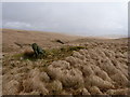
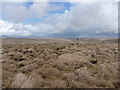
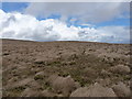
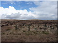
Nearby Images from Geograph Britain and Ireland:
©2011(licence)

©2011(licence)
©2011(licence)
©2011(licence)
©2011(licence)
The above images may not be of the site on this page, they are loaded from Geograph.
Please Submit an Image of this site or go out and take one for us!
Click here to see more info for this site
Nearby sites
Key: Red: member's photo, Blue: 3rd party photo, Yellow: other image, Green: no photo - please go there and take one, Grey: site destroyed
Download sites to:
KML (Google Earth)
GPX (GPS waypoints)
CSV (Garmin/Navman)
CSV (Excel)
To unlock full downloads you need to sign up as a Contributory Member. Otherwise downloads are limited to 50 sites.
Turn off the page maps and other distractions
Nearby sites listing. In the following links * = Image available
2.2km W 263° Domen Milwyn Cairn* Round Barrow(s) (SN8083271967)
4.0km SW 234° Carreg Naw Llyn* Standing Stone (Menhir) (SN79716989)
4.3km WSW 245° Carn-Y-Rhyrddod* Cairn (SN7906670426)
4.4km SE 126° Esgair Y Ty Cairn* Cairn (SN86546954)
4.4km NE 34° Maen Hir Stone* Standing Stone (Menhir) (SN85597577)
4.6km WSW 237° Waun Claerddu Cist* Cist (SN79106980)
4.6km NE 35° Maen Hir Cairn Cemetery* Barrow Cemetery (SN85757592)
4.7km SE 131° Esgair Beddau Cairn 1* Round Barrow(s) (SN8653469009)
4.7km NE 37° Glan Fedwen Cairn 2* Cairn (SN86027588)
4.8km SE 131° Esgair Beddau Cairn 2* Round Barrow(s) (SN8657068982)
4.8km WSW 241° Llan Ddu Fawr Cairn* Cairn (SN78766998)
4.8km NE 39° Glan Fedwen Cairn 1* Cairn (SN86147585)
5.0km SW 228° Craig Fawr Cairn (SN792689)
5.3km SE 128° Lluest Aber Caethon Mound* Round Barrow(s) (SN87146876)
5.5km WSW 250° Blaen Marchnant Cairn (SN77857040)
5.6km NE 56° Blaen Clawdd Du Cairn* Cairn (SN87767517)
5.6km SE 125° Lluest Aber Caethon Ring Cairn* Ring Cairn (SN8759268841)
5.8km NE 34° Cistfaen Barrow 2* Round Barrow(s) (SN86407685)
5.9km NNE 33° Cistfaen Cairn 1* Cairn (SN86367701)
5.9km NE 34° Cistfaen Barrow 1* Cist (SN86477694)
5.9km NNE 33° Cistfaen Cairn 2* Cairn (SN86367704)
6.2km E 79° Banc Cynnydd Cairn 2* Cairn (SN89177318)
6.3km ENE 78° Banc Cynnydd Cairn* Cairn (SN89227338)
6.5km SE 127° Esgair Gris Cairn* Cairn (SN88166817)
6.6km NE 48° Carn Y Groes* Cairn (SN88077645)
View more nearby sites and additional images


 We would like to know more about this location. Please feel free to add a brief description and any relevant information in your own language.
 Wir möchten mehr über diese Stätte erfahren. Bitte zögern Sie nicht, eine kurze Beschreibung und relevante Informationen in Deutsch hinzuzufügen.
 Nous aimerions en savoir encore un peu sur les lieux. S'il vous plaît n'hesitez pas à ajouter une courte description et tous les renseignements pertinents dans votre propre langue.
 Quisieramos informarnos un poco más de las lugares. No dude en añadir una breve descripción y otros datos relevantes en su propio idioma.