


<< Our Photo Pages >> Clywyd Watsh Defensive Enclosure - Hillfort in Wales in Carmarthenshire
Submitted by geoffstickland on Wednesday, 27 May 2020 Page Views: 506
Iron Age and Later PrehistorySite Name: Clywyd Watsh Defensive EnclosureCountry: Wales
NOTE: This site is 2.515 km away from the location you searched for.
County: Carmarthenshire Type: Hillfort
Nearest Town: Llandovery Nearest Village: Llywel
Map Ref: SN85353653
Latitude: 52.015314N Longitude: 3.672042W
Condition:
| 5 | Perfect |
| 4 | Almost Perfect |
| 3 | Reasonable but with some damage |
| 2 | Ruined but still recognisable as an ancient site |
| 1 | Pretty much destroyed, possibly visible as crop marks |
| 0 | No data. |
| -1 | Completely destroyed |
| 5 | Superb |
| 4 | Good |
| 3 | Ordinary |
| 2 | Not Good |
| 1 | Awful |
| 0 | No data. |
| 5 | Can be driven to, probably with disabled access |
| 4 | Short walk on a footpath |
| 3 | Requiring a bit more of a walk |
| 2 | A long walk |
| 1 | In the middle of nowhere, a nightmare to find |
| 0 | No data. |
| 5 | co-ordinates taken by GPS or official recorded co-ordinates |
| 4 | co-ordinates scaled from a detailed map |
| 3 | co-ordinates scaled from a bad map |
| 2 | co-ordinates of the nearest village |
| 1 | co-ordinates of the nearest town |
| 0 | no data |
Internal Links:
External Links:
I have visited· I would like to visit
geoffstickland has visited here
")
On the crest of the hill above a steep hill slope on the Mynydd Epynt Military Range, an incomplete enclosure about 30' by 60' with wide spread banks. Coflein says that its date is uncertain but it gives the impression of being prehistoric, probably Iron Age.
Coflein site no. 90165
You may be viewing yesterday's version of this page. To see the most up to date information please register for a free account.
Do not use the above information on other web sites or publications without permission of the contributor.
Nearby Images from Geograph Britain and Ireland:
©2008(licence)
©2022(licence)
©2019(licence)
©2020(licence)
©2013(licence)
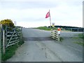
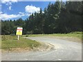
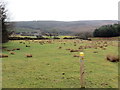
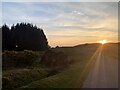
The above images may not be of the site on this page, they are loaded from Geograph.
Please Submit an Image of this site or go out and take one for us!
Click here to see more info for this site
Nearby sites
Key: Red: member's photo, Blue: 3rd party photo, Yellow: other image, Green: no photo - please go there and take one, Grey: site destroyed
Download sites to:
KML (Google Earth)
GPX (GPS waypoints)
CSV (Garmin/Navman)
CSV (Excel)
To unlock full downloads you need to sign up as a Contributory Member. Otherwise downloads are limited to 50 sites.
Turn off the page maps and other distractions
Nearby sites listing. In the following links * = Image available
960m ENE 68° Clawdd Brythonic Enclosure* Hillfort (SN86253687)
1.6km E 86° Dixies Corner* Hillfort (SN86983660)
2.4km E 83° Garn Wen (Maescar)* Ring Cairn (SN87723677)
3.4km E 88° Llyn Nant-Llys Round Barrow(s) (SN888366)
3.6km E 83° Bryn Melin Ring Cairn (SN889369)
4.7km S 171° Blaen Clydach Fach Cairn 2* Cairn (SN86003185)
4.8km ENE 68° Hirllwyn Hillfort (SN899382)
4.9km S 171° Blaen Clydach Fach Cairn 1* Cairn (SN86043170)
5.0km N 354° Abererbwll Roman Fortlet* Hillfort (SN84944152)
5.2km NE 40° Cefn Iolo Enclosure* Misc. Earthwork (SN88794050)
5.2km WNW 290° Cefn Pâl North Defended Enclosure* Hillfort (SN80433840)
5.3km WNW 285° Cefn Pâl South Defended Enclosure* Hillfort (SN80253805)
5.8km SSW 200° Pigwn Stone Circle 3* Stone Circle (SN83203117)
5.8km SSW 199° Trecastle Mountain ENE* Stone Circle (SN83343109)
5.8km SSW 202° Y Pigwn cairn 1* Cairn (SN83063119)
5.8km SSW 199° Trecastle Mountain WSW* Stone Circle (SN83313107)
5.8km SSW 198° Y Pigwn standing stone* Standing Stone (Menhir) (SN83423103)
5.9km SSW 199° Trecastle Mountain Row* Stone Row / Alignment (SN8327331053)
6.0km SSW 200° Y Pigwn cairn 2* Cairn (SN83143098)
6.2km WSW 255° Allt ynys-y-Bordeau Stone Circle (possible)* Stone Circle (SN79353503)
6.3km WSW 252° Ynys Y Borde Earthwork* Hillfort (SN79273472)
6.3km SSW 212° Trecastle Hill Mile stone* Standing Stones (SN8190631211)
6.4km SSE 158° Varlen Cairn* Cairn (SN87643060)
6.4km SSW 210° Waun Ddu Roman Fortlet* Hillfort (SN82063104)
6.5km NNW 342° Sugar Loaf Hill Fort* Hillfort (SN83484278)
View more nearby sites and additional images


 We would like to know more about this location. Please feel free to add a brief description and any relevant information in your own language.
 Wir möchten mehr über diese Stätte erfahren. Bitte zögern Sie nicht, eine kurze Beschreibung und relevante Informationen in Deutsch hinzuzufügen.
 Nous aimerions en savoir encore un peu sur les lieux. S'il vous plaît n'hesitez pas à ajouter une courte description et tous les renseignements pertinents dans votre propre langue.
 Quisieramos informarnos un poco más de las lugares. No dude en añadir una breve descripción y otros datos relevantes en su propio idioma.