


<< Our Photo Pages >> Pen Garn Goy possible Bronze Age Barrow - Cairn in Wales in Powys
Submitted by geoffstickland on Wednesday, 28 October 2020 Page Views: 325
Neolithic and Bronze AgeSite Name: Pen Garn Goy possible Bronze Age BarrowCountry: Wales
NOTE: This site is 0.494 km away from the location you searched for.
County: Powys Type: Cairn
Nearest Town: Llanwrtyd Wells
Map Ref: SN86144607
Latitude: 52.101211N Longitude: 3.663719W
Condition:
| 5 | Perfect |
| 4 | Almost Perfect |
| 3 | Reasonable but with some damage |
| 2 | Ruined but still recognisable as an ancient site |
| 1 | Pretty much destroyed, possibly visible as crop marks |
| 0 | No data. |
| -1 | Completely destroyed |
| 5 | Superb |
| 4 | Good |
| 3 | Ordinary |
| 2 | Not Good |
| 1 | Awful |
| 0 | No data. |
| 5 | Can be driven to, probably with disabled access |
| 4 | Short walk on a footpath |
| 3 | Requiring a bit more of a walk |
| 2 | A long walk |
| 1 | In the middle of nowhere, a nightmare to find |
| 0 | No data. |
| 5 | co-ordinates taken by GPS or official recorded co-ordinates |
| 4 | co-ordinates scaled from a detailed map |
| 3 | co-ordinates scaled from a bad map |
| 2 | co-ordinates of the nearest village |
| 1 | co-ordinates of the nearest town |
| 0 | no data |
Internal Links:
External Links:
I have visited· I would like to visit
geoffstickland has visited here
")
You may be viewing yesterday's version of this page. To see the most up to date information please register for a free account.
")
Do not use the above information on other web sites or publications without permission of the contributor.
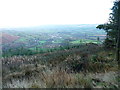
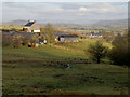
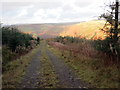
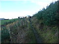
Nearby Images from Geograph Britain and Ireland:
©2014(licence)
©2009(licence)
©2018(licence)
©2014(licence)

©2018(licence)
The above images may not be of the site on this page, they are loaded from Geograph.
Please Submit an Image of this site or go out and take one for us!
Click here to see more info for this site
Nearby sites
Key: Red: member's photo, Blue: 3rd party photo, Yellow: other image, Green: no photo - please go there and take one, Grey: site destroyed
Download sites to:
KML (Google Earth)
GPX (GPS waypoints)
CSV (Garmin/Navman)
CSV (Excel)
To unlock full downloads you need to sign up as a Contributory Member. Otherwise downloads are limited to 50 sites.
Turn off the page maps and other distractions
Nearby sites listing. In the following links * = Image available
39m NE 56° Penmaenllwyd Cairn* Cairn (SN8617346091)
434m N 7° Banc Glyn Gyrnant Enclosure* Hillfort (SN862465)
1.3km NNW 328° Banc y Ddinas - possible Hill Fort/Defended Enclosure* Hillfort (SN85504715)
1.4km W 265° Garn Wen (Llanwrtyd Wells)* Cairn (SN84754597)
1.5km WNW 289° Waun Coli* Cairn (SN84754658)
1.7km N 6° Ystafell Fach Sculptured Stone* Early Christian Sculptured Stone (SN86364777)
1.8km SSE 156° Cae Rhedyn Enclosure* Ancient Village or Settlement (SN8681344441)
2.0km N 355° Pen y Ddinas Hillfort - possible* Hillfort (SN86024805)
2.1km SSW 198° Garth Fach Enclosure* Misc. Earthwork (SN8547044111)
2.2km NNE 24° Garn Dwad cairn* Cairn (SN871481)
2.7km ENE 58° Llanwrtyd Wells* Standing Stone (Menhir) (SN88494744)
3.2km ESE 117° Parc Gwyn Standing Stone* Standing Stone (Menhir) (SN88954454)
3.4km ESE 110° Pantioityn Standing Stone* Standing Stone (Menhir) (SN89274485)
3.4km WNW 287° Cnapau Hafodllewelyn Cairn* Cairn (SN82934711)
3.8km N 354° Cwm Irfon Standing Stone* Standing Stone (Menhir) (SN85844984)
4.2km WSW 256° Cynant Fach Cairn* Cairn (SN82054515)
4.2km SW 218° Sugar Loaf Hill Fort* Hillfort (SN83484278)
4.3km WNW 297° Croes Llywd Fach Cairn* Cairn (SN82374808)
4.3km NW 321° Cefn Blaencwmhenog Cairn* Cairn (SN8349449500)
4.3km N 356° Craig Dinas Fach Hill Fort (possible)* Hillfort (SN85955041)
4.5km ENE 61° Ty-Coch Cairn* Cairn (SN90184815)
4.7km SSW 193° Abererbwll Roman Fortlet* Hillfort (SN84944152)
4.8km NNE 28° Pen y Garn Goch* Chambered Tomb (SN885502)
4.8km NW 320° Esgair Garn* Cairn (SN83084983)
4.9km NE 35° Bwlch Mawr Mound (possible barrow)* Barrow Cemetery (SN89045007)
View more nearby sites and additional images


 We would like to know more about this location. Please feel free to add a brief description and any relevant information in your own language.
 Wir möchten mehr über diese Stätte erfahren. Bitte zögern Sie nicht, eine kurze Beschreibung und relevante Informationen in Deutsch hinzuzufügen.
 Nous aimerions en savoir encore un peu sur les lieux. S'il vous plaît n'hesitez pas à ajouter une courte description et tous les renseignements pertinents dans votre propre langue.
 Quisieramos informarnos un poco más de las lugares. No dude en añadir una breve descripción y otros datos relevantes en su propio idioma.