 with our Megalithic Portal iPhone app")


<< Our Photo Pages >> North Couston Refuge Stone - Early Christian Sculptured Stone in Scotland in West Lothian
Submitted by Anne T on Thursday, 12 October 2017 Page Views: 2080
Early Medieval (Dark Age)Site Name: North Couston Refuge Stone Alternative Name: Torphichen Preceptory Sanctuary Stone at North CoustonCountry: Scotland County: West Lothian Type: Early Christian Sculptured Stone
Nearest Town: Bathgate Nearest Village: Torphichen
Map Ref: NS95637078
Latitude: 55.918744N Longitude: 3.671571W
Condition:
| 5 | Perfect |
| 4 | Almost Perfect |
| 3 | Reasonable but with some damage |
| 2 | Ruined but still recognisable as an ancient site |
| 1 | Pretty much destroyed, possibly visible as crop marks |
| 0 | No data. |
| -1 | Completely destroyed |
| 5 | Superb |
| 4 | Good |
| 3 | Ordinary |
| 2 | Not Good |
| 1 | Awful |
| 0 | No data. |
| 5 | Can be driven to, probably with disabled access |
| 4 | Short walk on a footpath |
| 3 | Requiring a bit more of a walk |
| 2 | A long walk |
| 1 | In the middle of nowhere, a nightmare to find |
| 0 | No data. |
| 5 | co-ordinates taken by GPS or official recorded co-ordinates |
| 4 | co-ordinates scaled from a detailed map |
| 3 | co-ordinates scaled from a bad map |
| 2 | co-ordinates of the nearest village |
| 1 | co-ordinates of the nearest town |
| 0 | no data |
Internal Links:
External Links:
I have visited· I would like to visit
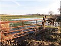
Anne T couldn't find on 30th Sep 2017 - their rating: Cond: -1 Amb: 3 Access: 4 North Couston Refuge Stone, West Lothian: From the Westfield Farm Refuge Stone, we set off towards North Couston with only a very small scale book of maps and Trigpointing UK on our mobile phone to try and find this stone. From Westfield, we got back onto the A801 southbound, then turned left onto the A800, turning left again onto a minor road to a farm, parking in a largish concreted area next to the field entrance at NS 95279 70925. From the Canmore record, we didn’t have much hope, but given as we were not far away, wanted to check whether or not this Refuge Stone was still there.
We waded around the edges of the very wet entrance to the field (the gates into the neighbouring field were almost shoulder high – too high for me to attempt to climb over, although this route would have been dry). The field edges of this recently harvested field were then drier, so we walked along the eastern side, then headed south at the corner, along the old, grubbed out hedge line. We walked most of the length of the Followed the field edges, prodding the fence line as I went, but could find no evidence of any stone along the field boundary.
")
The North Couston Refuge Stone is one of four associated with Torphichen Preceptory. Recorded as Canmore ID 47926, their entry from 1926, making reference to the Name Book of 1856, says: "This is an undressed pillar of stone, standing 4' 2" above ground and measuring 10 1/2" square at base, set in a field. The ONB notes that the Maltese cross which had been engraved on it, was effaced. This is one of the stones marking the area of the sanctuary associated with Torphichen Preceptory."
In 1952, this has been updated to say the stone had been moved some 30 metres east of its original position before 1945 and was now lying on the ground by the side of a fence at NS 9563 7078, but apparently broken. This was confirmed in a visit in 1974, but there were no further entries in this record.
As we were nearby, having found the much neglected Westfield Farm Refuge Stone, we decided to stop by and look for this stone. We both walked up and down the field boundary twice, me poking both sides of the former hedge/fence line with my walking pole every couple of feet, but found nothing. In the end, we concluded the stone had been moved, but could not identify where to.
You may be viewing yesterday's version of this page. To see the most up to date information please register for a free account.
Do not use the above information on other web sites or publications without permission of the contributor.
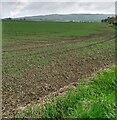
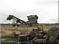
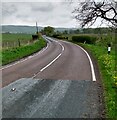
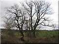
Nearby Images from Geograph Britain and Ireland:
©2021(licence)
©2020(licence)
©2021(licence)
©2020(licence)
©2014(licence)
The above images may not be of the site on this page, they are loaded from Geograph.
Please Submit an Image of this site or go out and take one for us!
Click here to see more info for this site
Nearby sites
Key: Red: member's photo, Blue: 3rd party photo, Yellow: other image, Green: no photo - please go there and take one, Grey: site destroyed
Download sites to:
KML (Google Earth)
GPX (GPS waypoints)
CSV (Garmin/Navman)
CSV (Excel)
To unlock full downloads you need to sign up as a Contributory Member. Otherwise downloads are limited to 50 sites.
Turn off the page maps and other distractions
Nearby sites listing. In the following links * = Image available
1.8km NW 315° Westfield Farm Refuge Stone* Early Christian Sculptured Stone (NS94377211)
2.1km NNE 34° Torphichen Churchyard Stone* Standing Stone (Menhir) (NS96847250)
3.2km ENE 71° Cairnpapple Hill* Round Cairn (NS98727175)
3.3km WSW 252° Hillhouse (Torphichen) Standing Stone (Menhir) (NS92456984)
3.3km ENE 63° Lower Craigmailing (Torphichen)* Ancient Cross (NS98627222)
3.3km ESE 105° Galabraes* Standing Stone (Menhir) (NS9881869839)
3.4km NE 45° Gormyre* Standing Stone (Menhir) (NS98067311)
3.5km E 80° Knock Stone Circle* Modern Stone Circle etc (NS99137133)
3.9km ENE 60° Craigmailing Boundary Marker (Torphichen)* Marker Stone (NS99097270)
4.2km SW 231° Boar Stone (Armadale)* Natural Stone / Erratic / Other Natural Feature (NS92336820)
4.6km NE 47° Kipps Farm* Round Cairn (NS99087387)
4.9km NE 41° Cockleroy Hill (Beecraigs)* Hillfort (NS98947438)
5.8km NE 35° Williamcraigs Standing Stone* Natural Stone / Erratic / Other Natural Feature (NS99037544)
6.8km ENE 63° Beecraigs Round Cairn (NT01827372)
7.0km NNE 25° The Boarstane (Linlithgow) Standing Stone (Menhir) (NS98757706)
7.9km NE 34° Cross Well (Linlithgow)* Holy Well or Sacred Spring (NT0021677170)
11.0km NW 323° Marion's Well (Falkirk) Holy Well or Sacred Spring (NS89267977)
12.9km NW 313° Watling Lodge, Antonine Wall* Ancient Village or Settlement (NS86347982)
13.1km SE 139° Cromwell's Stone (West Calder) Natural Stone / Erratic / Other Natural Feature (NT03986068)
14.2km ENE 60° Justice Stone Standing Stone (Menhir) (NT08087759)
15.0km NE 55° Abercorn Sculptured Stone (NT08147910)
16.2km ESE 102° Kirknewton stone Sculptured Stone (NT11426693)
16.7km N 356° Gubber Hill Standing Stone (Menhir) (NS948875)
16.8km E 82° Huly Hill Cairn* Round Cairn (NT1234272610)
16.8km E 82° Huly Hill Standing Stones* Standing Stones (NT1234272610)
View more nearby sites and additional images


 We would like to know more about this location. Please feel free to add a brief description and any relevant information in your own language.
 Wir möchten mehr über diese Stätte erfahren. Bitte zögern Sie nicht, eine kurze Beschreibung und relevante Informationen in Deutsch hinzuzufügen.
 Nous aimerions en savoir encore un peu sur les lieux. S'il vous plaît n'hesitez pas à ajouter une courte description et tous les renseignements pertinents dans votre propre langue.
 Quisieramos informarnos un poco más de las lugares. No dude en añadir una breve descripción y otros datos relevantes en su propio idioma.