

<< Text Pages >> Troqueer Cursus - Cursus in Scotland in Dumfries and Galloway
Submitted by EssexMan on Wednesday, 07 April 2010 Page Views: 3345
Neolithic and Bronze AgeSite Name: Troqueer CursusCountry: Scotland
NOTE: This site is 0.701 km away from the location you searched for.
County: Dumfries and Galloway Type: Cursus
Nearest Town: Dumfries Nearest Village: Troqueer
Map Ref: NX95837512 Landranger Map Number: 84
Latitude: 55.059598N Longitude: 3.632438W
Condition:
| 5 | Perfect |
| 4 | Almost Perfect |
| 3 | Reasonable but with some damage |
| 2 | Ruined but still recognisable as an ancient site |
| 1 | Pretty much destroyed, possibly visible as crop marks |
| 0 | No data. |
| -1 | Completely destroyed |
| 5 | Superb |
| 4 | Good |
| 3 | Ordinary |
| 2 | Not Good |
| 1 | Awful |
| 0 | No data. |
| 5 | Can be driven to, probably with disabled access |
| 4 | Short walk on a footpath |
| 3 | Requiring a bit more of a walk |
| 2 | A long walk |
| 1 | In the middle of nowhere, a nightmare to find |
| 0 | No data. |
| 5 | co-ordinates taken by GPS or official recorded co-ordinates |
| 4 | co-ordinates scaled from a detailed map |
| 3 | co-ordinates scaled from a bad map |
| 2 | co-ordinates of the nearest village |
| 1 | co-ordinates of the nearest town |
| 0 | no data |
Internal Links:
External Links:
Minor Cursus in Dumfries & Galloway
Status: Certain
NMR No. NX97NE 85
Extent: 300mx95m
Terminal type: Rounded
Note: This location marks one terminal (end) of a cursus monument. The location of the other terminal can be found in the Nearby Site list below.
You may be viewing yesterday's version of this page. To see the most up to date information please register for a free account.
Do not use the above information on other web sites or publications without permission of the contributor.
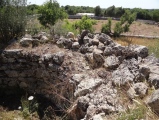
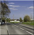
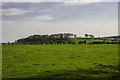
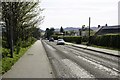
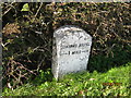
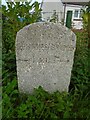
Nearby Images from Geograph Britain and Ireland:
©2014(licence)
©2014(licence)
©2014(licence)
©2019(licence)
©2020(licence)
The above images may not be of the site on this page, they are loaded from Geograph.
Please Submit an Image of this site or go out and take one for us!
Click here to see more info for this site
Nearby sites
Key: Red: member's photo, Blue: 3rd party photo, Yellow: other image, Green: no photo - please go there and take one, Grey: site destroyed
Download sites to:
KML (Google Earth)
GPX (GPS waypoints)
CSV (Garmin/Navman)
CSV (Excel)
To unlock full downloads you need to sign up as a Contributory Member. Otherwise downloads are limited to 50 sites.
Turn off the page maps and other distractions
Nearby sites listing. In the following links * = Image available
303m E 79° Troqueer Cursus Cursus (NX96137517)
1.3km ENE 61° Dumfries Museum* Museum (NX9698975731)
1.6km ENE 65° St Allan's Wells (Dumfries) Holy Well or Sacred Spring (NX97307576)
2.3km ENE 67° Greystone Park Stone Circle (NX980760)
2.9km S 183° St Queran's Well* Holy Well or Sacred Spring (NX95597222)
3.0km S 187° Picts Knowe* Henge (NX95387213)
3.8km NW 306° Ladye Well (Terregles) Holy Well or Sacred Spring (NX92767744)
4.1km WSW 251° Easthill* Stone Circle (NX91937388)
4.4km NNW 344° Twelve Apostles (Dumfries)* Stone Circle (NX9470079400)
4.5km NNW 347° Holywood A Cursus Cursus (NX94937951)
4.6km WNW 285° Beacon Hill (Dumfries and Galloway)* Hillfort (NX91397643)
4.8km NNW 347° Holywood A Cursus Cursus (NX94857979)
4.9km NNW 348° Holywood B Cursus Cursus (NX949799)
5.1km N 351° Holywood B Cursus Cursus (NX951802)
5.3km N 0° Holywood Cursus Cursus (NX95968038)
6.3km WSW 249° Lochrutton Loch* Crannog (NX89837299)
6.5km NW 318° Holywood Cursus Cursus (NX91558004)
6.8km NW 309° Hall Hill* Hillfort (NX90597949)
7.8km N 4° Kirkmahoe Cursus Cursus (NX96508286)
8.9km WNW 286° Angel Well (Barnsoul) Holy Well or Sacred Spring (NX87337770)
9.0km W 281° The Doons* Hillfort (NX86987699)
10.1km S 173° Lochhill* Chambered Cairn (NX96886507)
10.7km SSE 165° Ingleston Cairn (NX983647)
10.7km SE 141° Ward Law* Hillfort (NY0245766692)
10.8km NNW 337° Temple Wood (Dunscore)* Modern Stone Circle etc (NX91848522)
View more nearby sites and additional images


 We would like to know more about this location. Please feel free to add a brief description and any relevant information in your own language.
 Wir möchten mehr über diese Stätte erfahren. Bitte zögern Sie nicht, eine kurze Beschreibung und relevante Informationen in Deutsch hinzuzufügen.
 Nous aimerions en savoir encore un peu sur les lieux. S'il vous plaît n'hesitez pas à ajouter une courte description et tous les renseignements pertinents dans votre propre langue.
 Quisieramos informarnos un poco más de las lugares. No dude en añadir una breve descripción y otros datos relevantes en su propio idioma.