

<< Our Photo Pages >> Mynydd Blaengwynfi Cairn - Cairn in Wales in West Glamorgan
Submitted by sem on Sunday, 15 January 2012 Page Views: 4283
Neolithic and Bronze AgeSite Name: Mynydd Blaengwynfi CairnCountry: Wales
NOTE: This site is 1.4 km away from the location you searched for.
County: West Glamorgan Type: Cairn
Nearest Village: Blaengwynfi
Map Ref: SS9060297368
Latitude: 51.664407N Longitude: 3.583146W
Condition:
| 5 | Perfect |
| 4 | Almost Perfect |
| 3 | Reasonable but with some damage |
| 2 | Ruined but still recognisable as an ancient site |
| 1 | Pretty much destroyed, possibly visible as crop marks |
| 0 | No data. |
| -1 | Completely destroyed |
| 5 | Superb |
| 4 | Good |
| 3 | Ordinary |
| 2 | Not Good |
| 1 | Awful |
| 0 | No data. |
| 5 | Can be driven to, probably with disabled access |
| 4 | Short walk on a footpath |
| 3 | Requiring a bit more of a walk |
| 2 | A long walk |
| 1 | In the middle of nowhere, a nightmare to find |
| 0 | No data. |
| 5 | co-ordinates taken by GPS or official recorded co-ordinates |
| 4 | co-ordinates scaled from a detailed map |
| 3 | co-ordinates scaled from a bad map |
| 2 | co-ordinates of the nearest village |
| 1 | co-ordinates of the nearest town |
| 0 | no data |
Internal Links:
External Links:
I have visited· I would like to visit
sem has visited here
")
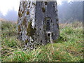
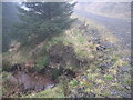
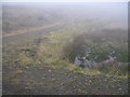
RCAHMW NPRN 307652, it is described as a low stony mound, 8m in diameter. There is a trig point on it.
You may be viewing yesterday's version of this page. To see the most up to date information please register for a free account.
Do not use the above information on other web sites or publications without permission of the contributor.
Nearby Images from Geograph Britain and Ireland:
©2008(licence)
©2008(licence)
©2008(licence)
©2008(licence)
©2008(licence)
The above images may not be of the site on this page, they are loaded from Geograph.
Please Submit an Image of this site or go out and take one for us!
Click here to see more info for this site
Nearby sites
Key: Red: member's photo, Blue: 3rd party photo, Yellow: other image, Green: no photo - please go there and take one, Grey: site destroyed
Download sites to:
KML (Google Earth)
GPX (GPS waypoints)
CSV (Garmin/Navman)
CSV (Excel)
To unlock full downloads you need to sign up as a Contributory Member. Otherwise downloads are limited to 50 sites.
Turn off the page maps and other distractions
Nearby sites listing. In the following links * = Image available
494m ESE 104° Pebyll Cairn* Ring Cairn (SS9108097239)
772m NNE 15° Bachgen Carreg* Cairn (SS9081298111)
1.7km NNW 345° Carn y Wiwer* Cairn (SS9019499035)
2.4km SE 143° Crugyrafan* Round Barrow(s) (SS920954)
3.2km SSE 166° The Werfa Round Barrow(s) (SS913942)
4.2km SSE 160° Carn-Y-Hyrddod* Cairn (SS91999339)
4.5km SE 129° Bwlch y Clawdd* Modern Stone Circle etc (SS94039450)
4.8km NNE 18° Blaenrhondda Ancient Village* Ancient Village or Settlement (SN92160193)
4.9km ESE 120° Bwlch y Clawdd Cairn Cairn (SS948948)
5.4km ESE 102° Treorchy Gorsedd Circle* Modern Stone Circle etc (SS9585596145)
5.4km SE 128° Craig y Geifr Cairn (SS94809395)
5.5km SSE 149° Burry Holms Fort Hillfort (SS933926)
5.5km N 1° Carn Foesan Cairn (SN90780288)
5.9km N 0° Garn Fach Cairn (SN90740327)
6.2km N 10° Llyn Fawr* Holy Well or Sacred Spring (SN91770347)
6.4km N 349° Craig-Y-Pant Cairn (SN89560367)
6.5km SE 134° Garn Fawr (Ogmore Valley)* Cairn (SS95229271)
6.6km N 352° Y Foel Cherwn Cairn (SN89840388)
7.3km E 90° Tarren Maerdy Cairn 1 Cairn (SS97959720)
7.4km SSE 168° Garn Lwyd* Ring Cairn (SS9199090146)
7.6km ESE 113° Mynydd Y Gelli* Stone Circle (SS975942)
7.6km SE 137° Garn Fach Cairn (SS957917)
8.4km SSE 150° Bryn-Y-Cae Cairn (SS94689002)
9.0km WNW 291° Carn Caca Cairn* Ring Cairn (SN82230077)
9.5km SE 143° Mynydd Maendy Cairn (SS96168964)
View more nearby sites and additional images


 We would like to know more about this location. Please feel free to add a brief description and any relevant information in your own language.
 Wir möchten mehr über diese Stätte erfahren. Bitte zögern Sie nicht, eine kurze Beschreibung und relevante Informationen in Deutsch hinzuzufügen.
 Nous aimerions en savoir encore un peu sur les lieux. S'il vous plaît n'hesitez pas à ajouter une courte description et tous les renseignements pertinents dans votre propre langue.
 Quisieramos informarnos un poco más de las lugares. No dude en añadir una breve descripción y otros datos relevantes en su propio idioma.