 with our Megalithic Portal iPhone app")


<< Our Photo Pages >> Pixy Well - Holy Well or Sacred Spring in England in Somerset
Submitted by HOLYWELL on Monday, 18 February 2008 Page Views: 4748
Springs and Holy WellsSite Name: Pixy WellCountry: England County: Somerset Type: Holy Well or Sacred Spring
Nearest Village: Allerford
Map Ref: SS9066646634
Latitude: 51.208414N Longitude: 3.566539W
Condition:
| 5 | Perfect |
| 4 | Almost Perfect |
| 3 | Reasonable but with some damage |
| 2 | Ruined but still recognisable as an ancient site |
| 1 | Pretty much destroyed, possibly visible as crop marks |
| 0 | No data. |
| -1 | Completely destroyed |
| 5 | Superb |
| 4 | Good |
| 3 | Ordinary |
| 2 | Not Good |
| 1 | Awful |
| 0 | No data. |
| 5 | Can be driven to, probably with disabled access |
| 4 | Short walk on a footpath |
| 3 | Requiring a bit more of a walk |
| 2 | A long walk |
| 1 | In the middle of nowhere, a nightmare to find |
| 0 | No data. |
| 5 | co-ordinates taken by GPS or official recorded co-ordinates |
| 4 | co-ordinates scaled from a detailed map |
| 3 | co-ordinates scaled from a bad map |
| 2 | co-ordinates of the nearest village |
| 1 | co-ordinates of the nearest town |
| 0 | no data |
Internal Links:
External Links:
")
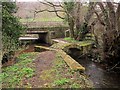
By a busy road, this conical beehive shaped structure is thought to be a dried up well called the Pixy Well. Why it was called the Pixy well no one in the village could tell me, but it may have related folklore like the Pixy well in Cornwall. The name may indicate a pagan origin.
You may be viewing yesterday's version of this page. To see the most up to date information please register for a free account.
Do not use the above information on other web sites or publications without permission of the contributor.
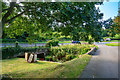
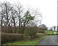
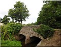
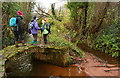
Nearby Images from Geograph Britain and Ireland:
©2019(licence)
©2019(licence)
©2018(licence)
©2012(licence)
©2015(licence)
The above images may not be of the site on this page, they are loaded from Geograph.
Please Submit an Image of this site or go out and take one for us!
Click here to see more info for this site
Nearby sites
Key: Red: member's photo, Blue: 3rd party photo, Yellow: other image, Green: no photo - please go there and take one, Grey: site destroyed
Download sites to:
KML (Google Earth)
GPX (GPS waypoints)
CSV (Garmin/Navman)
CSV (Excel)
To unlock full downloads you need to sign up as a Contributory Member. Otherwise downloads are limited to 50 sites.
Turn off the page maps and other distractions
Nearby sites listing. In the following links * = Image available
783m NNW 347° St Agnes Fountain Holy Well or Sacred Spring (SS905474)
1.2km ENE 63° Bury Castle (Exmoor)* Hillfort (SS91744716)
3.8km S 177° Joaney How Cairn (SS90814279)
3.9km S 177° Robin How* Cairn (SS90764273)
4.5km SSW 201° Sweetworthy settlement* Ancient Village or Settlement (SS890425)
5.1km WSW 249° Berry Castle (Exmoor) Hillfort (SS859449)
5.2km SSW 195° Dunkery Beacon* Barrow Cemetery (SS892416)
5.3km W 265° Whit Stones* Standing Stones (SS8532846255)
6.0km SSW 210° Rowbarrow Group* Barrow Cemetery (SS87544154)
6.0km SSW 201° Codsend Moor Multiple Stone Rows / Avenue (SS88364110)
6.3km W 263° Porlock Common North East* Stone Row / Alignment (SS8434946032)
6.4km WSW 251° Porlock Common SW* Multiple Stone Rows / Avenue (SS8457544654)
6.4km WSW 251° Porlock Circle* Stone Circle (SS84514467)
6.8km SW 227° Wilmersham Common North* Stone Row / Alignment (SS8561242129)
6.8km SW 226° Wilmersham Common South* Multiple Stone Rows / Avenue (SS85664197)
6.9km WSW 253° Porlock Allotment NE* Standing Stones (SS84014471)
7.0km WSW 250° Coley Water, South* Stone Row / Alignment (SS84074438)
7.1km SW 217° Hoar Moor (E)* Standing Stone (Menhir) (SS86214106)
7.2km SE 136° Timberscobe Wood Hill Fort Hillfort (SS956414)
7.3km W 275° Culbone Hill* Stone Row / Alignment (SS83434738)
7.5km W 274° Culbone Stone* Early Christian Sculptured Stone (SS8321047374)
7.6km SW 218° Hoar Moor (W) Standing Stone (Menhir) (SS85864075)
7.8km WSW 247° Porlock Allotment SW* Multiple Stone Rows / Avenue (SS8335543785)
8.0km WSW 249° Hoscombe SE* Stone Row / Alignment (SS8311443876)
8.0km SW 231° Almsworthy* Stone Circle (SS8430941698)
View more nearby sites and additional images


 We would like to know more about this location. Please feel free to add a brief description and any relevant information in your own language.
 Wir möchten mehr über diese Stätte erfahren. Bitte zögern Sie nicht, eine kurze Beschreibung und relevante Informationen in Deutsch hinzuzufügen.
 Nous aimerions en savoir encore un peu sur les lieux. S'il vous plaît n'hesitez pas à ajouter une courte description et tous les renseignements pertinents dans votre propre langue.
 Quisieramos informarnos un poco más de las lugares. No dude en añadir una breve descripción y otros datos relevantes en su propio idioma.