


<< Text Pages >> Biggar Cursus - Cursus in Scotland in South Lanarkshire
Submitted by EssexMan on Wednesday, 07 April 2010 Page Views: 4519
Neolithic and Bronze AgeSite Name: Biggar CursusCountry: Scotland
NOTE: This site is 2.364 km away from the location you searched for.
County: South Lanarkshire Type: Cursus
Nearest Town: Motherwell Nearest Village: Biggar
Map Ref: NT01663657 Landranger Map Number: 72
Latitude: 55.612753N Longitude: 3.562785W
Condition:
| 5 | Perfect |
| 4 | Almost Perfect |
| 3 | Reasonable but with some damage |
| 2 | Ruined but still recognisable as an ancient site |
| 1 | Pretty much destroyed, possibly visible as crop marks |
| 0 | No data. |
| -1 | Completely destroyed |
| 5 | Superb |
| 4 | Good |
| 3 | Ordinary |
| 2 | Not Good |
| 1 | Awful |
| 0 | No data. |
| 5 | Can be driven to, probably with disabled access |
| 4 | Short walk on a footpath |
| 3 | Requiring a bit more of a walk |
| 2 | A long walk |
| 1 | In the middle of nowhere, a nightmare to find |
| 0 | No data. |
| 5 | co-ordinates taken by GPS or official recorded co-ordinates |
| 4 | co-ordinates scaled from a detailed map |
| 3 | co-ordinates scaled from a bad map |
| 2 | co-ordinates of the nearest village |
| 1 | co-ordinates of the nearest town |
| 0 | no data |
Internal Links:
External Links:
Long Enclosure in South Lanarkshire
Status: Possible
NMR No. NT03NW 125
Extent: 70mx17m
Terminal type: Square
Pit-defined
You may be viewing yesterday's version of this page. To see the most up to date information please register for a free account.
Do not use the above information on other web sites or publications without permission of the contributor.
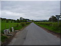
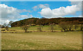
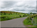
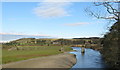
Nearby Images from Geograph Britain and Ireland:
©2008(licence)
©2016(licence)
©2015(licence)
©2008(licence)
©2008(licence)
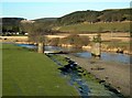
The above images may not be of the site on this page, they are loaded from Geograph.
Please Submit an Image of this site or go out and take one for us!
Click here to see more info for this site
Nearby sites
Key: Red: member's photo, Blue: 3rd party photo, Yellow: other image, Green: no photo - please go there and take one, Grey: site destroyed
Download sites to:
KML (Google Earth)
GPX (GPS waypoints)
CSV (Garmin/Navman)
CSV (Excel)
To unlock full downloads you need to sign up as a Contributory Member. Otherwise downloads are limited to 50 sites.
Turn off the page maps and other distractions
Nearby sites listing. In the following links * = Image available
2.6km ENE 61° Moat Park Heritage Centre Museum (NT040378)
3.6km S 170° Culterpark Hill* Hillfort (NT02213305)
3.7km WNW 285° Boatbridge Quarry Cist (NS981376)
4.0km SSE 167° Snaip Hill* Hillfort (NT02463269)
4.2km NNE 31° Carwood Farm Ancient Village or Settlement (NT039401)
4.8km SSE 156° Nisbet* Hillfort (NT03543216)
5.2km ESE 116° Mitchelhill Rings Hillfort (NT06283417)
5.5km W 270° Fallburn at Tinto Hillfort (NS96193674)
6.0km E 99° Cleuch Hill* Cairn (NT07573546)
6.7km E 100° Parkgatestone Hill Ancient Village or Settlement (NT08293529)
7.3km ESE 116° Knowe Kniffling* Hillfort (NT08163323)
7.4km ESE 112° Mill Rings Misc. Earthwork (NT08493357)
9.2km ESE 102° Whitslade Hill Burnt Mound Artificial Mound (NT10603447)
9.3km NNE 12° Tod Holes (Weston) Sculptured Stone (NT03844560)
9.3km N 7° Weston henge* Henge (NT03004578)
9.4km E 96° Helm End Hillfort (NT10983532)
9.6km NE 38° Howburn Farm Ancient Village or Settlement (NT078440)
10.2km ESE 106° Rachan Hill Henge (NT11423363)
10.2km ESE 103° Piper's Stone Standing Stone (Menhir) (NT11533400)
10.4km SW 216° Devonshaw Hill* Hillfort (NS954283)
10.8km E 95° Dreva Craig* Standing Stone (Menhir) (NT12453545)
11.0km E 95° Dreva Craig* Hillfort (NT12673533)
11.3km E 94° Dreva Hill West (Broughton)* Ancient Village or Settlement (NT12923553)
11.5km NE 48° Netherurd Mains (Kirkurd) Ancient Cross (NT10414403)
11.8km ESE 116° Woodend, Mossfennan Farm* Cist (NT12173124)
View more nearby sites and additional images


 We would like to know more about this location. Please feel free to add a brief description and any relevant information in your own language.
 Wir möchten mehr über diese Stätte erfahren. Bitte zögern Sie nicht, eine kurze Beschreibung und relevante Informationen in Deutsch hinzuzufügen.
 Nous aimerions en savoir encore un peu sur les lieux. S'il vous plaît n'hesitez pas à ajouter une courte description et tous les renseignements pertinents dans votre propre langue.
 Quisieramos informarnos un poco más de las lugares. No dude en añadir una breve descripción y otros datos relevantes en su propio idioma.