


<< Text Pages >> St Bega's Well (St Bees) - Holy Well or Sacred Spring in England in Cumbria
Submitted by Anne T on Monday, 18 July 2022 Page Views: 605
Springs and Holy WellsSite Name: St Bega's Well (St Bees)Country: England
NOTE: This site is 1.063 km away from the location you searched for.
County: Cumbria Type: Holy Well or Sacred Spring
Nearest Town: Egremont Nearest Village: St Bees
Map Ref: NX9751413094
Latitude: 54.502770N Longitude: 3.58415W
Condition:
| 5 | Perfect |
| 4 | Almost Perfect |
| 3 | Reasonable but with some damage |
| 2 | Ruined but still recognisable as an ancient site |
| 1 | Pretty much destroyed, possibly visible as crop marks |
| 0 | No data. |
| -1 | Completely destroyed |
| 5 | Superb |
| 4 | Good |
| 3 | Ordinary |
| 2 | Not Good |
| 1 | Awful |
| 0 | No data. |
| 5 | Can be driven to, probably with disabled access |
| 4 | Short walk on a footpath |
| 3 | Requiring a bit more of a walk |
| 2 | A long walk |
| 1 | In the middle of nowhere, a nightmare to find |
| 0 | No data. |
| 5 | co-ordinates taken by GPS or official recorded co-ordinates |
| 4 | co-ordinates scaled from a detailed map |
| 3 | co-ordinates scaled from a bad map |
| 2 | co-ordinates of the nearest village |
| 1 | co-ordinates of the nearest town |
| 0 | no data |
Be the first person to rate this site - see the 'Contribute!' box in the right hand menu.
Internal Links:
External Links:
Holy Well or Sacred Spring in Cumbria
The location of this well is shown on the Historic England map search, to the east of St Michael's Chapel and at the edge of an area of woodland. Classified as a holy well, it is recorded in the Cumbria Historic Environment Records as HER no. 3680, which tells us that: "St Bega's Well is exactly opposite Chapel How (St Michael's Chapel), ca 150 yards east of the road, with traces of a lane leading down to it. It is now covered over and overgrown."
The HER entry points us to a document by CA Parker, dated 1909, "Some medieval crosses, cross sites and cross names in West Cumberland" (CWAAS IX, pages 113-114)", which adds: "The chapel by the roadside was probably connected with the well one hundred feet lower down the hillside, and a supply of the water may have been kept at the chapel for the benefit of wayfarers".
Does anyone have any additional information about this well? Do you know what its waters were used for?
Have you visited this site and have any photographs you can add? Thank you.
You may be viewing yesterday's version of this page. To see the most up to date information please register for a free account.
Do not use the above information on other web sites or publications without permission of the contributor.
Nearby Images from Geograph Britain and Ireland:
©2009(licence)
©2005(licence)
©2009(licence)
©2005(licence)
©2005(licence)
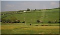
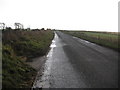
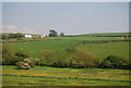
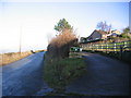
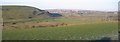
The above images may not be of the site on this page, they are loaded from Geograph.
Please Submit an Image of this site or go out and take one for us!
Click here to see more info for this site
Nearby sites
Key: Red: member's photo, Blue: 3rd party photo, Yellow: other image, Green: no photo - please go there and take one, Grey: site destroyed
Download sites to:
KML (Google Earth)
GPX (GPS waypoints)
CSV (Garmin/Navman)
CSV (Excel)
To unlock full downloads you need to sign up as a Contributory Member. Otherwise downloads are limited to 50 sites.
Turn off the page maps and other distractions
Nearby sites listing. In the following links * = Image available
1.1km SSW 213° St Bee's Priory Crosses* Ancient Cross (NX9687212142)
3.1km SE 139° Egremont Stone Circle (NX995107)
5.1km NNE 14° Le Wheles Stone Circle (NX989180)
7.2km ESE 109° Yewcroft* Stone Circle (NY043106)
7.7km SE 144° Beckermet Ancient Crosses (St John's Church)* Ancient Cross (NY01890671)
8.0km SSE 149° Beckermet Ancient Crosses (St Bridget's)* Ancient Cross (NY015061)
8.5km E 82° Blakeley Raise* Stone Circle (NY06011403)
8.8km ESE 109° Friar's Well Barrow Cemetery (NY058101)
8.8km E 98° Swarth Fell funerary cairn* Round Cairn (NY06241167)
10.0km ESE 102° Capelcrag Beck* Ring Cairn (NY07231072)
10.0km ESE 108° Tongue How Cairn* Ring Cairn (NY070098)
10.1km ENE 62° Lamplugh Stone Circle (NY065177)
10.4km ESE 108° Tongue How Settlement* Ancient Village or Settlement (NY074097)
10.6km ESE 113° Thornholme farm* Ancient Village or Settlement (NY0727008760)
11.2km ESE 120° Birrel Sike Ancient Village or Settlement (NY071073)
11.3km NNE 34° Studfold Stone Circle* Stone Circle (NY03992234)
12.2km SSE 150° Grey Croft* Stone Circle (NY03340238)
12.5km SE 137° Gretigate C Stone Circle (NY058037)
12.5km SE 137° Gretigate B Stone Circle (NY058037)
12.5km SE 138° Gretigate A Stone Circle (NY057036)
13.3km ESE 111° Sampson's Bratfull* Long Barrow (NY098080)
13.4km SE 133° Gosforth Holy Well* Holy Well or Sacred Spring (NY07190383)
13.5km ESE 110° Stockdale Moor* Cairn (NY101082)
13.6km SE 133° Gosforth Cross* Ancient Cross (NY07230357)
15.5km NE 37° St Oswald's Church (Dean)* Rock Art (NY0709725353)
View more nearby sites and additional images


 We would like to know more about this location. Please feel free to add a brief description and any relevant information in your own language.
 Wir möchten mehr über diese Stätte erfahren. Bitte zögern Sie nicht, eine kurze Beschreibung und relevante Informationen in Deutsch hinzuzufügen.
 Nous aimerions en savoir encore un peu sur les lieux. S'il vous plaît n'hesitez pas à ajouter une courte description et tous les renseignements pertinents dans votre propre langue.
 Quisieramos informarnos un poco más de las lugares. No dude en añadir una breve descripción y otros datos relevantes en su propio idioma.